** Darla Travels is reader-supported.
When you buy through our links, we may earn a commission. **

Looking across acres and acres of open space in Cherry Creek State Park, it’s easy to forget that it’s embedded in the Denver metropolitan area. A 30-minute drive from downtown Denver and less than 45 minutes from Denver International Airport, Cherry Creek State Park provides trails for exploring on foot year-round along with access to a multitude of other outdoor activities, both on land and water.
The main feature of Cherry Creek State Park is the 880 surface acre (3556 ha) reservoir and dam. The Army Corps of Engineers built this earthen dam in 1950 to create the body of water flowing from Cherry Creek. The dam is instrumental in preventing flooding downstream in Denver.

The park has three entrances for vehicles, designated west, east, and south. Check which entry point is more convenient to a desired location because it takes several minutes to drive around the park. It’s also possible to enter the park without a car–more on that below.
This large park has multiple parking lots, many next to lakeside picnic tables and restrooms, making it easy to find a starting point.
Choosing a hiking trail in Cherry Creek State Park
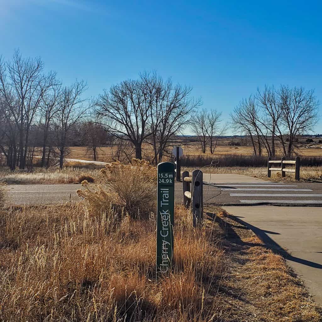
The park contains 35 total miles (56 km) of trails. Of these, 15 miles (24 km) 0.3are on pavement. The park trail map lists 22 trails, ranging in distance from a mere 0.37 miles to 7.79 miles (0.6 to 12.5 km). According to the park website, 26 (41.2) miles of trail are available for biking, and 26.5 miles are open to horseback riders, while all 35 miles can be used for hiking, cross country skiing, or snowshoeing in the winter. Nearly 10 miles (16.1 km) of trails are marked wheelchair accessible.

The Wetlands Preserve area of the park contains trails open only to hikers. The Wetlands are essential as a wildlife habitat and watershed. Mature trees cover this part of the park, contrasting with the open prairie surrounding it. Cherry Creek flows through this fragile area and into the reservoir.
Choosing a trail to take might be as easy as pulling into a parking space next to a path. But with so many routes and options in the park, coupled with the ability to go long distances, I’d recommend a little planning.
AllTrails contains several suggestions for routes within the park that combine various trails for a range of distances. For example, here’s a 5.8 mile (9.3 km) hike that takes the Piney Creek Trail into the park, followed by a loop on the Cottonwood Creek and Cherry Creek trails.
Loop around the Cherry Creek Reservoir
One winter morning, I hiked all the way around the reservoir. I used the park’s west entrance, parked next to the marina, and headed roughly south on the paved Cherry Creek Trail. The trail snakes between the lake and the road. I saw some brave ice fishermen on the ice-covered reservoir. On this side of the lake, there are clear views to the west. I also watched a few large birds of prey flying around and perching in trees.
Slightly past the south edge of the reservoir, I turned toward the east at the intersection with the Pipeline Trail. The Pipeline Trail is a soft-surface trail that heads into the trees and traverses the Wetlands Preserve area. A coyote sprinted across the path, reminding me that wildlife is never far. At the other side of the Wetlands, I turned north on the Smoky Hill Trail to continue moving around the lake. Again, there were great views to the west.

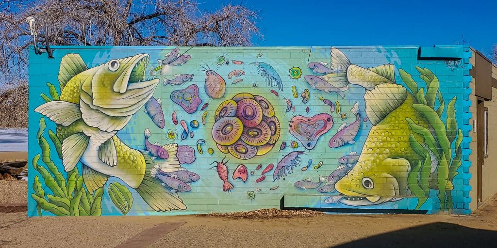
Toward the northern part of the lake, the trail started meandering somewhat due to an increasing number of parking lots and picnic areas. I took a minute to investigate the swim beach, which of course, was desolate in the winter. Still, a colorful mural of fish on the restroom building suggested that swim season wasn’t too far off.
I moved on to the Campground Trail for the next segment, which took me to the edge of the park. At this point, a bumpy maintenance road (not shown on the park map) headed back toward the lake and dam and connected with the Dam Trail. The Dam Trail is a 1.35-mile (2.17-km) trail that separates the dam’s base from the reservoir’s edge by mere steps.
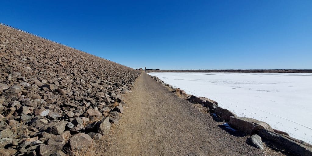
As I approached the trail end near the marina, several eagles were circling above, looking for fish in the corner of the reservoir that wasn’t frozen. I saw a few of these impressive birds sitting on the edge of the ice, attempting to eye their prey in the water.
After observing the eagles for a few minutes, I finished my hike by passing behind the marina, where I was reunited with my car.
The total distance was 7 miles (11.26 km). I rate this hike as moderate because of the distance and partly because the total elevation gain was a surprising 1200 feet (366 m).
The route on AllTrails:
Don’t see the map or want to see the original? Click here to go to the map page on AllTrails.
Hiking with Pets in Cherry Creek State Park
Dogs on leash are allowed in the park and on most paved trails, but not on the trails in the Wetlands Preserve. Cherry Creek State Park has a treat for these furry friends, a dog off-leash area. At 107 acres, this fenced area has plenty of space for dog exercise including getting into the water. Use of the dog off-leash area requires an additional fee.
Trail connections
As I mentioned above, I took the Cherry Creek Trail on the western side of the reservoir. Not only does this trail run through the park for almost 8 miles (12.9 km), it’s part of a 40-mile (64.4 km) long regional trail of the same name. The park map shows the path of the Cherry Creek Trail in and out of the park.
The Piney Creek Trail is a 9.5-mile (15.3 km) paved path that stretches from Denver’s eastern suburbs, with the westernmost segment of 0.38 miles (0.61 km) within the park.
Both the Cherry Creek Regional Trail and Piney Creek trail are paved and popular with cyclists. There is no park entrance fee if entering on foot or by bike.
More about Cherry Creek State Park
Other things to do
With the reservoir being the main attraction in this park, it’s no surprise that boating, fishing, and water sports, including water-skiing and stand-up paddleboarding, are popular.
On land, in addition to the dog off-leash area, some of Cherry Creek State Park’s more distinctive features include an amphitheater, model airplane field, family shooting range, and horse rental.
Food and Drink
Pelican Bay at Cherry Creek offers services at the marina. The Lake House event center sits behind a beach area where The Pub serves drinks and a limited menu. The Wharf rents non-motorized watercraft and also sells beer, soda, water, and sun protection essentials. Check the website for operating hours.
Accommodations
Cherry Creek has at least 144 campsites and is one of the state parks that allows winter camping. On my winter loop hike, I noted that the campgrounds had a reasonably good occupancy.
The majority of the campsites have full hookups, but there are 30 basic sites and three group sites. Additionally, three campsites are marked as handicap accessible.
Colorado State Park camping must be reserved online in advance at the CPW shop. Check the reservations page for fees–they vary based on the site type.

Park Fees
Daily Vehicle Pass: $11
Annual Affixed Pass (for one vehicle): $83
Family Annual Pass (one address, any vehicle): $123
Dog Off-Leash Area Passes
Daily Pass: $3
Annual Pass: $25
For more information on these passes, multiple vehicles passes, or other specialty passes available (such as 64+, disabled, veteran, or military), see the CPW Park Pass page.
Getting to Cherry Creek State Park
East Entrance: 4201 S Parker Rd, Aurora, CO 80014; about one mile south of I-225 on Parker Road at E Lehigh Ave
West Entrance: Use the Pelican Bay address of 4800 S Dayton St, Greenwood Village, CO 80111
South Entrance (access to dog off-leash area and horse stables): At the intersection of E Orchard Rd and S. Entrance Rd, Aurora, CO 80015
The State Park Passport

I have a goal to visit all 42 of Colorado’s State Parks. The Colorado State Parks Passport makes it easy to plan and keep track of State Park stops. It’s fitting that one of my first passport stamps was in Colorado’s first state park-Cherry Creek State Park,
I’ll undoubtedly return to Cherry Creek State Park sometime during my pursuit of all the State Park stamps. It’s close and convenient. With miles of hiking trails, wildlife, and water activities, this State Park showcases the Colorado outdoors without even leaving the city.
Pin it for later!

What trail will you take in Cherry Creek State Park? Leave a comment below!
What is that new road that is being constructed off of S. Dayton across from the High School and just south of the entrance to the Lake View Rd. entrance? Looks like it is going clear across the partk to Belleview.
I have to say I don’t know what they’re doing there!
What a beautiful state park! That hike around the reservoir looks incredible!
It was! Glad you enjoyed this post!
How beautiful! I need to spend more time actual IN Denver and not just flying or driving through. It would be so wonderful hiking these trails early in the morning with my camera!
This would be a good place to visit if you have a long layover, it’s less than a one-hour drive from the airport!
I have actually never been out to Denver before, but have only heard great things from friends and family who have been before. It looks lovely from all of your pictures. I love staying active while on vacation so the idea of visiting the state park seems great! If I was really up for it maybe I would try to hike all 35 miles!!!
Glad you enjoyed the post – I love your optimism!
How nice that it’s only a 30-minute drive from Denver. And it seems like being hours away from anything and anywhere.
Does it get busy during summer? Love the mural. 🙂
Yes, it is very popular in the summers. For the last two years, the park was at full capacity at times on most weekends!
I love water and the idea of doing this hike on a warmer day when the ice was already frozen over. So cool to see eagles too!
Glad you liked it! We have plenty of winter days like that!