** Darla Travels is reader-supported.
When you buy through our links, we may earn a commission. **

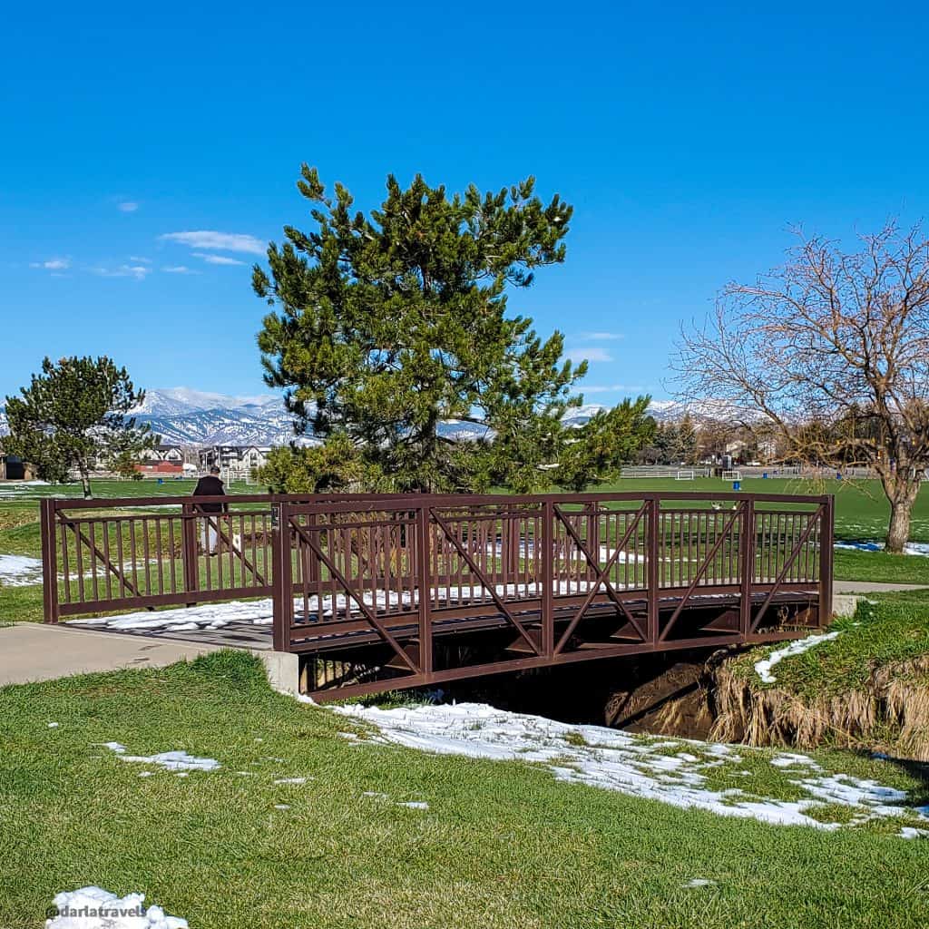
Jefferson County’s Van Bibber Park in Arvada, Colorado, packs 5.2 miles (8.4 k) of trails into a 164-acre (66.4 ha) open space featuring a tree-lined creek, mountain views, and a city overlook.
The wide pathways and primarily flat terrain will be an easy hike for most reasonably fit people. However, anyone who wants more effort can climb the single hill in the park and increase the hike distance by following the trail outside the park and into Arvada.
Keep reading for more about Van Bibber Park and open space.
About Van Bibber Park
Van Bibber Park is one of 28 parks managed by Jefferson County Open Space and one of only three JeffCo city parks. Longer in the east-west direction than north-south, it’s not quite rectangular. The terrain is relatively flat on the park’s north side, with a slope uphill to the south boundary.
One of the main features is Van Bibber Creek, which runs roughly east to west. The park and the creek get their names from Issac Van Bibber, who established a farm near the waterway in 1859. Settlement began in Jefferson County this year due to the Colorado Gold Rush. Coincidentally, 1859 also saw the first irrigation ditches in Jefferson County. While the Gold Rush only lasted until 1861, Arvada’s agricultural industry became established and expanded. In addition to crops of wheat, or oats and barley, processed at the nearby Arvada Flour Mill, surrounding farms produced a variety of other products, including fruits, celery, and even carnations!
Farming continued, but residential and commercial development of Arvada picked up in the 1950s. By the 1970s, there was a push for the preservation of open space. Jefferson County first acquired the land for Van Bibber Park in 1978 and expanded it to its current size in 1995. (Land for other JeffCo Parks, such as Mount Falcon Park, was also acquired in the 1970s).
Today, this greenbelt open space is a wildlife habitat surrounded by housing developments with business parks and interstates nearby.

Access the main parking lot and the trailhead from Ward Road. Another trailhead and smaller parking lot are at the opposite end of the park (to the west) on Indiana St. For proximity to restrooms and picnic facilities, choose the Ward Road trailhead.
Dogs (on leash) are allowed, and the trails allow walking, biking, and horseback riding.
Walking in Van Bibber Park
From the Ward Road Trailhead, trails branch in different directions. Pick any path to start exploring this slice of nature surrounding Van Bibber Creek, as they all connect to the three main trails in the park.
Van Bibber Creek Trail
The first main trail is the Van Bibber Creek Trail. This paved path is never too far from Van Bibber Creek and its tree-lined banks. Stretching the park’s entire length from trailhead to trailhead, it’s about 1.5 miles (2.4 k) in one direction.
The tall trees near the creek lend themselves to bird watching along this route. Toward the west, North Table Mountain comes into view, with the Front Range further in the distance.
Lattice electrical transmission towers also line this trail and make for an interesting perspective.

Outer Loop Trail
The second major trail in Van Bibber Park is the Outer Loop Trail, a 1.85-mile (3-km) trail roughly circling the park just inside its boundary. The Outer Loop Trail is a natural surface trail next to the Van Bibber Creek Trail near the park’s north boundary. While the Van Bibber Creek trail connects both of the park trailheads from east to west, the Outer Loop Trail turns toward the south side for a modest climb as the landscape slopes upward. At the edge of this hill, the trail skirts a suburban neighborhood with a few access points to the park. This loop trail eventually comes back down the hill and returns to its starting point.

At a bench along the hilltop, pause to view the whole park along with metro Denver beyond the park border. Continue on the loop trail from here, or head downhill to the Jimmy Go Trail.

Jimmy Go Trail
The final main trail is named Jimmy Go. The Jimmy Go Trail (0.3 mile, 0.5 km) connects the Van Bibber Creek Trail and the Outer Look Trail diagonally. An observation deck near a pond near the middle of the park is a quiet destination and wetland area attracting birds and other wildlife.

Trail connections
The Jefferson County Open Space map for Van Bibber Park shows the park trails ending at the east end, near the Wark Road Trailhead; however, the creek and paved creek trail continue through an underpass beneath Ward Road.
Once past the underpass, the trail moves past the Rainbow Bridge neighborhood then enters Skyline Park, an Arvada city park with a skateboarding area.
The trail continues through the 80-acre Stenger soccer complex with its multiple soccer fields. Close to the end of the complex, the trail turns toward the south, running parallel to Oak Street, then turns east again at an underpass.
One fun feature here is a scale model of the solar system. Simple concrete markers with the sun and names of the planets are arranged next to the trail such that they represent relative distances in the actual solar system.

On the other side of the Oak Street underpass, walk by the Apex Field House, then the Harold D. Lutz sports complex featuring several baseball fields.
Next, with one more underpass, the trail traverses Kipling Parkway and moves into a more residential area, becoming a sidewalk along Grandview Avenue. Along this stretch, the trail passes by the historic Arvada cemetery, established in 1863. Finally, the trail ends at the intersection of Grandview Avenue and Independence Street. At least, maps show the route ending here. Unfortunately, there are no signs or other markers, but it’s just a regular sidewalk past the Grandview/Independence intersection.

Custom Maps of Van Bibber Park Trails
On a fall day, I took the Outer Loop Trail with the Van Bibber Creek Trail to the eastern trailhead, backtracked, continued on the Outer Loop Trail, then completed the loop by crossing the open space on the Jimmy Go Trail.
On a spring morning, I walked the Van Bibber Creek Trail to the end of the park and back, then continued out of the park via the Ward Road underpass all the way to the intersection of Grandview Avenue and Independence Street in Arvada before returning to the start.
Don’t see the maps or want to see the originals? Click here and here to go to the map pages on AllTrails.
Other Trail Information
| Getting There | Van Bibber Ward Road Trailhead 5575 Ward Road, Arvada, CO 80002 Van Bibber Indiana Trailhead 5590 Indiana Street, Arvada, CO 80002 |
| Distance | Total of 5.2 miles (8.3 km) Van Bibber Creek Trail continues for 2 miles (3.25 km) outside the Park. |
| Difficulty | easy to moderate |
| Trail Type | Out and back with options for loops |
| Trail Surface | Paved and natural |
| Besides Hiking: | running, biking, equestrian |
| Links | Jefferson County Open Space Page Colorado Trail Explorer (COTREX) Page AllTrails page for the Van Bibber Park Trail |
| Closest Towns | Arvada |
Conclusion
Van Bibber Creek, along with Arvada’s farming history, set the stage for Van Bibber Park. Its trails extend past the park boundary into recent recreation and residential developments. As a result, the Van Bibber Park area provides an easy to moderate open space hike within an urban corridor.
Pin it for Later!

Have you hiked in Van Bibber Park? What did you think? Leave a comment below!
Leave a Reply