
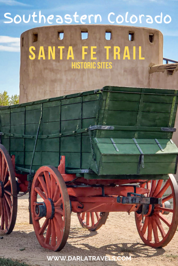
Cutting through the High Plains of southeastern Colorado, the historic Santa Fe Trail was once a thriving commercial route. While Colorado’s iconic Rocky Mountains often steal the spotlight, the grasslands of the High Plains shouldn’t be overlooked. Here, you’ll find remnants of frontier forts, echoing boomtowns, and reminders of the complex and troublesome relationship between westward expansion and Native American nations. It’s a region filled with frontier history, waiting to be explored.
So get ready to learn about four historic sites that bring the story of the Santa Fe Trail to life in southeastern Colorado. You can visit them all on a two- to three-day road trip.
These places and the people associated with them share intertwined histories. But before we dive into the monuments, let’s take a moment to understand the region’s compelling history as it relates to the Santa Fe Trail.
- The Santa Fe Trail in Southeastern Colorado
- The Sand Creek Massacre National Historic Site: A Place of Sorrow and Remembrance
- Kit Carson Memorial Chapel at Fort Lyon National Cemetery
- Boggsville Historic Site: Permanent Settlement in Southeastern Colorado
- Bent’s Old Fort National Historic Site
- Where to Stay in Southeastern Colorado
- Santa Fe Trail Historic Sites in Southeastern Colorado: Pin It for Later
- Conclusion: Reflect and Remember
The Santa Fe Trail in Southeastern Colorado
The Santa Fe Trail was a legendary overland route that linked Missouri to Santa Fe beginning in 1821. Goods for trade made their way from Missouri and into New Mexico on two prairie routes. The first, the Cimarron Route, just barely touched the far southeastern corner of Colorado. The second, the Mountain Route, carved a path through the Arkansas River Valley following the north bank of the river.
Although it began as a commercial trade route, the Mountain Route assumed significant military importance during the Mexican-American War. The trail became a vital pathway for the movement of troops and supplies. As the war ended and the West opened, the trail transformed into a national road. Now it was for adventurers of every stripe, including traders, gold seekers, and missionaries.
But by 1880, a railroad paralleling the route was completed, rapidly sidelining the Santa Fe Trail. Its bustling days were over. Yet even today, over 140 years after the Trail lost its significance, monuments from this era remain in southeastern Colorado and continue to inform and inspire casual tourists and history buffs alike.
The Santa Fe Trail Scenic and Historic Byway
In Colorado, the Mountain Route in southeastern Colorado is commemorated today as the Santa Fe Trail Scenic and Historic Byway. It spans 188 miles (302.5 km) through Prowers, Bent, Otero, and Las Animas counties. This designation highlights both the historical significance and the scenic beauty of the trail as it passes through southeastern Colorado.
The Byway follows the longer Santa Fe National Historic Trail, which extends from Missouri to New Mexico. Visitors can explore museums, historic sites, and even original segments of the trail.
At Raton Pass near Trinidad, Colorado, and Raton, New Mexico, the Colorado Santa Fe Trail Scenic and Historic Byway connects to the similarly named Santa Fe Trail Scenic Byway, a 381-mile (613-km) route in New Mexico that continues the historic path toward Santa Fe.
A Note on the History of Colorado’s Santa Fe Trail Sites
The history of each of the four sites described below could easily fill volumes of encyclopedias! To keep this article manageable, I’ve distilled some of the most compelling details. If you’re eager to explore further, I’ve included several references (linked) to help you dive deeper into the fascinating legacy of the Santa Fe Trail in southeastern Colorado.
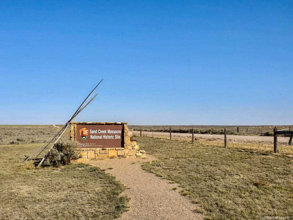
The Sand Creek Massacre National Historic Site: A Place of Sorrow and Remembrance
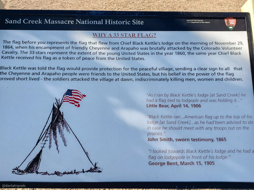
One of the darkest events in U.S. frontier history unfolded in today’s southeastern Colorado on November 29, 1864. It became known as the Sand Creek Massacre. At dawn, a regiment under the command of Colonel John Chivington launched a surprise attack on a peaceful Cheyenne and Arapaho encampment. The soldiers brutally killed around 230 tribe members, 150 of them women, children, and elderly.
The National Register of Historic Places added the Sand Creek Massacre site in 2001, and the completed Sand Creek Massacre National Historic Site (NHS) was inaugurated on April 28, 2007.
Context of the Sand Creek Massacre
Commerce along the Santa Fe Trail meant increasing contact between the Plains tribes and settlers and traders moving goods over 900 miles (1448 km) of the trail between Missouri and New Mexico. Conflicts between Indigenous nations on the Great Plains and early Colorado settlers led to the 1861 Treaty of Fort Wise; however, flaws in the treaty and poor implementation meant that tensions continued to rise.
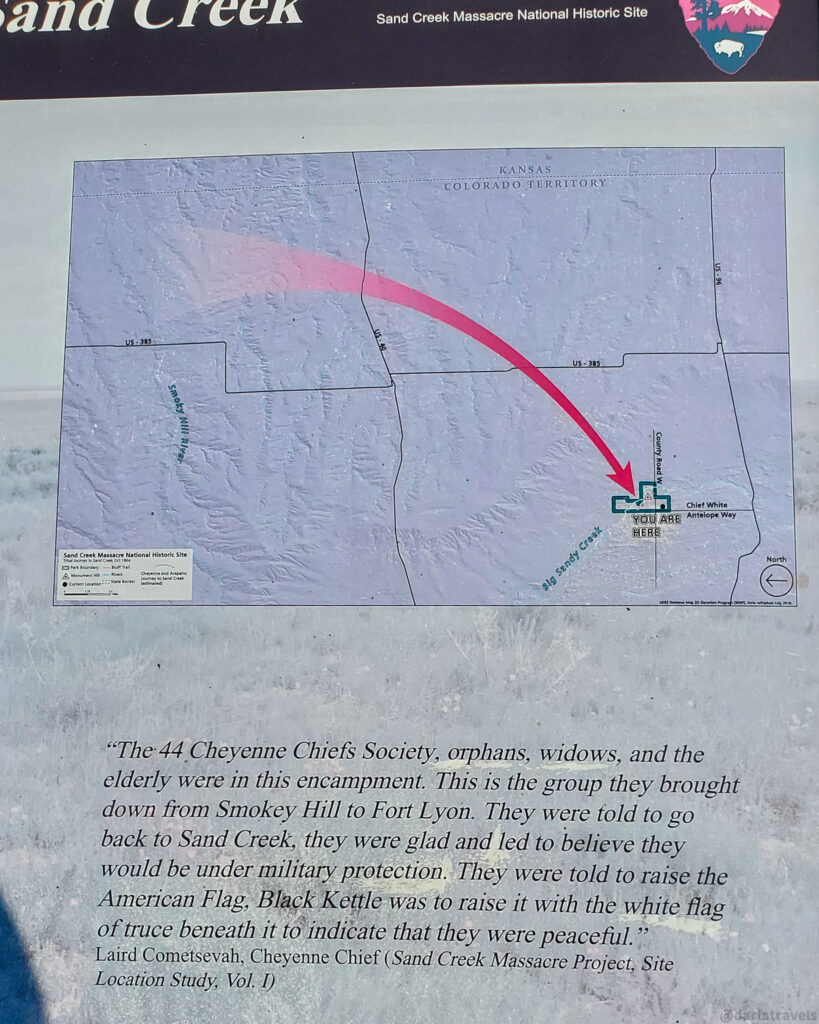
In 1864, Cheyenne sub-chief Ochinee (Lone Bear/One-Eye), father of Amache Ochinee Prowers of Boggsville, made peace offers to Major Edward Wynkoop at Fort Lyon. Wynkoop agreed to protect the tribes if the Cheyenne and Arapaho relocated to Sand Creek, a spot within their treaty-designated land.
Opposition to the Peace Efforts
Many, however, opposed peace with the Native Americans. Colonel John M. Chivington was known for his animosity toward the tribes and wanted to further his political ambitions through military action. He likely influenced Major Wynkoop’s removal, replacing him with Major Scott Anthony, who was more sympathetic to Chivington’s agenda.
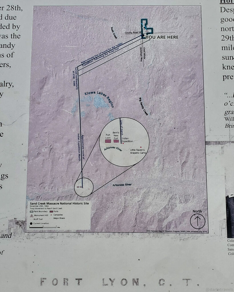
As late as November 15, 1864, Anthony and Wynkoop met with Cheyenne and Arapaho leaders at Fort Lyon (formerly known as Fort Wise). They advised the tribes to await further instructions. A mere two weeks later, on November 28, Chivington arrived at the fort, blocked communication with the tribes, and led 675 troops overnight to the tribal encampment at Sand Creek.
At dawn on November 29, Chivington launched a surprise attack on the temporary camp despite visible signs of non-aggression, including an American flag. Among the dead was Ochinee (Amache Ochinee Prowers’s father). Some soldiers mutilated many of the corpses, keeping body parts as trophies.
Initially celebrated, the attack, later known as the Sand Creek Massacre, sparked outrage and was investigated by the government. Chivington resigned in early 1865. The massacre deeply damaged U.S.–Indigenous relations and escalated military presence on the plains.
To this day, it remains a harrowing moment in American history.
Honoring the Victims at Sand Creek Massacre NHS
The Sand Creek Massacre National Historic Site was developed by the National Park Service (NPS) in consultation with the Northern and Southern Cheyenne and Arapaho Tribes. The Site holds sacred and spiritual significance for the Cheyenne and Arapaho people, serving as a place to honor the ancestors lost in the tragic event.
At this monument, the truth is laid bare. There is no glossing over the role the federal government played in the sordid violence and murder of the Cheyenne and Arapaho people at Sand Creek. Visitors can acknowledge the atrocity directly, honor the Cheyenne and Arapaho victims, and reflect on the consequences of betrayal and violence. The NPS indicated that the memorial would provide information to visitors to “assist in minimizing the chance of similar incidents in the future.”
The Visitor Center and Monument Hill
Start your visit at the modest visitor center, where you’ll find a bookstore. Then visit the outdoor visitor use area, thoughtfully curated with interpretive panels.
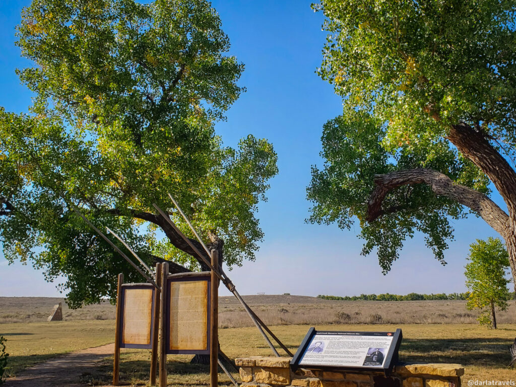
From there, a short, reflective walk leads you to Monument Hill, with signs that provide further information. At the top, an overlook offers a solemn view of Big Sandy Creek, also known as Sand Creek.
This sacred site also includes a repatriation area, a respectful resting place for human remains and cultural artifacts of the Cheyenne and Arapaho Tribes.
The Bluff Trail
From Monument Hill, the Bluff Trail stretches northwest along a ridge. As you walk, interpretive signs deepen your understanding of the massacre’s timeline and terrain. The quiet surroundings contrast with the violent events that unfolded here.

An AllTrails Map shows the trail to Monument Hill and the continuation of the Bluff Trail. The walk from Monument Hill to the end of the Bluff Trail covers approximately 1.2 miles (2 km).
The Section 36 Pullout
On the entrance road to the monument, there is a pullout with interpretive signs worth stopping at, either before or after your visit to the main visitor area. The signs tell the story of the Cheyenne and Arapaho journey to Sand Creek, as well as the soldiers’ overnight trek from Fort Lyon to the location. It’s humbling to look over the plains and imagine the scene in 1864, knowing the lasting impact of the massacre on Cheyenne and Arapaho communities.
Practical Information for the Sand Creek Massacre NHS
Getting to the Sand Creek Massacre National Historic Site
The Sand Creek Massacre National Historic Site is in Kiowa County in rural southeastern Colorado at the intersection of Chief White Antelope Way (County Road 54) and County Road “W”. It’s 23 miles (37 km) northeast of Eads, Colorado, and getting there includes driving at least 8 miles (12.9 km) on dirt roads.
I recommend following the directions to the Sand Creek Massacre National Historic Site on the official National Park Service website. Contact information is also available for questions regarding road conditions.
Hours and Fees at the Sand Creek Massacre National Historic Site
The Sand Creek Massacre NHS is open Thursday through Monday from 9:00 AM to 4:00 PM, except on certain national holidays. The Historic Site is closed on Tuesdays and Wednesdays. There is no entry fee for the Sand Creek Massacre National Historic Site.
The Sand Creek Massacre Visitor and Education Center in Eads, Colorado, is closed until further notice.
Kit Carson Memorial Chapel at Fort Lyon National Cemetery
Our next stop is the Kit Carson Memorial Chapel just outside the Fort Lyon National Cemetery near Las Animas, Colorado. Fort Lyon National Cemetery is next to Fort Lyon. But why is the Kit Carson Memorial Chapel here?

About Kit Carson
In 1826, at just 16 years old, Christopher H. “Kit” Carson escaped his apprenticeship as a saddle maker in Franklin, Missouri—the eastern end of the Santa Fe Trail—and joined a caravan heading to Santa Fe, New Mexico. Carson traveled extensively along the Santa Fe Trail, and in time, he became a renowned frontiersman, Army scout, and guide.
About Fort Lyon
Fort Lyon served as a key military outpost for the Mountain Branch of the Santa Fe Trail in southeastern Colorado. Troops from the fort escorted wagon trains and patrolled the trail to help maintain safe passage. Fort Lyon, originally named Fort Wise, was established in 1860 near Bent’s New Fort and the Arkansas River. This is the same Fort Lyon that played a role in the Sand Creek Massacre. After this location was flooded in 1866, Fort Lyon relocated 20 miles (32 km) upstream to an area near Las Animas.
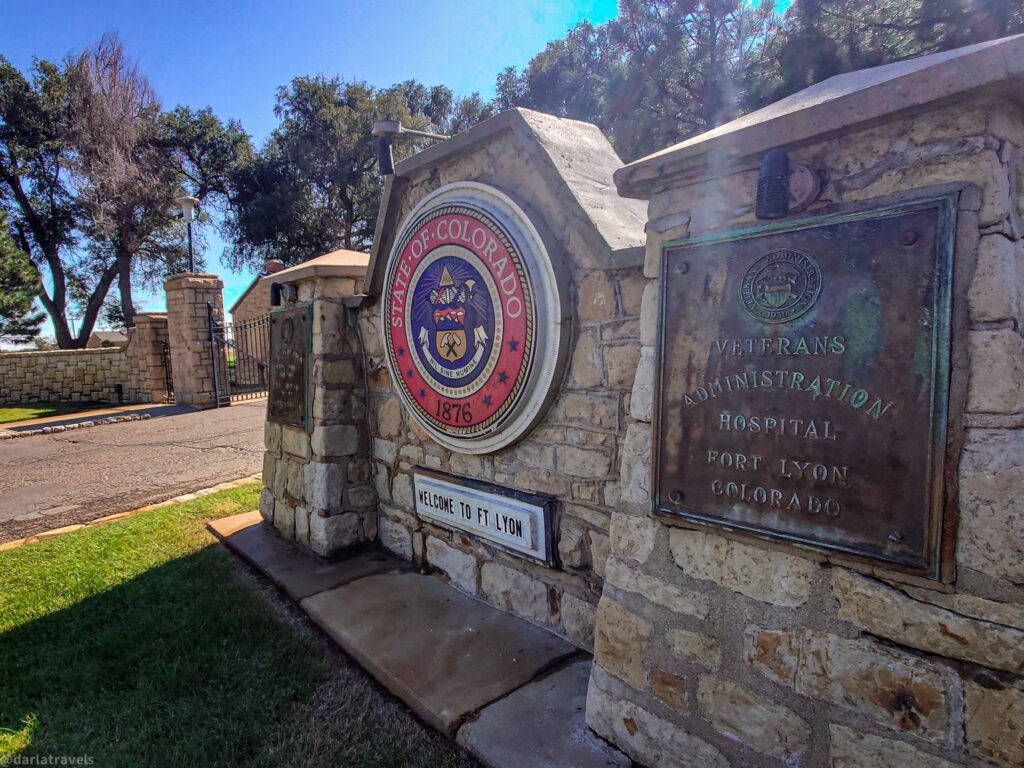
The Origin of the Fort Lyon National Cemetery
The U.S. Army abandoned Fort Lyon in 1897, but in 1906, the U.S. Navy began using it as a tuberculosis hospital. The Navy also established a cemetery as part of the hospital complex. After being overseen by various government agencies for decades, the cemetery became part of the National Cemetery System in 1973. It remains active and is managed by the United States Department of Veterans Affairs. The National Register of Historic Places added it to their listings in 2017.
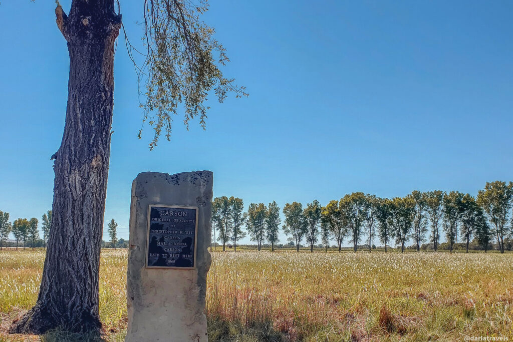
Origin of the Kit Carson Memorial Chapel
Kit Carson lived in nearby Boggsville, now the Boggsville Historic Site, with his family in his final years. When he fell ill for the last time, he went to nearby Fort Lyon for treatment. He died there in Surgeon General Tilton’s Quarters on May 23, 1868. The building was subsequently used as a blacksmith shop, a meeting hall, and a museum.
In 1959, the Veterans Administration created the Kit Carson Memorial Chapel using stones taken from the Surgeon General’s Quarters building, which had fallen into disrepair. After the Colorado Department of Corrections took ownership of Fort Lyon in 2001 and turned it into the Fort Lyon Correctional Facility, the Kit Carson Memorial Chapel was relocated to the entrance of Fort Lyon.
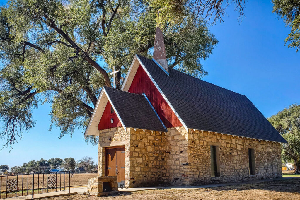
Unfortunately, perhaps due to its proximity to a State Prison, visitor access to the Chapel dwindled, and it became dilapidated. However, there was sufficient interest to generate funds for the renovation of the Chapel and reopen it in 2007. This renovation included refurbished stained-glass windows and new flooring installed by prisoners at the Fort Lyon Correctional Facility.
Visiting the Kit Carson Memorial Chapel
The Kit Carson Memorial Chapel stands at a quiet edge of the Fort Lyon National Cemetery. The Chapel is locked and can only be admired from the outside. (However, it may be possible to view the interior through the John W. Rawlings Heritage Center & Museum in Las Animas.)
This modest building, constructed from repurposed stone, features no elaborate ornamentation and exudes a tranquil ambiance. The plain wooden entrance contrasts with its sharply pitched roof, a nod to Gothic Revival architecture. A slender white steeple tops the Chapel, and a red-painted gable with white trim on the eaves adds a quaint contrast.

Walk around the side, and you’ll notice narrow stained-glass windows—touches of beauty that hint at the reverence with which the building was designed and restored.
Walking around the Chapel doesn’t take long, but if you’re anything like me, you’ll find yourself lingering. Something about its quiet presence invites you to sit, reflect, and take it all in. I was especially drawn to the story behind this building, the thoughtful simplicity of its design, and the care that’s gone into preserving it for curious visitors like us.
What Happened to the Fort Lyon Building?
And what about Fort Lyon? It still stands, but not as a monument or museum. Instead, it’s now home to the Fort Lyon Supportive Residential Community. This innovative program offers transitional housing and comprehensive support services for individuals experiencing homelessness, many of whom are also recovering from substance use disorders.
What was once a military outpost, a hospital, and a prison now serves as a haven for healing and hope. This new chapter in Fort Lyon’s history as a place of safety recalls its original mission of providing safe passage for travelers on the Santa Fe Trail.
Practical Information for the Kit Carson Memorial Chapel
Getting there: From Highway 50 near Las Animas, turn south on Highway 183 and travel about 1 mile (1.6 km) to the entrance of Fort Lyon. The Kit Carson Memorial chapel is past the Fort Lyon gate at the junction of Gate Road and Cemetery Road.
To view the Chapel interior, inquire at the John W. Rawlings Heritage Center & Museum
in Las Animas. Email: bentctyheritage “at” gmail dot com. This museum gets good reviews for its insight into the local history of the Santa Fe Trail.
Boggsville Historic Site: Permanent Settlement in Southeastern Colorado
Just a few miles south of Fort Lyon lies the Boggsville Historic Site—an essential stop for understanding the broader story of Kit Carson, Fort Lyon, and the development of southeastern Colorado.
Boggsville was a pioneer settlement established in 1866 along a side route of the Santa Fe Trail. At the time, it was about three miles (4.8 km) above the Purgatoire River’s confluence with the Arkansas River. Today, the closest town to Boggsville is Las Animas.
Before the settlers arrived, Native American tribes used the open plains between the two rivers here for seasonal encampments. Cheyenne, Arapaho, Kiowa, and to a lesser extent, Comanche continued to frequent the area as trading centers like Boggsville and Bent’s Old Fort (described below) were built.
Boggsville boomed due to traffic on the Santa Fe Trail and commerce with nearby Fort Lyon for only about seven years before new railroad lines bypassed the town, changing the way business and trade were conducted.
The Boggsville Historic Site has been listed on the National Register of Historic Places since 1986 and is also designated as a National Historic District. It’s well worth a visit because of its significance in several categories, including architecture, agriculture, exploration and settlement, commerce, transportation, and Hispanic ethnic heritage.
Visiting Boggsville Historic Site
Upon arrival at the Boggsville Historic Site, a friendly docent offered me a golf cart tour. My knowledgeable guide recounted the history of Boggsville and its founding pioneers. We began the tour by driving through a short lane lined with small cottonwood trees. Once a stately entrance to the village, it’s barely recognizable as such today.
Boggsville Historic Site is undergoing restoration. While it’s absolutely worth visiting, it will be even better once improvements can be made to the grounds.
The Territorial Architecture of Boggsville
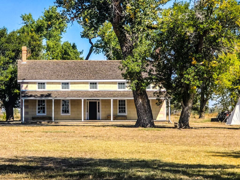
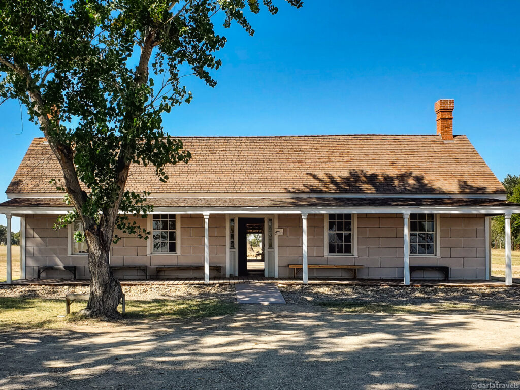
The main structures at the Boggsville Historic Site are two restored houses: the Boggs House and the Prowers House.
- The Boggs House was built in 1866 by Boggsville founder Thomas O. Boggs for himself and his wife, Rumalda Maria Luna Bent Boggs —a member of the prominent Bent family (stepdaughter of Charles Bent). She inherited the land through Mexican land grants.
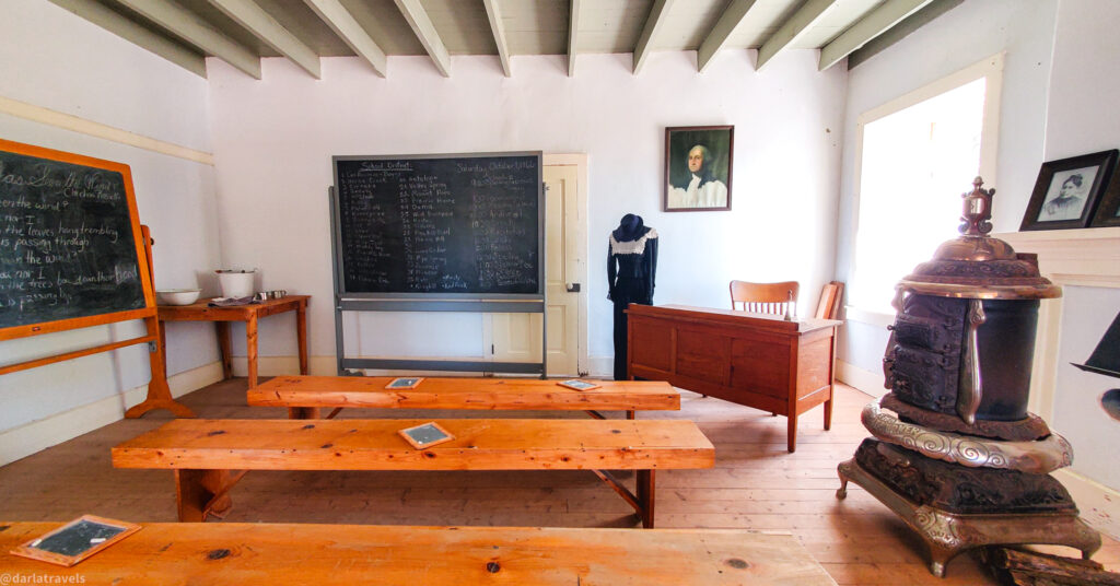
- The Prowers House, built in 1867–68, belonged to John Wesley Prowers. Prowers supplied Fort Lyon with food and livestock, and his large home also functioned as a school, store, and county office.
The Boggs and Prowers Houses are prime examples of Territorial architecture. Constructed of thick adobe brick, each house originally had a U-shaped Hispanic floor plan. The houses also featured Greek Revival style details, such as the windows and transoms.
I visited Boggsville on an unseasonably hot fall day, but the adobe houses remained impressively cool inside, even with their doors and windows open.
Agricultural Significance of Boggsville
Thanks to Boggs, Prowers, and other early settlers, Boggsville was the first large-scale agricultural development in southeastern Colorado. In 1867, residents of Boggsville dug (by hand) the Tarbox Ditch, a seven-mile (11.2 km) irrigation canal. The Tarbox Ditch brought water from the Purgatoire River to cultivate over 1000 acres (404 ha) of crops, including potatoes, corn, wheat, alfalfa, and vegetables. Fort Lyon bought a large portion of these products.
Upon relocating to Boggsville, John Wesley Prowers continued the cattle ranching business he started in 1861. He was the first settler to drive cattle in Colorado and introduced Hereford cattle to the area. By 1881, he had 15,000 head of cattle.
Other Notable Boggsville Residents
Boggs’s marriage to Rumalda Bent was an example of a late 1800s trend in which Anglo men married into high-class Mexican families for their valuable assets, including land and networking opportunities.
Boggsville also stands out for its other intercultural marriages and notable women.
- Kit Carson spent his final months here with his wife, Josefa (Rumalda’s niece), before dying at Fort Lyon in 1868. Their Boggsville cabin was destroyed in a 1921 flood.
- Amache Ochinee Prowers, wife of John Wesley Prowers, was a Cheyenne woman whose father died in the Sand Creek Massacre. She used the reparations land awarded to her by the U.S. government to expand their ranch. She also served as a mediator between Native, Mexican, and European American communities.
The Decline of Boggsville
Despite its early success, Boggsville began to decline in 1873 when the Kansas Pacific Railroad bypassed the settlement in favor of the nearby town of Las Animas. Prowers relocated to Las Animas in 1873 or 1874, and Boggs moved to New Mexico in 1877 due to land disputes. By the early 20th century, Boggsville was largely abandoned, but the land continued to be used as a farm and ranch for several decades.
Practical Information about Boggsville Historic Site
Take Highway 101 south from Las Animas for about 2 miles (3.2 km) and follow the signs to Boggsville Historic Site.
There is no entry fee for the Boggsville Historic Site.
Boggsville is open from spring to fall, Tuesdays through Saturdays. For current information, call 719-456-1358 or email: boggsville “at” gmail dot com.
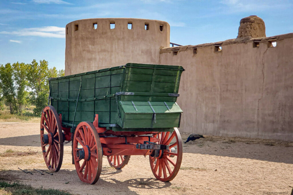
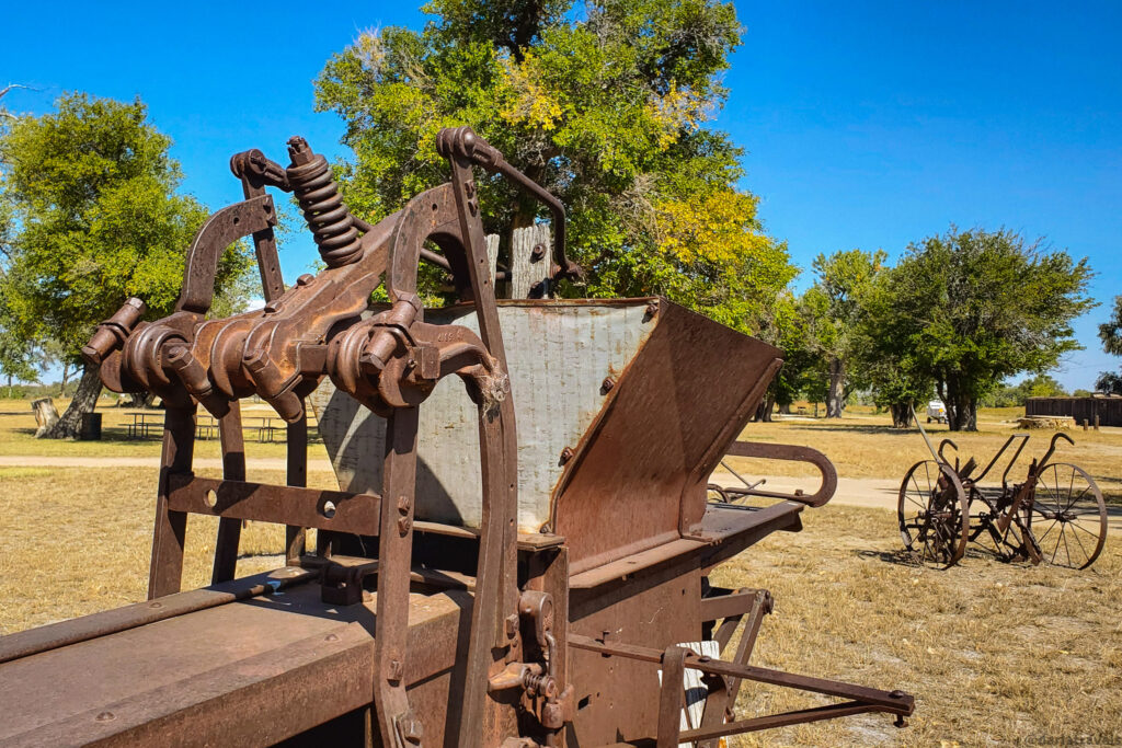
Bent’s Old Fort National Historic Site
No journey through this region is complete without a stop at Bent’s Old Fort National Historic Site (NHS), which features a reconstructed adobe fort from the Santa Fe Trail era.
The Fort area became a National Historic Site under the NPS on June 3, 1960. It became a National Historic Landmark later that year on December 19, 1960. The fort itself was reconstructed in 1976 and is open to the public today.
Bent’s Old Fort: A Hub for Trade
In 1833, William and Charles Bent, along with Ceran St. Vrain, constructed the original Bent’s Fort as a significant trading post for their company, Bent, St. Vrain & Company. The goal was to transport manufactured goods from St. Louis to Santa Fe and trade with the Southern Cheyenne, Arapaho, and Plains Indian tribes for buffalo furs.
At the time, Bent’s Fort was the only significant American settlement between Missouri and the Mexican border. It served not only as a commercial hub but also as a diplomatic crossroads. Travelers could buy supplies, food, and water, and even have their wagons repaired. Kit Carson worked here as a hunter, and in 1846, the fort became a staging area for the U.S. Army during the Mexican–American War.
Demise and Reconstruction of Bent’s Old Fort
Bent’s Fort was abandoned by William Bent in 1849 for numerous reasons. For example, there was a cholera epidemic among the Plains Indians. Personal tragedies also played a role, including the murder of his brother Charles Bent. An unsuccessful attempt to sell the fort to the U.S. government led Bent to remove his goods and partially destroy the building by setting it on fire. The ruins were used for various purposes until they had crumbled into rubble by 1910.
In 1852, Bent relocated his operations to a new site near Big Timbers, located near modern-day Lamar, Colorado. Bent built what became Bent’s New Fort on the bluffs above Big Timbers in the fall of 1853. In 1860, he sold this structure to the U.S. Army, which, with additional buildings, established Fort Wise (later Fort Lyon) in the same year. Bent’s New Fort no longer exists, but a Historical Marker stands at the site.
Reconstructing Bent’s Old Fort in 1976 necessitated extensive archaeological work, which led to the discovery of over 30,000 artifacts and historical records. Although not all details were available, researchers utilized engineering plans and eyewitness accounts to inform the design.
Visiting Bent’s Old Fort
The Gate of Bent’s Old Fort
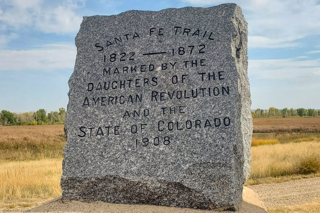
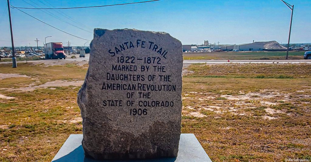
The stone gateway at Bent’s Old Fort Gate marks the original entrance to the roadway to the Fort. It was built by the La Junta Chapter of the Daughters of the American Revolution (DAR). DAR bought and preserved the land here until 1954, when it was sold to the Colorado State Historical Society. The National Park Service took ownership in 1960. Without the foresight of the DAR, Bent’s Old Fort NHS might not exist today! There are two historical markers, also placed by DAR, near the gate: one to mark the site of the fort, and one to mark the route of the Santa Fe Trail.

Note: The DAR has placed multiple markers along the Santa Fe Trail in Colorado. Another marker close to Bent’s Old Fort is at the end of the Red Shin Trail in nearby John Martin Reservoir State Park.
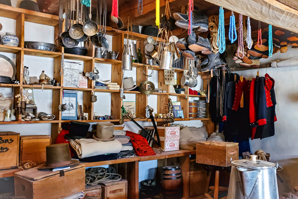
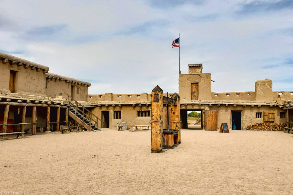
Inside Bent’s Old Fort
Stepping inside the reconstructed Bent’s Old Fort is a window into frontier life. The adobe structure is built around a central plaza and includes a trading room, kitchen, blacksmith shop, storerooms, a powder magazine, a well room, living quarters, and a livestock corral. Ceran St. Vrain’s quarters were located on the second floor, although that level has been closed for safety reasons since 2023.
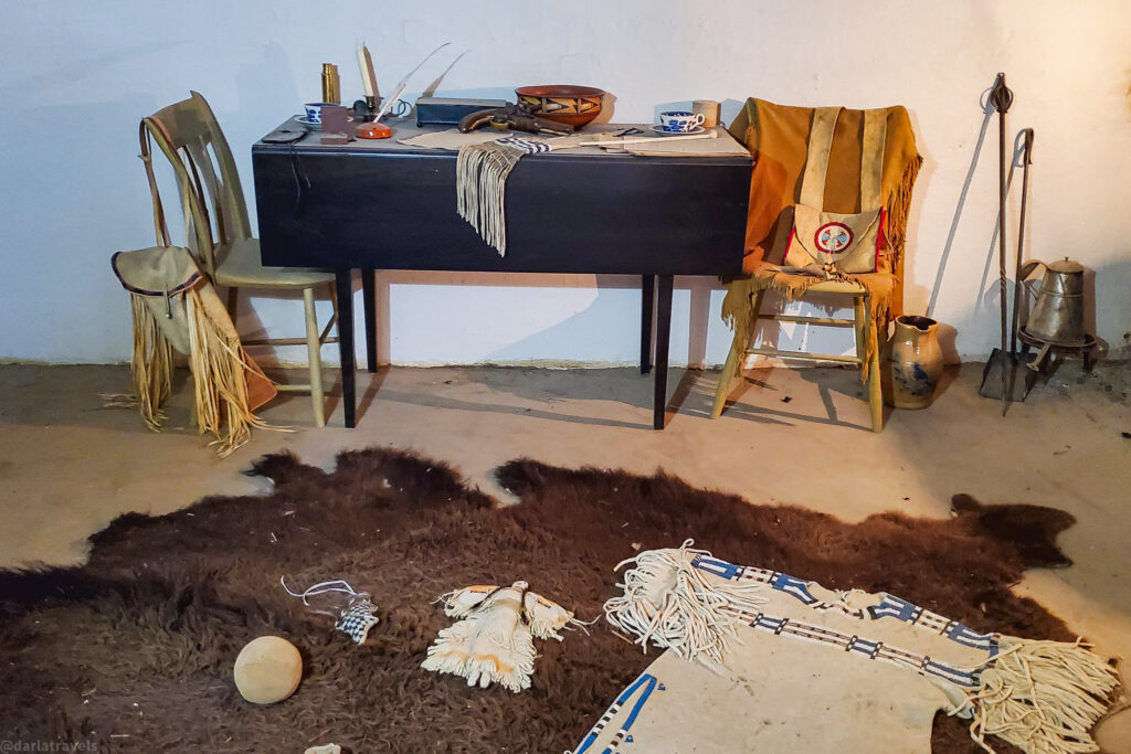
While once a center for immersive living history programs, these demonstrations have been scaled back. Nevertheless, each room is furnished with period-appropriate materials, providing a realistic glimpse into 19th-century life at the Fort.
Hiking at Bent’s Old Fort NHS
A two-mile (3.2 km) loop trail surrounds the fort and follows the nearby Arkansas River. It’s a peaceful walk with opportunities for birdwatching and wildlife sightings. The trail is marked on AllTrails and is accessible for most visitors.
Practical Information for Bent’s Old Fort National Historic Site
⚠️⚠️The reconstructed fort at Bent’s Old Fort Historic Site is experiencing structural safety hazards.
The Fort grounds and trails are open.
During the summer of 2025, fort will be open for guided tours only.
Guided tours of the fort will occur at 9:00 and 11:00 a.m. on Saturdays.
On Sundays, Mondays, Thursdays, and Fridays, guided tours will be available at 11:00 a.m. only.
Each tour will last approximately seventy-five minutes and begin at the visitor parking orientation shelter.
The official park address is 35110 State Highway 194 E., La Junta, CO. The official website for Bent’s Old Fort NHS gives detailed driving directions from La Junta and Las Animas.
A 1/4 mile (1,275 feet, 402 m) paved trail that connects the parking area to Fort’s entrance gate.
The park grounds are open from 9:00 a.m. to 4:00 p.m. every day, except on certain national holidays.
Unless you have an annual pass, the entrance fee to Bent’s Old Fort is $10.
Where to Stay in Southeastern Colorado
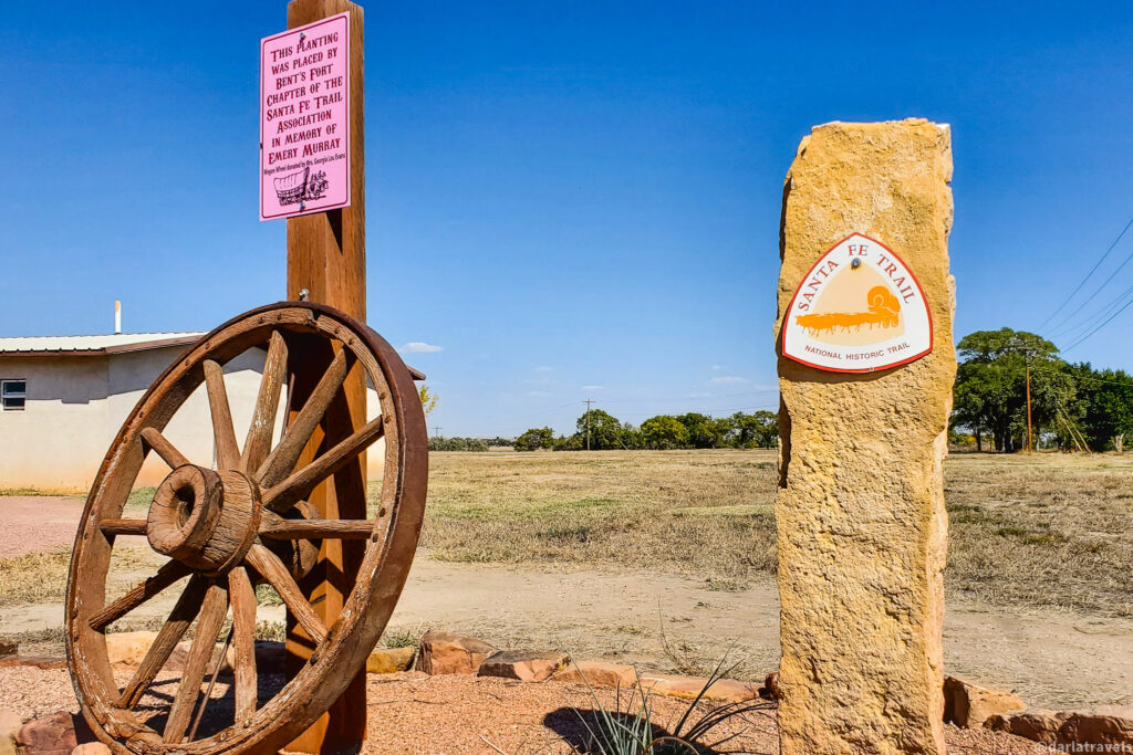
Lamar, Colorado, makes an excellent home base for exploring the historic sites of southeastern Colorado. Look for the Santa Fe Trail Marker in Lamar Big Timbers Museum Interpretive Park (at the intersection of Scenic U.S. 50/287 and State Highway 196). This marker is one of those placed by DAR to preserve the memory of the Trail.
Lamar has plentiful gas stations, grocery stores, restaurants, and hotels. You’ll enjoy a comfortable stay in Lamar while you plan visits to the area’s historic and scenic sites.
Consider the recently renovated Historic Cow Palace Inn, which features the Tavern 1301 restaurant on-site, for accommodations.
Across the street, the Days Inn offers modern comforts, including in-room coffee, a microwave, and a mini-fridge, at a budget-friendly price.
Use the map and links below to book your stay and start planning your journey through southeastern Colorado’s Santa Fe Trail historic sites.
Book now at Booking.com ♦ Book now at Expedia ♦ Book now at Hotels.com
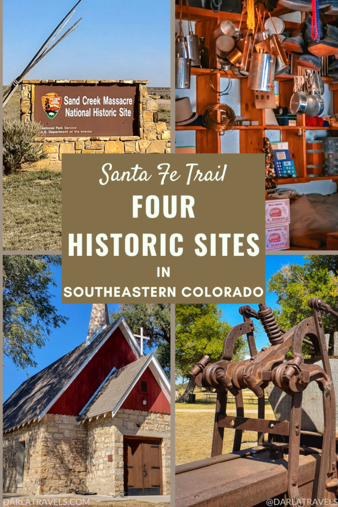
Santa Fe Trail Historic Sites in Southeastern Colorado: Pin It for Later
I created these images for the Santa Fe Trail historic sites in southeastern Colorado for your Pinterest boards:
Conclusion: Reflect and Remember
Each of the Sand Creek Massacre NHS, the Kit Carson Memorial Chapel, the Boggsville Historic Site, and Bent’s Old Fort NHS reveals a facet of life in the Santa Fe Trail era in southeastern Colorado. From frontier trade to intercultural exchange to early agricultural innovation, the southeastern corner of Colorado offers a chance to engage with the past.
While the Santa Fe Trail vanished over 145 years ago, its impact on shaping the American West is evident in the lives of figures such as Chief Ochinee, Kit Carson, William and Charles Bent, and John and Amache Ochinee Prowers, as well as their associated monuments.
We’ve never had the chance to spend time in the area around Lamar. I’d like to visit the Kit Carson Memorial Chapel and Old Bent Fort site.
That sounds like a good plan! You’ll get to get to soak up some history while you enjoy the high plains!
The Massacre at Sand Creek is a very sad footnote in American history. Thanks for sharing!
Absolutely, it really is a heartbreaking part of our history. I’m glad we have a historic site to to remember this event so we can learn from it and take the lessons learned into the future.
It was interesting to read how Old Fort Bent had to be reconstructed and the 30,000 artifacts that they found.
I agree! All the artifacts really shows how much history is packed into the reconstructed fort!
How many days did it take you to experience and visit each of these sights? It doesn’t seem like you could see them all in one day but I am unfamiliar with the distance between sights in this area.
Great question! No, it wouldn’t be possible to see all of these in one day. Because of the remote location, I would set aside a full day to visit the Sand Creek Massacre NHS. I visited Boggsville and Bent’s Old Fort on two different days. However, they could be done in the same day, the drive between them is only about 25 minutes. You could visit one in the morning and one in the afternoon. Note, however that there is a limited amount of services and restaurants in Las Animas, the town between the two sites. The Kit Carson Memorial Chapel is very close to the highway and is a quick stop, so I would recommend seeing this site on your way to or from Boggsville, which is a 15 minute drive. I hope that’s helpful. Please let me know if you have any more questions!