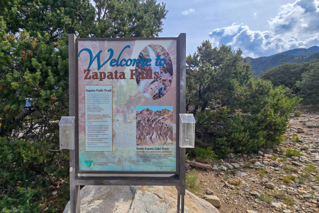
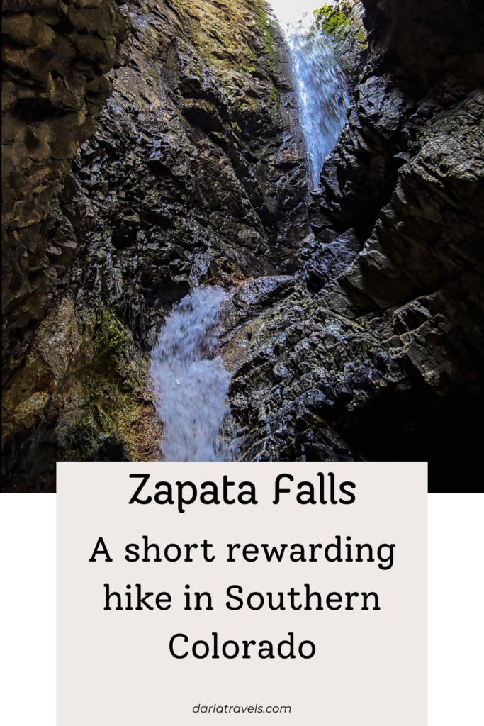
In a small hidden canyon in southern Colorado, between the Great Sand Dunes National Park and the town of Alamosa, lies one of the region’s most enchanting hiking experiences: Zapata Falls. This year-round destination offers a breathtaking payoff for a short hike, featuring a hidden 30-foot (9.1) meter waterfall that is approachable on foot after a brief trek and a short walk through South Zapata Creek.
With just a little planning, you’ll be able to complete the short hike confidently, wade through the creek, and reach the base of Zapata Falls. This guide covers everything you need to know for a successful hike to Zapata Falls any time of the year.
** Darla Travels is reader-supported.
When you buy through our links, we may earn a commission. **
In a hurry? Book an excellent stay near Zapata Falls (near Alamosa) now:
👉🏽 Booking.com ⯁ Expedia ⯁ Hotels.com
What’s so special about Zapata Falls?
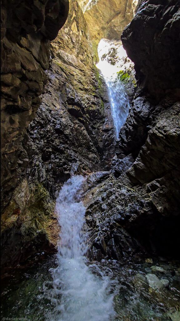
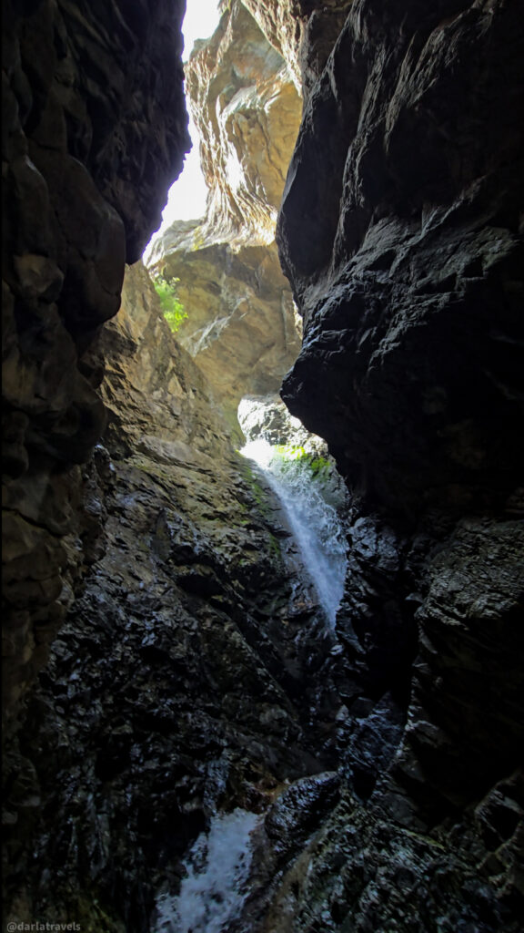
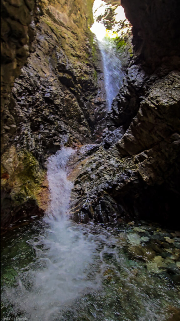
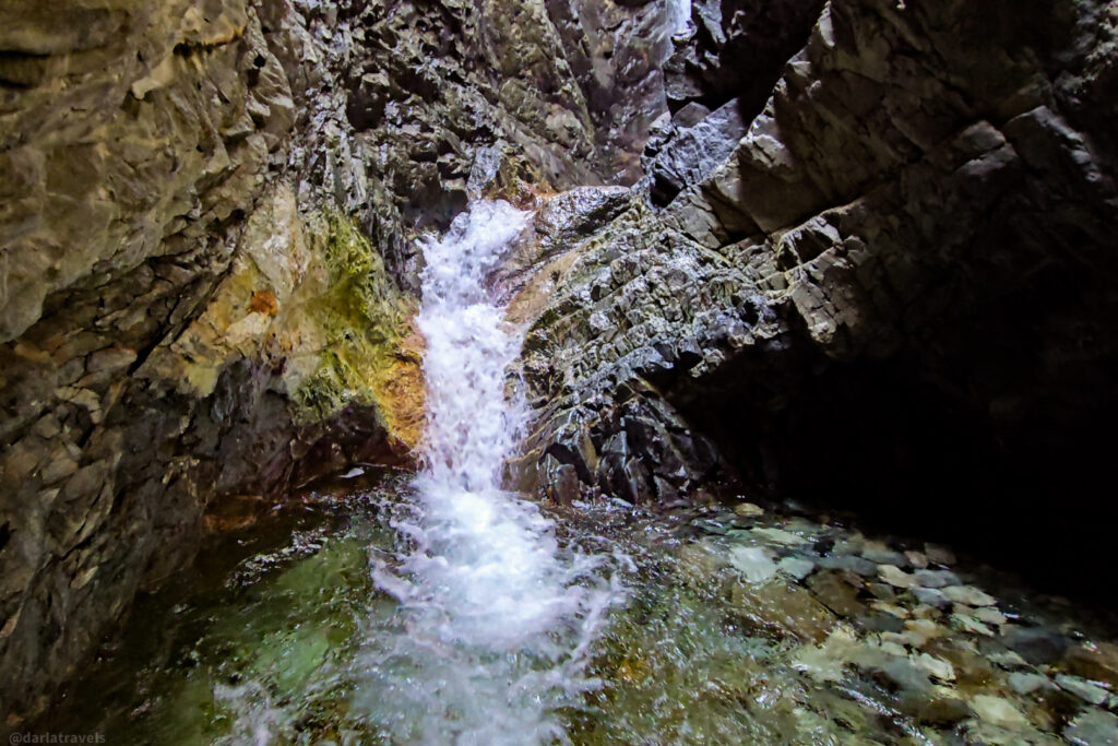
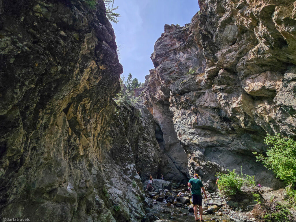
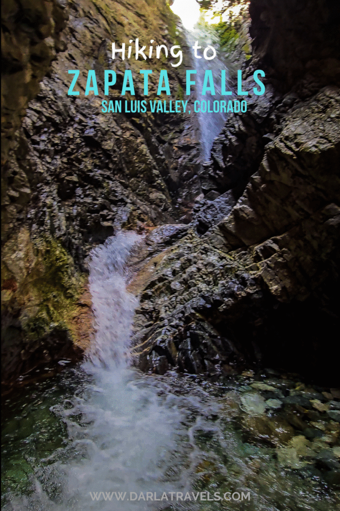
Hidden Waterfall: A narrow, rocky canyon houses Zapata Falls, making them invisible from the trail. To view the falls, one must wade through Zapata Creek.
Zapata Falls boasts several features that make it an exceptional destination; there’s a reason it receives approximately 180,000 visitors per year.
A Year-Round Experience: In the warmer months, the falls are at a cool, shaded spot with flowing water. In the winter, the falls freeze into a spectacular column of ice.
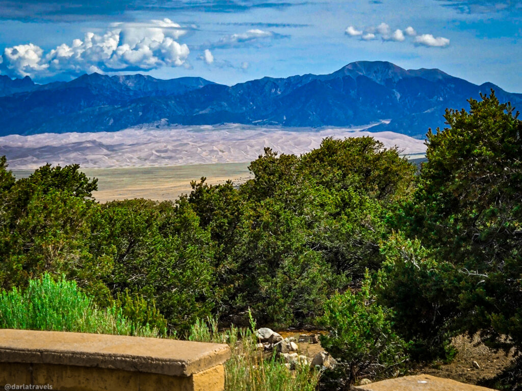
The Views: The falls are situated at the border of the San Luis Valley and the Sangre de Cristo Mountain Range. Enjoy panoramic views of the Great Sand Dunes National Park and the San Luis Valley from the trailhead parking lot and spots on the trail.
Settlement History: “Zapata” is the Spanish word for shoe. To raise sheep and other livestock, Mexican families established the community of Zapata below Zapata Falls in 1864. Zapata Ranch was established in the 1870s through the consolidation of land holdings for cattle raising purposes. Zapata Ranch is still an active bison and cattle ranch.
An Unusual Geologic Feature: Zapata Falls are the result of powerful forces of nature that have been at work over millions of years. Two million years ago, massive glaciers slid down the Sangre de Cristo Mountains. As the glaciers melted, the rushing water began carving out a narrow gorge at a weak point in the landscape. Over thousands of years, South Zapata Creek continued to wear away crystalline and softer sedimentary rock, creating the deep canyon and the stunning 30-foot (9.1 m) waterfall we see today.
Rare Bird Sightings: Zapata Falls is a significant and well-known breeding site for the American Black Swift (Cypseloides niger borealis). The waterfall provides a misty, secluded environment. The swifts require this setting for nesting, often behind the falling water. This site has been central to long-term research on the species, with monitoring efforts beginning in 2004 and continuing through the present.
Protection and Preservation: Zapata Falls is situated within the Bureau of Land Management’s Zapata Falls Special Recreation Management Area (SRMA), which borders the active Rio Grande Rift. (This is the geological feature that allowed the Sangre de Cristo Mountains to grow while the San Luis Valley sank).
The area is also part of Colorado State Trust Land (relevant to hunters). It is a designated Colorado Natural Area — a location that has one or more unique natural features important to Colorado.
Other Waterfall Hikes
I have a few other posts on waterfall hikes. Another short waterfall hike with a big payoff is Fish Creek Falls near Steamboat Springs. For a longer hike to a bigger waterfall, look at Delaney Falls near Québec City.
Getting to Zapata Falls: Directions and Trailhead Info
Zapata Falls is located near Alamosa, Colorado, in the San Luis Valley.
Where is Zapata Falls?
The Zapata Falls trailhead parking lot can be reached by Colorado State Highway 150 between mile markers 10 and 11, approximately :
- 5 miles (8 km) south of Great Sand Dunes National Park and Preserve.
- 10.5 miles (17 km) north of U.S. Highway 160.
- 29 miles (47 km) from Alamosa
- 25 miles (40 km) from Fort Garland.
Directions to Zapata Falls
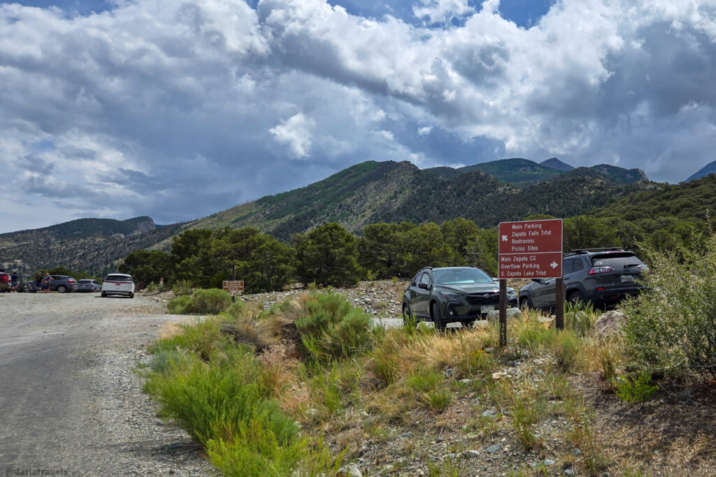
On Highway 150, look for signs that point you to Zapata Falls. You’ll turn on Zapata Falls Road, also known as BLM Road 5415, which ends at the trailhead parking lot in about 3.5 miles (5.6 km). Use the following location information in your mapping apps:
📍Zapata Falls Trail, Mosca, CO 81146
📍Google Plus code: JCCR+J5 Mosca, Colorado
📍GPS coordinates: 37°37’17.8″N 105°33’34.3″W
You may have read that the road to Zapata Falls is unpaved and very rocky. I’m happy to report that this information is outdated, as Zapata Falls Road was paved in 2021. The drive from the valley floor to the parking lot and trailhead–about 1,000 feet (305 m) of elevation gain–is now a smooth road navigable by any reasonable passenger car.
At the Zapata Falls Trailhead
Just FYI, dogs are allowed here and on the trail, but must be leashed.
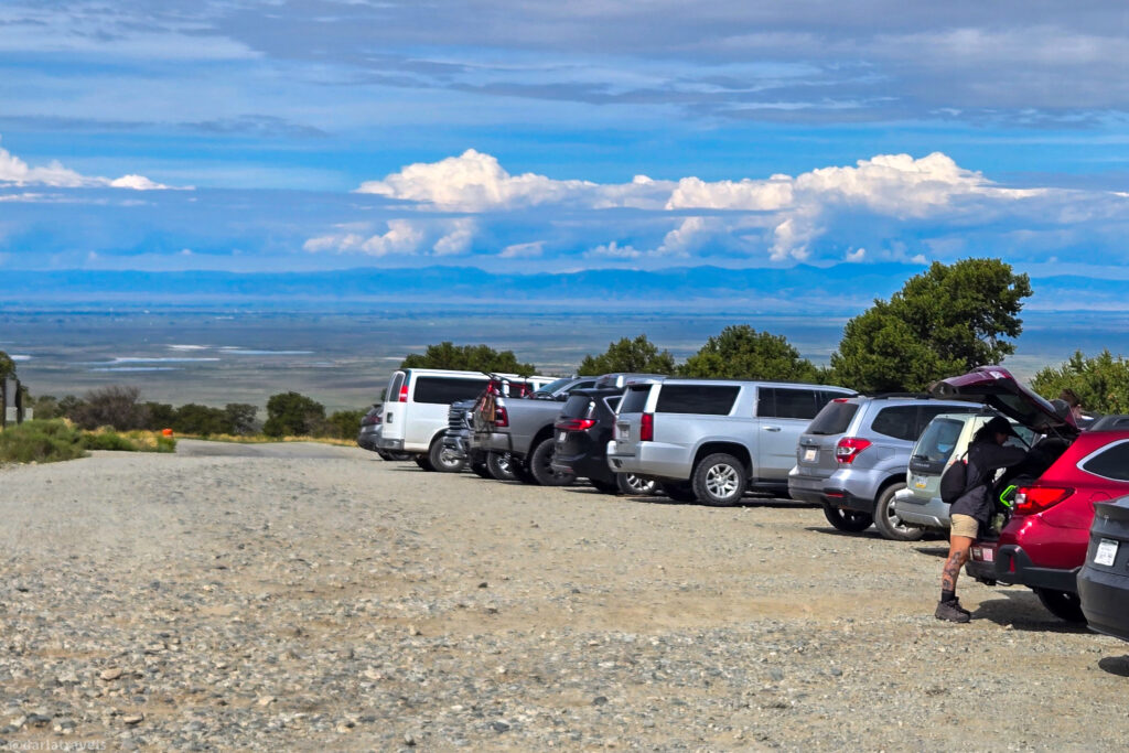
Zapata Falls Parking Area
The parking area itself is unpaved. It’s not that large and can be very crowded. But because the hike is short, people are always coming and going, so it shouldn’t take too long for a spot to open up.
Zapata Falls Overlook
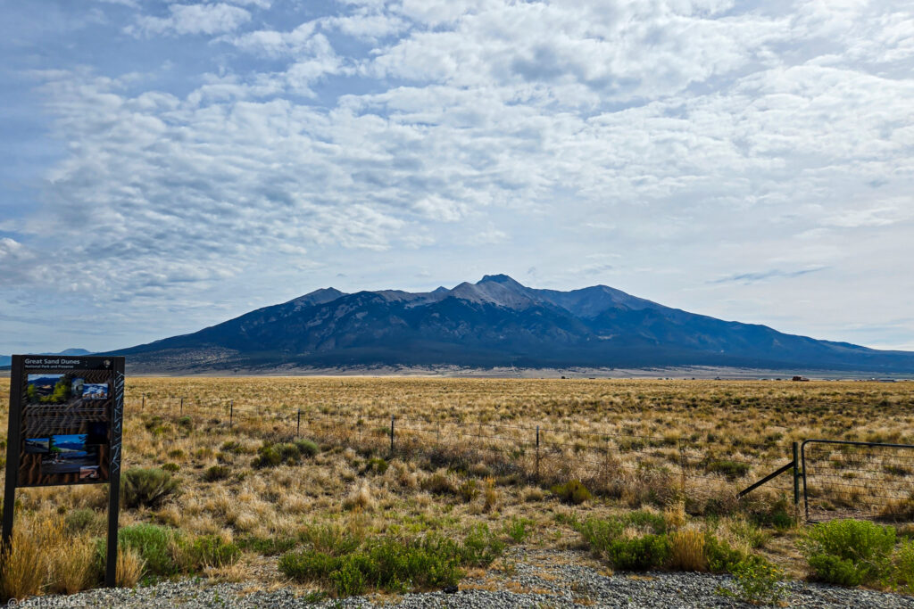
Be sure to pause for a few minutes at this overlook spot, which offers panoramic views of the San Luis Valley and features interpretive panels. From this vantage point, you can see the wide open floor of the valley stretching out to the west, with the San Juan Mountains visible in the distance.
The most prominent feature, however, is located to the north and east: the impressive dunes of Great Sand Dunes National Park. The sand dunes are built up against the Sangre de Cristo mountains. The contrast of the sandy foreground with the jagged mountain peaks (some of them over 14,000 feet (4,267 m) above sea level) is breathtaking.
Restrooms at the Trailhead:
Yes, there is a building with pit toilets at the Zapata Falls trailhead! I found the women’s restroom to be spacious, clean, and well-stocked.
The Hike to Zapata Falls
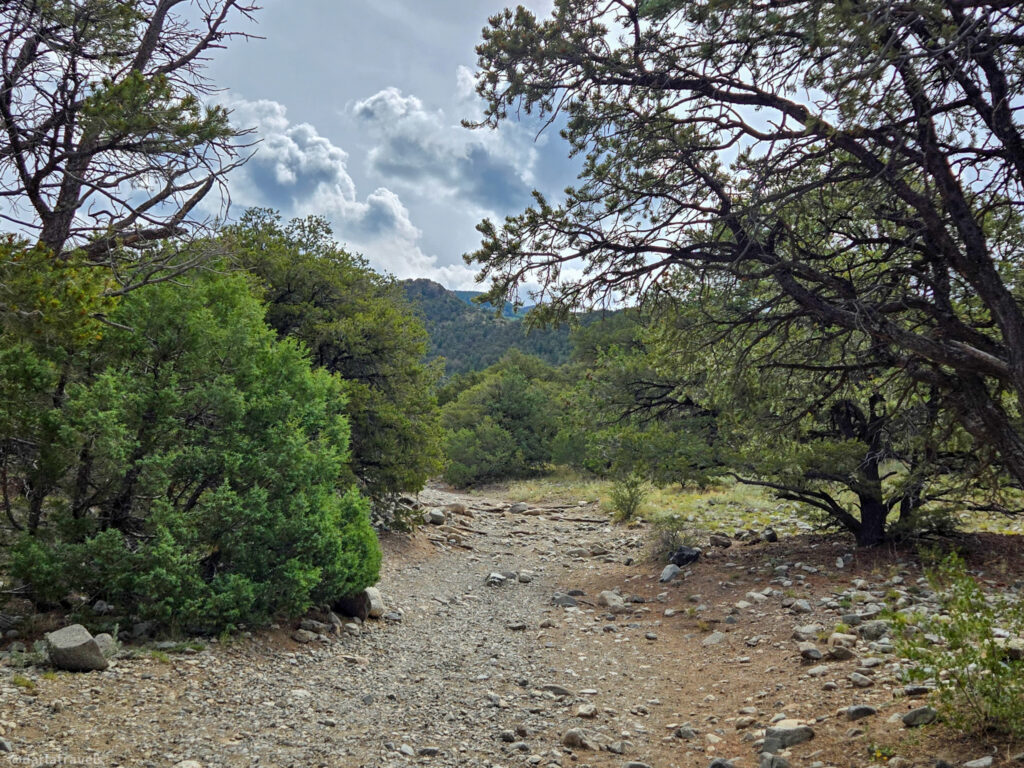
The trail to Zapata Falls is short, rocky, and moderately steep. AllTrails indicates that it’s about 0.4 miles (0.7 km) one way for a total distance of 0.8 miles (1.3 km) out and back. The starting elevation for this hike is 9,072 feet (2,765 m). Over the course of the hike, the climb is 134 feet (59 m).
The trail map shows the end of the trail stopping short of the falls, which are around 200 feet (61 m) away (at most). At this point, you’ll be able to hear the rushing water from the hidden waterfall.
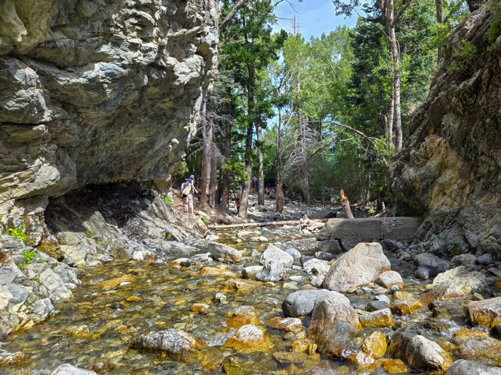
On my recent visit to Zapata Falls, I recorded a round-trip distance of 1.1 miles (1.7 km), which included walking around the creek area and up to the base of the falls. The last little bit of distance to the falls, not shown on the trail map, is through South Zapata Creek.
Preparing to Walk in South Zapata Creek in Warmer Months.
There’s no getting around it; if you want to see Zapata Falls for yourself, you’ll have to wade or rock-hop through the chilly water. Even in July, I found the creek water to be frigid! I saw people walking barefoot in the creek, but I can’t recommend doing this because the rocks can be slippery.
Bring Proper Footwear for Walking in the Creek.
So what kind of footwear should you have? I wore my regular hiking shoes to hike the trail. At the side of the creek, where there were several benches to sit on, I changed into:
🧦Waterproof socks (Drymile brand) and
🩴Hiking sandals (an old pair of Tevas)
Although my feet were cold, they were not wet, and the grippy soles on my sandals meant I didn’t have to worry about slipping.
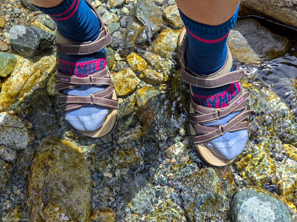
The creek was deep enough at the falls that the water level was higher than the tops of my socks. So after I returned to dry land, I was happy I had brought:
💧A lightweight, packable travel towel (Sea to Summit Airlite),
While you’re changing your footwear, I recommend taking a few minutes to watch how others navigate the creek so you can plan how you want to cross it.
Note: The water is generally safe to wade through, but always check the depth of the creek and current. Some users report swift water in the spring and early summer.
Arriving at Zapata Falls
If it seems like there is a lot of preparation here, be assured that the payoff is worth it! Walking up the creek, the roar of the falls increases, so you’ll know you’re getting close.
And once inside the cave-like crevasse, look up to see the 30-foot (9.1 m) waterfall. You’ll want to spend at least a few minutes here observing the falls. The water does not fall in a straight line, but cascades over a rocky wall and changes direction before dropping into South Zapata Creek. In this relatively narrow space, you may have to crane your neck to get a glimpse of the sky through the narrow gap at the top of the falls.
Hiking Zapata Falls in the Winter
I confess that I have not visited Zapata Falls in the winter, but I’ve prepared this summary based on the recommendations of others.
Zapata Falls freezes into an ice column in the winter, and it may be blanketed by snow. Hikers must be cautious of icy and snow-packed surfaces as they approach the falls.
Users sometimes report that rushing water can be heard under the ice and may even be flowing over the top. Hikers are cautioned that the ice may not be thick enough to support their weight.
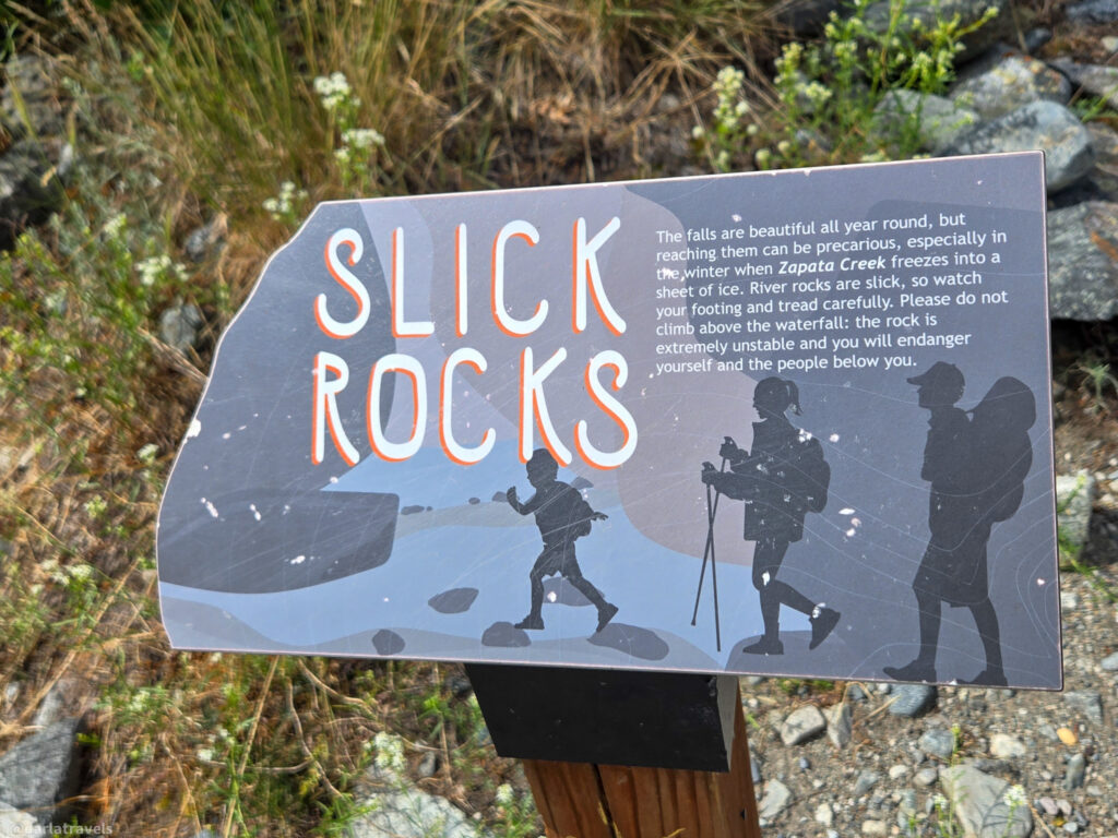
Specific recommendations for hiking to Zapata Falls in winter include wearing waterproof footwear and traction devices, such as microspikes or crampons, to ensure stability and prevent slipping.
In the winter, or even in the cooler months of spring and fall, getting wet poses a risk of frostbite or hypothermia. Bring towels and warm clothing in these conditions!
One final safety note: Climbing the rocky walls around the falls is not allowed. The rocks are unstable, making the climb dangerous for both the climber and other hikers below.
Where to Stay Near Zapata Falls
Camping Near Zapata Falls
If you’re a camper, consider the Zapata Falls Campground–it’s adjacent to the trailhead! Sites at this basic campground must be reserved in advance. Campsites have a table, tent pad, fire ring, food storage locker, and parking. Vault/pit toilets are available, but there is no water or electricity. Individual sites start at $11 a night.
The Piñon Flats Campground at Great Sand Dunes National Park is open from April through October and features 88 individual sites. There is a fire grate and picnic table at each site, but no hookups are available. While the campground offers restrooms and potable water, it does not have showers. Reservations are required.
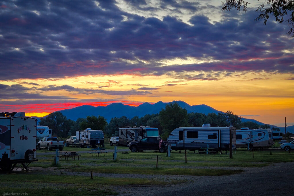
For a more upscale camping experience, consider the Alamosa / Great Sand Dunes KOA Journey. It’s got great mountain views and almost too many amenities to list, including WiFi, indoor restrooms and showers, a swimming pool, and a convenience store. Campsites include RV sites and tent sites, some of which offer electricity. Campers can also rent a cabin.
Hotels and Vacation Rentals Near Zapata Falls
If you’re also visiting the Great Sand Dunes National Park, consider staying at the Great Sand Dunes Lodge in nearby Mosca, Colorado.
Otherwise, book your stay in Alamosa, Colorado, approximately 35-40 minutes from Zapata Falls. This attractive and historic town has several cozy hotels and vacation rentals to serve visitors. And it’s a solid basecamp for exploring southern Colorado beyond Zapata Falls. Use the map and links below to research and book your accommodation in the Alamosa area.
Find your Alamosa lodging from your preferred booking site:
🛎️ Booking.com 🏨 Expedia 🛏️ Hotels.com
Hiking to Zapata Falls-Pin It for Later!
I created these images about hiking to Zapata Falls for your Pinterest Boards.
Wrapping up the Hike to Zapata Falls
Zapata Falls offers a quick but adventurous hike to a stunning secret waterfall in Southern Colorado’s San Luis Valley. The hike is short, but the rewards are many: a beautiful location with fascinating geology, a creek crossing, and a cave housing the “secret” falls. And since it’s accessible year-round, every visit offers something new.
Have you been to Zapata Falls? Share your favorite memory in the comments!
Leave a Reply