** Darla Travels is reader-supported.
When you buy through our links, we may earn a commission. **
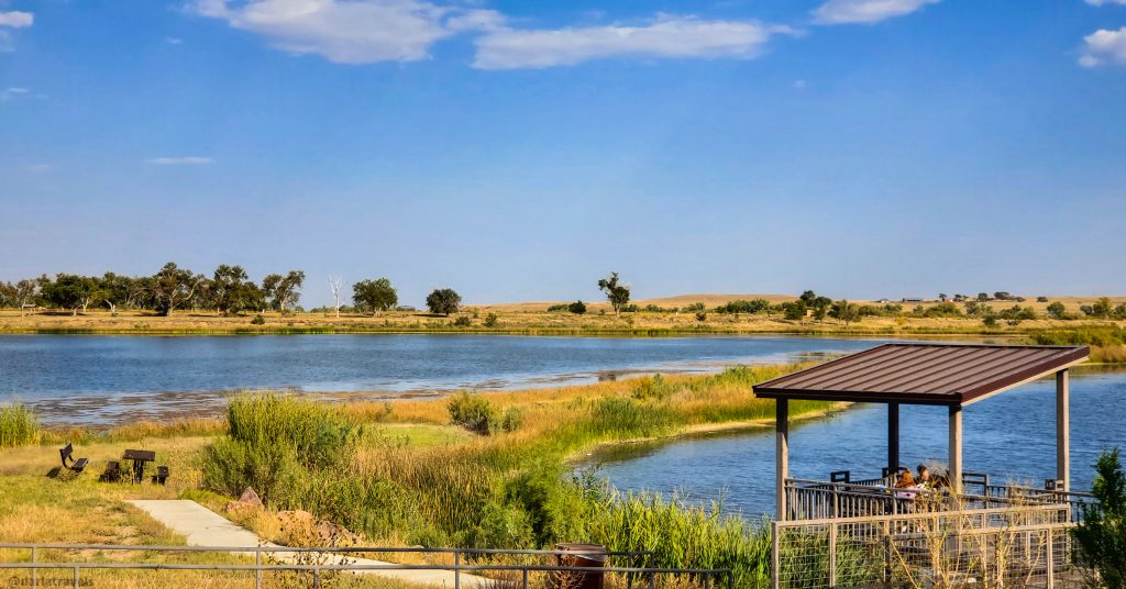
In southeastern Colorado, camping in John Martin Reservoir State Park offers you a quiet escape from your everyday routine. A hike around the park provides wide-open prairie views, potential for wildlife sightings, and even history lessons. This post will guide you through the hiking trail, the camping setup, and additional recreational activities for your John Martin Reservoir State Park getaway. Get ready to connect with nature and get in touch with the past in this premier recreation area on Colorado’s prairie. Keep reading to learn more about this state park in the lower Arkansas River Valley.
Table of Contents
- About John Martin Reservoir State Park
- Activities Central to John Martin Reservoir State Park
- Camping at John Martin Reservoir State Park
- Hiking the Red Shin Trail in John Martin Reservoir State Park
- Exploring Red Shin Standing Ground in John Martin Reservoir State Park
- Food and Drink at John Martin Reservoir State Park
- Alternate Accommodations Near John Martin Reservoir State Park
- More Practical Information About John Martin Reservoir State Park
- John Martin Reservoir State Park – Pin it for Later
- Final Thoughts on John Martin Reservoir State Park
About John Martin Reservoir State Park
In southeastern Colorado, John Martin Reservoir State Park is over 100 miles (161 km) from the next nearest state park (although it is close to many state wildlife areas). No surprise, the main feature of John Martin Reservoir State Park is the John Martin Reservoir. Dubbed “the Sapphire of the Plains,” the reservoir is the second largest body of water entirely within the state (Blue Mesa Reservoir in Gunnison County is number one). The reservoir is named after Colorado congressman John Martin, who pushed for legislation for the dam’s creation but passed away before its completion. The reservoir’s water level, volume, and surface area vary due to river and weather conditions, but when full, the surface area is reported to be 11,658 acres (47.18 km2).
Note: Many Colorado State Parks are situated around dams. Just as a few examples, these include Cherry Creek State Park, Chatfield State Park, Lake Pueblo State Park, and Stagecoach State Park.
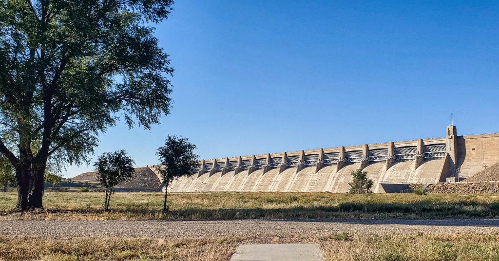
The John Martin Dam
The reservoir was formed by damming the Arkansas River for flood control and preservation of water for irrigation of the arid plains. The U.S. Army Corps of Engineers built the earth-fill embankment dam, named the John Martin Dam. It’s 118 feet tall (36 m) and 2.6 miles long (4.2 km). The dam began storing water in 1943, but completion had to wait until 1948 due to low resources during World War II.
Establishing John Martin Reservoir State Park
For decades, the U.S. Army Corps of Engineers licensed land around the reservoir to the State of Colorado as a wildlife area. John Martin Reservoir State Park came into existence in 2001 when Colorado made an agreement with the U.S. Army Corps of Engineers to manage the recreational areas on the reservoir’s north shore. The adjacent parcels of land (19,471 acres, 7880 ha) are now managed by the U.S. Army Corps of Engineers under the name John Martin Reservoir Wildlife Area. The Wildlife Area is for day use only. (See, for example, Miller, N. (n.d.). John Martin Dam: 75 years of history.)
Some History of John Martin Reservoir State Park Area
The Arkansas River Valley, where John Martin Reservoir State Park now stands, has a rich history. Various Native American tribes, including the Comanche, Kiowa, Apache, Arapaho, and Cheyenne, occupied this land at various times due to changing climate, the need for resources, and as a result of conflicts with others.
The Louisiana Purchase of 1803 brought the area into the United States, leading fur traders and other adventurers to explore the region and tap into its resources.
The Santa Fe Trail, a critical commercial route established in 1821, passed through this valley, facilitating trade. Later, the Santa Fe Trail served as a pathway for military invasion in the Mexican-American War. It also had a role in westward expansion. Events like the California Gold Rush and, later, the smaller gold rushes in Colorado further increased traffic on the trail. However, the railroad’s completion along the route in 1880 meant the decline of this historic wagon trading trail.
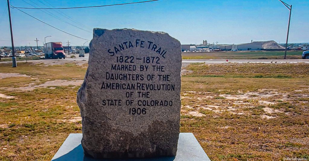
The Santa Fe Trail route went through part of today’s John Martin Reservoir State Park, an important point that will be highlighted below.
The Arkansas River Valley transformed into a significant agricultural hub in the post-Santa Fe Trail era. The demand for food in mining towns like Denver spurred cattle ranching and farming. Entrepreneurs like John Wesley Prowers established large-scale cattle operations, and the railroad enabled the transportation of agricultural products to eastern markets. Today, the valley continues to be a cornerstone of Colorado’s agricultural heritage, even though it still faces challenges of water scarcity and market fluctuations.
(See Athearn, F. J. (1985). Land of contrast: A History of Southeast Colorado, especially Chapter III, available here).
Activities Central to John Martin Reservoir State Park
Besides camping and hiking, described in detail later in this post, other activities in the park include water-based recreation and birdwatching.
Water-Based Recreation.
Today, the dam and reservoir continue the flood control and irrigation mission. The massive reservoir is also open for all kinds of water-based recreation. Boating, fishing, waterskiing, jet skiing, and swimming are popular activities in the main reservoir. The park’s Lake Hasty is ideal for paddleboards and other hand-propelled watercraft. Lake Hasty has an accessible fishing pier, a fish cleaning station, and a small swimming beach.

Birdwatching
he park bills itself as a “bird-watcher’s paradise,” as over 400 species of birds dwell or migrate in and near the park, including shorebirds, songbirds, and raptors. The park has nesting areas for the Piping Plover and the Interior Least Tern, which are endangered. You can download a bird list from the park’s official website.
Now, let’s turn to a description of the park’s camping options.
Camping at John Martin Reservoir State Park
The park has two campgrounds with different vibes: the Lake Hasty Campground and the Point Campground. Each campground has some sites open year-round. (Additionally, group camping reservations are available at the Caddoa Shelter).
The Lake Hasty Campground in John Martin Reservoir State Park
The Lake Hasty Campground lies next to Lake Hasty below the John Martin Dam. This modern campground has 109 sites with electrical hook-ups (20, 30, and 50 amps at each site). Each site also has a picnic table with shelter and a fire ring. A variety of sites accommodate different-sized vehicles.
Water spigots are dotted around the campground. The campground has two restroom buildings and another with showers and laundry facilities (both require a fee). Some reviews indicate that the restrooms and showers could be better maintained.

Consider Camping at a Shaded Site
Shade is an essential consideration for the campgrounds at John Martin, as temperatures in the summer can soar into and above the mid-90s Fahrenheit (about 34C).
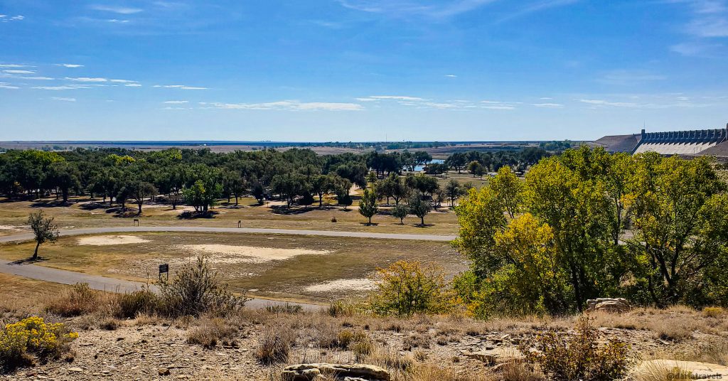
Within the campground, a string of partially shaded campsites lines the waterfront on the north side of Lake Hasty (sites 30-28). This location also provides views of the impressive John Martin Dam. Large, mature trees shade several campsites near the center of the campground (particularly sites 39-45 and 61-72), but other spots have little shade other than the picnic shelter (98-109). In particular, there are no shade trees at all in the loop containing sites 1-29.
The Experience at Lake Hasty Campground
While comfortable camping here in a tent, I noticed no sites with dedicated tent pads. And, like many reviewers, I found the restroom and shower facilities needed attention.
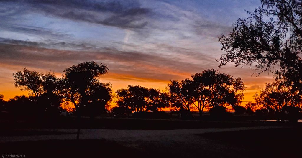
I can confirm that the park’s reputation as an excellent birding location is well-deserved. During my stay at Lake Hasty Campground, I saw large numbers of turkey vultures roosting in the shade trees in the afternoon. And one early morning, I saw a flock of wild turkeys make their way across the campground.
Additionally, I found the sunrises at Lake Hasty to be spectacular.
The Point Campground in John Martin Reservoir State Park
The other campground in the park is the Point Campground. It’s a spacious basic campground with 104 sites above the reservoir on its north shore. Neither electricity nor water is available at this campground. While each site has a picnic table and fire ring, there are no trees or shade shelters, which you should consider if you plan to camp on high-temperature days.
Some campers report high insect numbers and long walks to restrooms. Campers at the Point Campground may use the amenities at the Lake Hasty Campground.
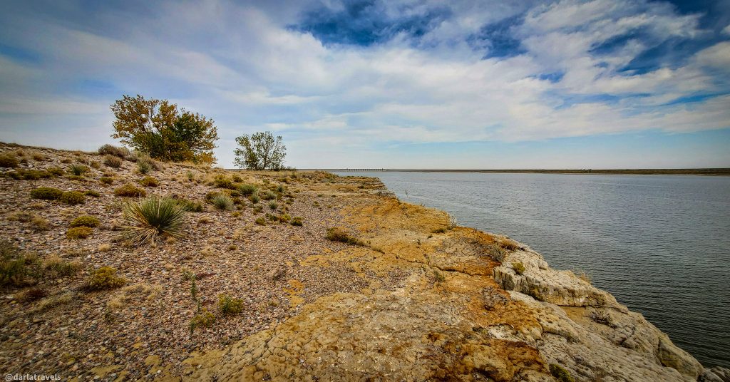
At the end of the Point Campground, one finds “the Point,” an overlook with a picnic area and sweeping views of the reservoir.
Camping Reservations
Campers must reserve campsites at John Martin Reservoir State Park online at the CPW shop. Check the reservations page for fees–they vary based on the site type. The campsites have limits on the number of vehicles and people that can occupy a campsite. This and other helpful information is visible when reserving a site.
In addition to a paid camping reservation, note that every vehicle in the campground must have a valid paid park pass.
Hiking the Red Shin Trail in John Martin Reservoir State Park
The park contains a single trail, the Red Shin Trail, which is 4.5 miles (7.2 km) one way with a modest elevation gain of about 187 feet (57 m). Red Shin was a Cheyenne warrior who lived in the Arkansas River Valley around 1833. The legend surrounding Red Shin is described below.
The Start of the Red Shin Trail
I recommend starting the trail at the trailhead near Lake Hasty. You’ll learn the reason for this preference later in this post. Keep reading!
To start, park in the day-use area near Lake Hasty’s fishing pier (restrooms available). You may have to poke around in the bushes a bit to find the official trailhead below the John Martin Dam near the stilling basin. On my visit, the trailhead sign was cracked, faded, barely legible, and nearly hidden by overgrown bushes. Use my map below to make navigation to the start easier.
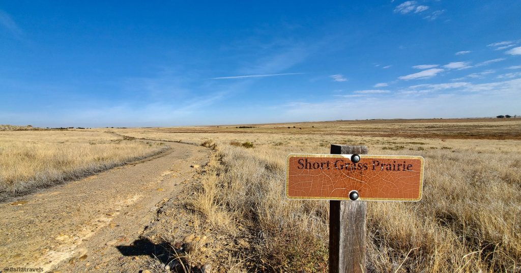
After leaving the overgrown area paralleling the Arkansas River, the trail transitions into a wide service road lined with tall bushes. The trail turns and travels through the shortgrass prairie toward the park’s Visitor Center. Past the Visitor Center, the trail passes through the West Santa Fe Slough area before crossing a park road and ending a short distance later at the North trailhead.
Sights along the Red Shin Trail
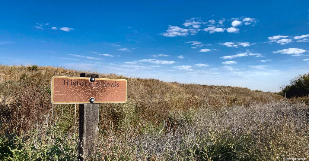
Along the way, signs indicate points of interest. These include the North Bluff Rock Art Site, historic canals, short grass prairie, the Prowers-Hudnell Ranch, and wetland areas named the East and West Santa Fe Sloughs.
Unfortunately, like the sign at the trailhead, some of these signs were damaged and hard to read. On top of that, there was no additional information about any of these features.
I skipped the rock art site because it was unclear how far off trail the petroglyphs were, and I knew rattlesnakes might lurk there. Were the canals for ranch irrigation or another function? And I wanted to know more about the Prowers-Hudnell Ranch. When did it operate, and what were its products? Also, what caused the white appearance of parts of the sloughs?
This trail generally gets middling reviews, but with some interpretive signs and better descriptions, I’m certain the hike would be more enjoyable and rate higher.
The Santa Fe Trail Marker at the end of the Red Shin Trail
Past the West Santa Fe Slough and the park, the trail finishes at its most exciting feature: a section of the historic Santa Fe Trail about half a mile (0.8 km) long. This fenced area has wooden turnstiles for entry. Within the fence, a roped-off granite stone marker indicates that it was placed here by the State of Colorado and the Daughters of the American Revolution in 1908.
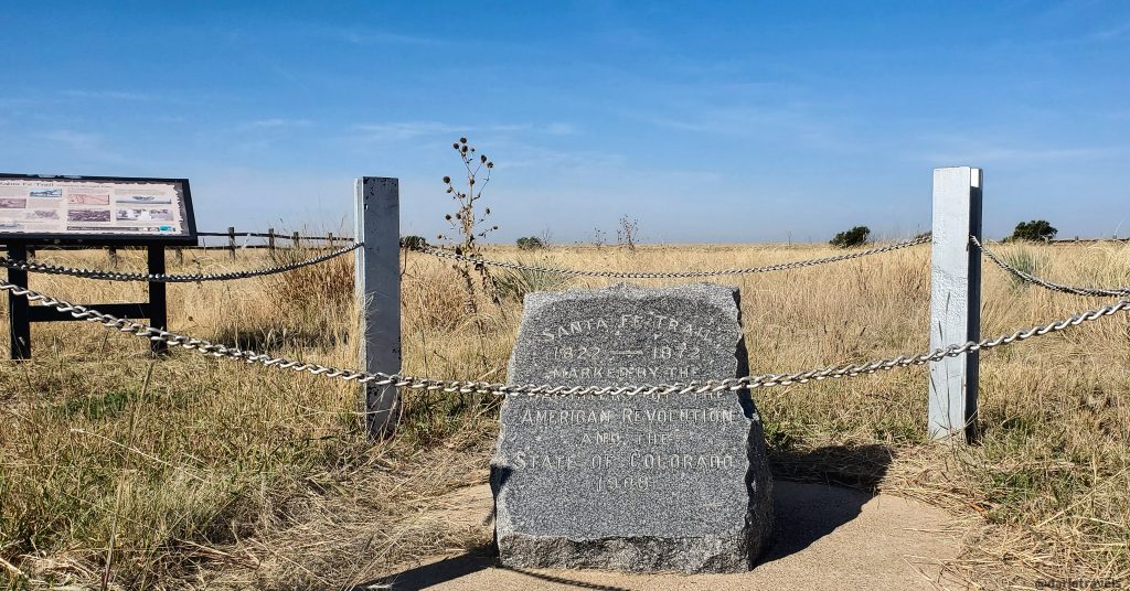
According to an informational sign next to the granite marker, it’s one of 36 such markers in Colorado marking the Santa Fe Trail. These markers preserve the Santa Fe route:
“so that our children never need ask: ‘Where is it?’”
Red Shin Trail Map
Here’s the map with the route for the complete Red Shin Trail:
If you don’t see the map or want to see the original, click here to see this map on AllTrials.
Additionally, you can click here for the Red Shin Trail map on Colorado Trail Explorer (COTREX).
Although the Red Shin Trail is the only hiking trail in the park, one more park location is worth exploring on foot. Keep reading to learn about it.
Exploring Red Shin Standing Ground in John Martin Reservoir State Park
John Martin Reservoir State Park contains a Dakota sandstone rock formation named Red Shin Standing Ground. Perplexingly, the Red Shin Trail does not include this landmark. This rock formation is not on the park map, so it’s easy to miss this outcropping just off the road to the Lake Hasty campground. Nonetheless, you should aim to stop by.
The name Red Shin Standing Ground derives from a legend surrounding a disagreement over a woman between Cheyenne warrior Red Shin and another tribe member.
After the dispute, and armed to the teeth with two flintlock muskets, a tomahawk, bow and arrows, and butcher knives, Red Shin situated himself on top of the rock formation. Word must have traveled quickly because other warriors sympathetic to his rival arrived to attack Red Shin. But Red Shin was an expert marksman, so much so that the assailants eventually backed off, realizing their assault on Red Shin would fail. Based on this story, the rock formation was dubbed Red Shin Standing Ground.
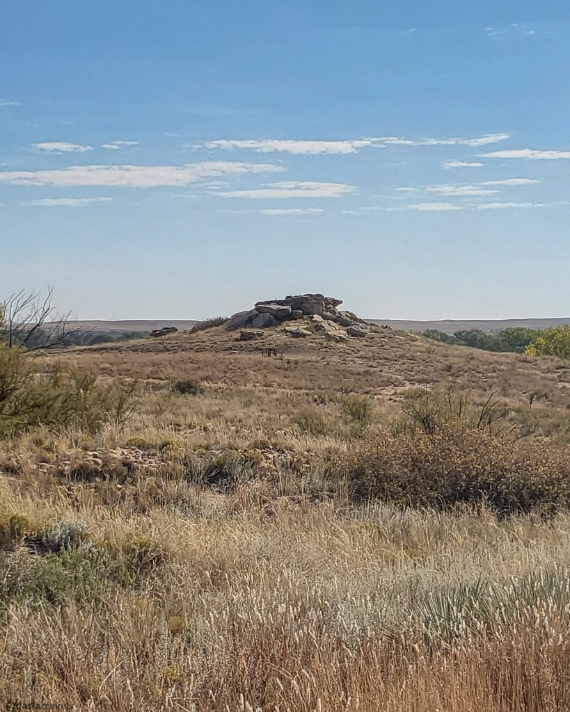
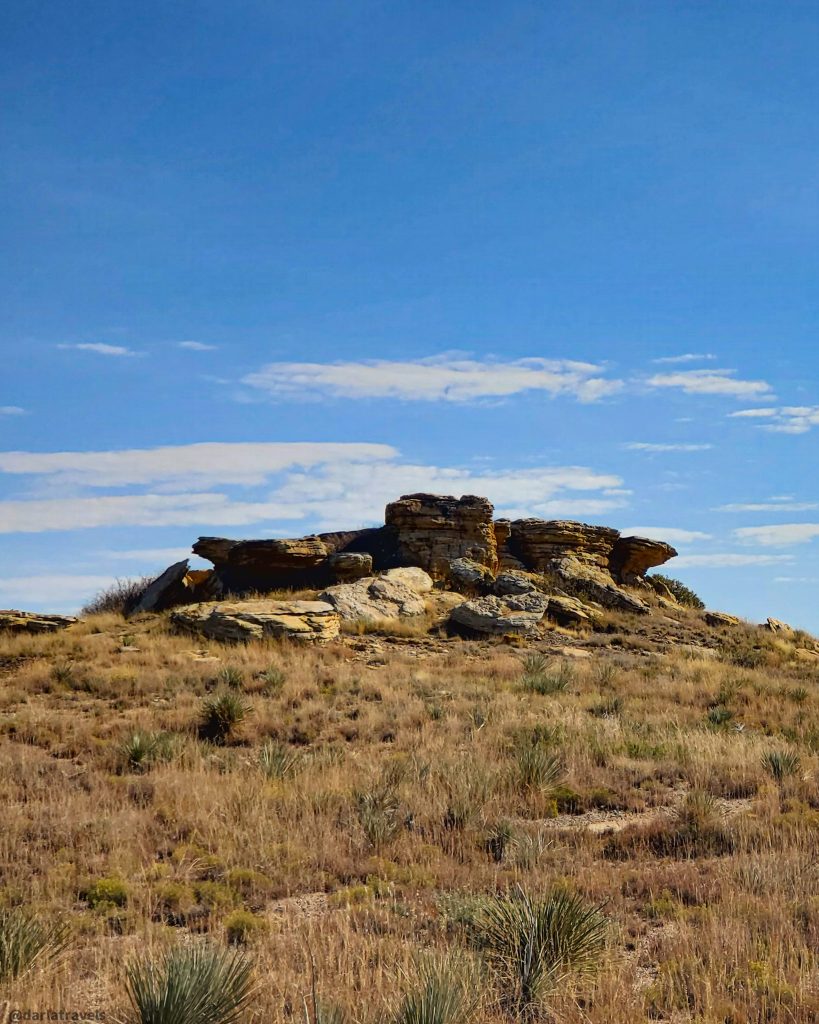
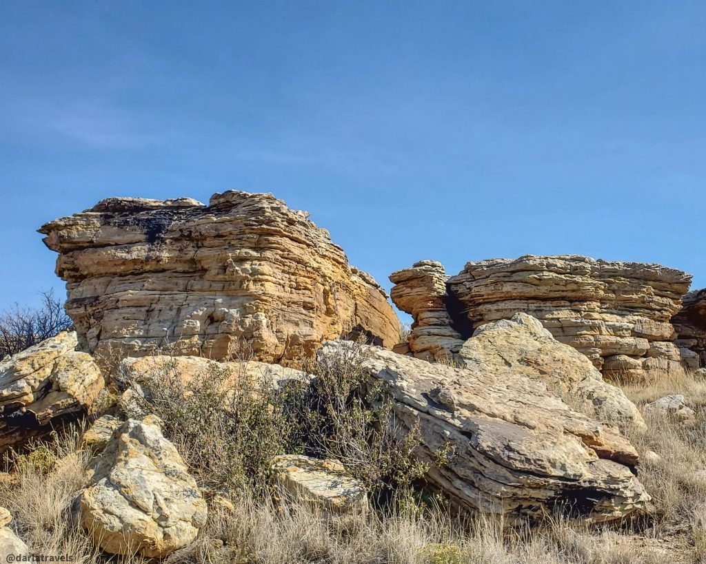
A small parking lot and an information plaque are at the foot of Red Shin Standing Ground. A very short trail leads up and around the rock formation, which has excellent views of the surrounding grasslands and the Lake Hasty campground area.
Hiking and Camping with Pets
Dogs on leash are allowed in the park and the campgrounds. The park also permits horses.
Food and Drink at John Martin Reservoir State Park
One of the charms of John Martin Reservoir State Park is its remote location. With this isolation comes tradeoffs, including a lack of food and drink, both within the park and nearby. I found only a few options for groceries close by. Valley Grocery in Hasty (100 S Main St.) is a small grocery/convenience store that sells essentials and serves up breakfast items, pizza, burritos, and sandwiches. And on the way into the park, Mapes Lakeview RV Park (31230 Co Road 24, Hasty, CO) sells convenience store items and fishing supplies.
Therefore, I recommend that you bring a good selection of food and more water than you think you need with you on your park visit.

Successful anglers can consider visiting the park’s “Catch and Fry” picnic area, where a fresh catch from the nearby fishing area can be prepared. Visitors can enjoy their meals while viewing the reservoir and surrounding landscape.
Alternate Accommodations Near John Martin Reservoir State Park
If you prefer hotels to campgrounds, stay in Lamar, Colorado, approximately 20 miles (32 km) west of John Martin Reservoir State Park via US Highway 50. Lamar has several chain hotels and independent properties. Vacation rentals are available but less common. Use the map below to search and book your Lamar hotel.
Book now at Booking.com ♦ Book now at Expedia ♦ Book now at Hotels.com
More Practical Information About John Martin Reservoir State Park
Park Fees
Daily Vehicle Pass: $10
Individual Daily Pass (entering on foot, bike, horseback, etc.): $4
Annual Affixed Pass (one vehicle): $80
Keep Colorado Wild Pass (Colorado residents with vehicle registration): $29
Family Annual Pass (multiple vehicles): $120
Aspen Leaf Annual Pass (64+) (one vehicle): $70
Getting There
John Martin Reservoir State Park is at 30703 County Road 24, Hasty, CO 81044.
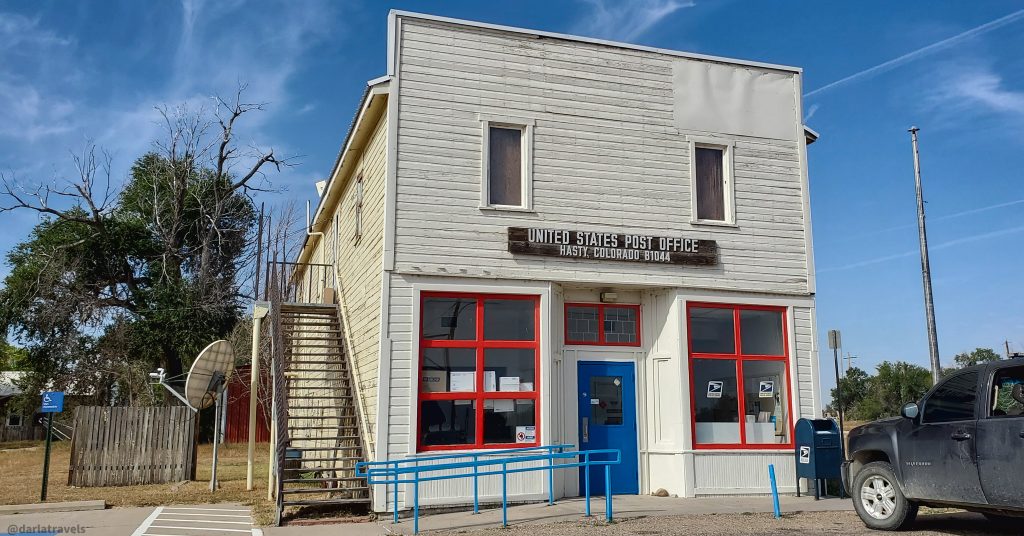
Hasty is about 20 miles west of Lamar, Colorado, via US-50 W, or about 97 miles (156 km) east of Pueblo, Colorado, also via US-50 W. At the town of Hasty, turn south on S. School St from US-50 W. The park Visitor Center is approximately two miles (3.2 km) south.
The Colorado State Park Passport
Keep track of your visits to Colorado’s State Parks with the Colorado State Parks Passport. Each park has a page in the passport book with a spot to stamp the park’s signature logo. At John Martin Reservoir State Park, the park’s Visitor Center staff can stamp your passport.
John Martin Reservoir State Park – Pin it for Later
Here are a couple of images of John Martin Reservoir State Park for your Pinterest boards:
Final Thoughts on John Martin Reservoir State Park
John Martin Reservoir State Park is a prime prairie destination for getaways in southeastern Colorado. Whether you’re here for fishing, boating, the historic trail, birdwatching, or just kicking back at camp, you’ll appreciate the history of the Arkansas River Valley and the park’s connection to the local agricultural and farming traditions. So, prepare your camping gear and embrace a quiet adventure at this expansive park on the Colorado plains.
It’s too bad that the signs and facilities are not maintained. Hopefully, some resources can be used to bring the park up to better standards.
I know that some of the campground buildings are being worked on during the low season this fall/winter, so there is an excellent chance that they will be improved for the busy season next year.
Sounds like a fun place especially for the water recreation and birdwatching. Hoping we can try out the park next time we are driving east towards Kansas.
I think that sounds like a great idea-it would be a nice place to stretch your legs on the long drive to Kansas.
I want to see the Santa Fe Trail Marker. I’m a DAR so that’s really cool and interesting to me. Another great outdoor place in Colorado. It’s full of beautiful ones!
Glad you enjoyed the post–if you came through on a road trip, you could see lots of the Santa Fe Trail markers. I believe that some DAR chapters in Kansas have placed markers in that state as well!
I love all the history! That post office is so cute, and the Breakfast being cooked on the camp stove brought back cherished memories of camping in Yosemite every summer several decades ago. That was our family go-to spot every summer until I graduated from high school.
I’m glad you enjoyed the post!