** Darla Travels is reader-supported.
When you buy through our links, we may earn a commission. **

Parker, Colorado’s Tallman Gulch Trail cuts a path through the town about 20 miles (32 km) from Denver. A hike on this paved suburban path delivers a good dose of nature thanks to the open space buffer separating it from the houses. Even in the middle of the ‘burbs, this path makes it easy to look past the modern development and get a glimpse into Parker’s history. Keep reading to learn more about this suburban hike.
About The Tallman Gulch Trail
The Tallman Gulch Trail is an approximately 3 mile (5 km) paved path around southern and western Parker, Colorado, following Tallman Gulch. This trail appears flat, but there is a slight downhill grade from the south terminus near Legend High School: the total elevation change is about 302 feet (92 m). It shapes up to be a respectable suburban hike with a round-trip distance of just over 6 miles (9.7 km).

History
Parker is in Douglas County, about 20 miles (32 km) southwest of Denver. Parker was first named Pine Gulch when settlers arrived in the mid-1860s. In 1882, it gained the name Parkers’, a reference to brothers James and George, who owned land in the town. Eventually shorted to Parker, the community stayed small. Parker’s Main Street retains its old-fashioned charm, but new development has engulfed this pioneer settlement. Now a popular commuter base, Parker’s population of 285 in 1981 has grown to over 60,000.
Currently, Parker has over 30 miles (48.3 km) of trails (concrete and soft surface) along with over 1,250 acres (506 hectares) of open space and developed parks.

The Tallman Gulch Trail is one of these. The waterway that inspired the trail, Tallman Gulch, is named for Elizabeth and John Tallman. These pioneers arrived in Colorado in the mid-1800s and took up cattle ranching. Elizabeth Tallman also wrote about her interactions with Native Americans. Although no longer in its original location, the cabin they built in 1866 still stands and is reputed to be the oldest log cabin in Parker. The Colorado State Register of Historic Places lists it as a historic landmark.
This paved trail is a good choice in winter. Any snow and ice will rapidly melt from the exposed concrete on sunny days, revealing a safe walking path.
The trail starts behind Legend High School off Hilltop Road in south Parker. If parking here isn’t possible, there are several parking spots at nearly Tallman Meadow Park on Canterberry Parkway.
Tallman Meadow Park has portable restrooms by the playground and also next to the sports field, although these restrooms may be seasonal.

Walk through the park to the pedestrian bridge over Tallman Gulch to get to the Tallman Gulch Trail. For details, see the custom map below.
From the bridge, turn right (east) to get to the start of the trail behind Legend High School (about 0.8 miles, 1.4 km). This stretch, in my view, has few distinctive features and can easily be skipped. So instead, turn left (west) at the pedestrian bridge for the longer and more engaging route.
The trail is bordered by a sizeable buffer of open space filled with tall grasses and mature cottonwood trees. The suburban houses of Parker are always in sight but are generally not so close as to be annoying.
The trail passes next to numerous small parks, playgrounds, and even a pond or two within the open space.
Sights along the Tallman Gulch Trail
Although relatively short at 3 miles (5 km), the Tallman Gulch Trail has several points of interest that recall the gulch’s past.
For example, less than a quarter-mile (330 m) to the west of the pedestrian bridge into Tallman Meadow Park, note the bench overlooking the creek along with a plaque honoring John and Elizabeth Tallman.
Shortly west of this stop, a sign marking a cattle crossing appears on the trail. While it might seem odd to see evidence of farm animals in a modern suburb, it’s a reminder that this was once ranchland.

Parker has some of the most informative trail signs I’ve seen, making it difficult to get lost. However, the one spot on this trail that might be confusing is the approach to Tallman Rd. To stay on the course, cross over Tallman Rd. and keep walking on the sidewalk toward Iron Horse Elementary School on the left.
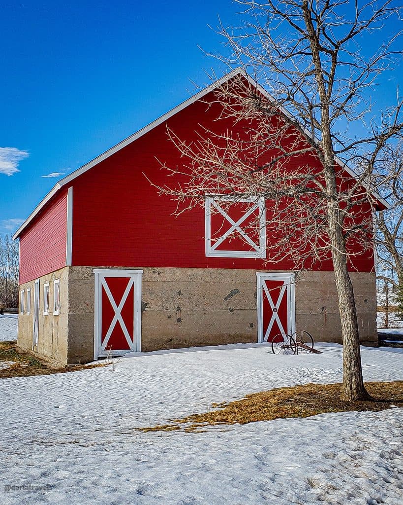
One of the trail’s best features comes into view here, the historic Slemmer Ranch Barn. Now located in Iron Horse Park, the barn was built in 1919 to support the dairy farm of Edmund and Anna Slemmer. Restored in 1996, the barn with its bright red paint is easy to spot.

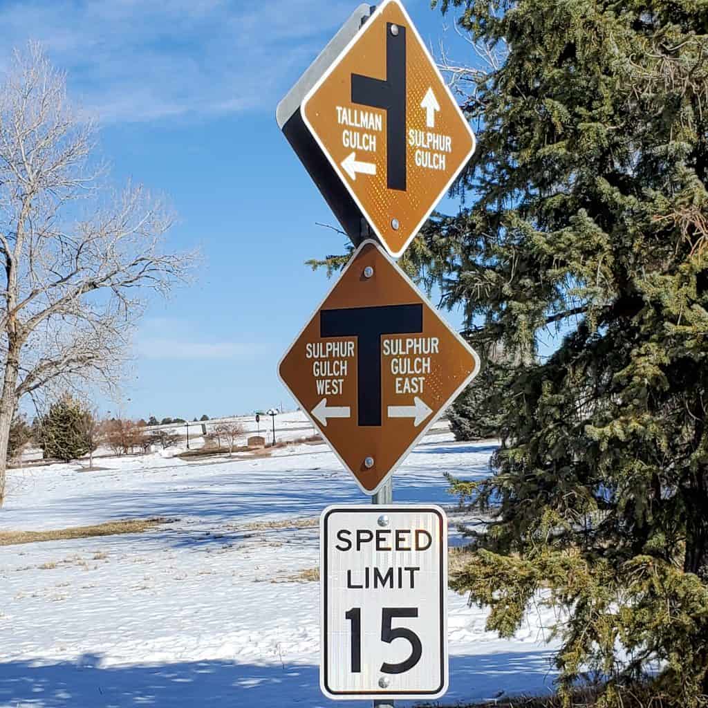
Past the barn, the trail crosses through Seibert Circle and its ample interior of open space. Exiting the circle, the trail parallels Stonehenge Way for a short distance (⅛ mile, 0.2 km) to its end at the connection to the Sulphur Gulch Trail.
Trail connections
As Tallman Gulch is a tributary of Sulphur Gulch, it’s not surprising that The Tallman Gulch Trail intersects with another Parker Trail, the Sulphur Gulch Trail, which runs from east to west. See my write-up on the Sulphur Gulch Trail (including a map) here.

The Sulpher Gulch trail further connects with the Cherry Creek Regional Trail on the east side of Parker. The Cherry Creek Regional Trail is a 40+-mile (64+-km) paved path popular with cyclists and pedestrians alike.
The Tallman Gulch Trail connects to the natural surface Prairie Voice Loop Trail behind Legend High School. This 1.8-mile (2.9-km) trail has several ups and downs and a few shortcuts that allow for different routes. The high point of the system is about 95 feet (29 m) above the start.
At Tallman Meadows Park, signs point to a small trail network within the Idyllwilde community. Other neighborhood access to the trail is shown on the trail map below.
Trail Map for The Tallman Gulch Trail
I created this map on AllTrails to summarize all of the access information on The Tallman Gulch Trail in this post.
Legend
Red: Tallman Gulch; Blue: Connector from Tallman Meadow Park: Green: Prairie Voice Loop Trail
Don’t see the map or want to see the original? Click here to go to the map page on AllTrails.
Other Trail Information
| Distance | Approximately 3 miles (5 km) |
| Difficulty | Easy (total elevation gain: 302 feet, 92 m) |
| Trail Type | Out and back |
| Trail Surface | Paved |
| Besides Walking: | Running, cycling |
| Links | Parker Parks and Rec Interactive Trail Map Parker Parks and Rec Trail Page Colorado Trail Explorer (COTREX) Page AllTrails Page for the Tallman Gulch Trail |
| Closest Towns | Parker |
Pin It for Later!
Parker, Colorado’s Tallman Gulch Trail slices through the suburbs of this southeast metro Denver community. Although houses are always in sight, the trail’s wide natural space is an adequate buffer from the residences. In addition, parks and historical sights along the trail make it a worthwhile suburban hike.

Have you hiked the Tallman Gulch Trail? Leave a comment below!
This is such a great article! I just moved to Parker, and it’s awesome to learn about local history and existing trails. The mountains are more than a five minute drive from this location, so it’s nice to know what is in the backyard 🙂
Glad this article was helpful Becky! Also check out the Sulpur Gulch Trail and the Rueter-Hess Incline and recreation area.