Wray, Colorado, may be one of the state’s most underrated road-trip destinations. With surprisingly good restaurants, fascinating frontier history, and genuine small-town hospitality, this welcoming High Plains community is one of eastern Colorado’s best-kept secrets.
In the northeastern corner of Colorado, roughly three hours from Denver, Wray delivers far more than its footprint suggests. This small city sits far enough off the beaten path that most Coloradans have never made the drive. That’s too bad, because this amiable community delivers experiences that rival those of much larger destinations.
The dining scene is genuinely good, the community events calendar runs year-round, there’s an emphasis on recreation, and even a museum with surprising depth.
The history here is the real thing: frontier battles, century-old downtown buildings with stories to tell, and distinctive architecture, like a lovingly preserved 1950s movie theater that still shows films on weekend nights. Factor in sweeping hilltop views of the Republican River valley and a nationally significant battleground just 18 miles (29 km) south of town, and Wray starts to look less like a detour and more like a destination.
Whether you’re only driving three hours from Denver or exploring eastern Colorado as part of a longer road trip, Wray rewards travelers who venture beyond the usual tourist stops. It’s an underrated destination where reasons to stay and explore just keep popping up.
This is your guide to Wray: what to see, where to eat, where to stay, and why the drive from Denver is worth every mile.
Darla Travels appreciates the assistance of Ardith Hendrix, director of the Wray Museum, in the preparation of this article.
** Darla Travels is reader-supported.
When you buy through our links, we may earn a commission. **
Ready to book your Wray stay? Find a great hotel here:
A Brief Orientation and History of Wray, Colorado
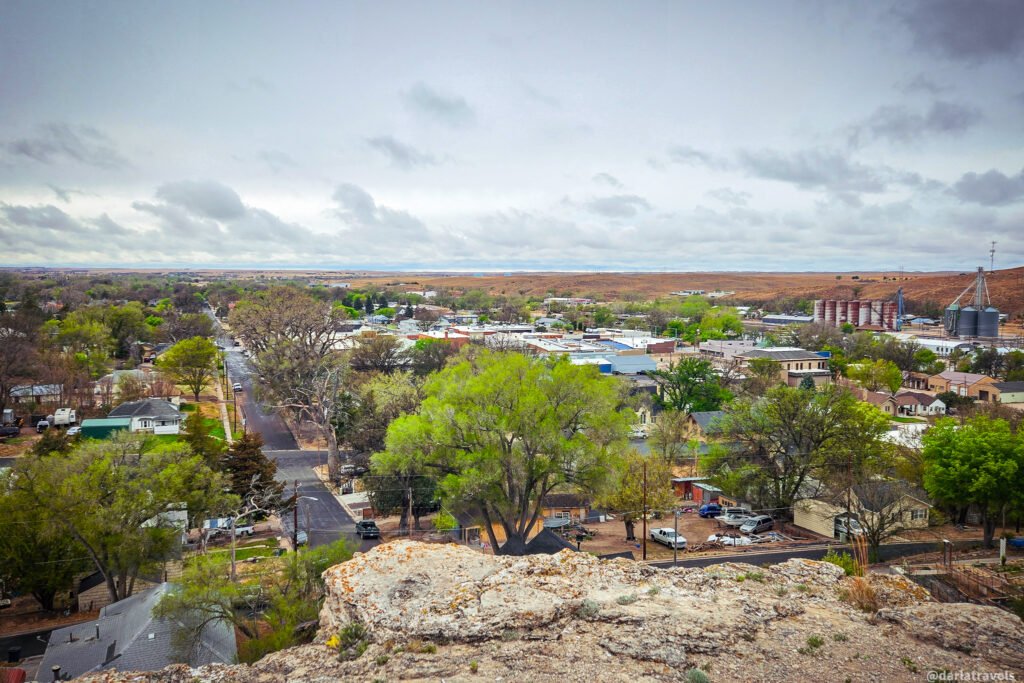
The town of Wray is the seat of Colorado’s Yuma County, at the junction of US-34 and US-385. It’s located in northeastern Colorado along the south shore of the North Fork of the Republican River. It lies under a striking bluff rising about 110 feet (33.5 m) above the valley floor.
👋🏻If you’re instead heading to southeastern Colorado, consider a visit to Lamar, another High Plains railroad town with deep history and its own compelling reasons to visit.
The land around present-day Wray, Colorado, has been home to people for thousands of years. Archaeological sites across Yuma County have yielded evidence of human habitation dating to 17,700 B.C.
The Arikaree and Republican River valleys remained important seasonal hunting grounds for the Pawnee, Cheyenne, and Arapaho well into the nineteenth century. At the same time, other Plains tribes, including the Kiowa, also traveled through the region.
The first non-Native settlers to stay were cattlemen, who began arriving in the 1870s. One of those operations belonged to I.P. Olive, whose ranch sat just east of present-day Wray.
When the Burlington Railroad arrived in the summer of 1882, the new settlement took the name of Olive’s ranch foreman, James Thomas “Old Tom” Wray. Wray had assisted and hosted railroad survey crews working through the area. Also in 1882, and a post office was established and named in honor of Wray.
When a post office was established on June 26, 1882, Peter Campbell suggested it be
named Wray in honor of Tom. The name endured when Campbell and Amos Steck of the See
Bar See Land and Cattle Company officially platted the town on July 31, 1886.
That same year, a wave of homesteaders arrived from the east. Wray was incorporated as a city in 1906 and became the seat of Yuma County in 1902.
Note: Some sources indicate that the town was named for Tom’s younger brother, John Wray, but materials from the Wray Museum confirm that this is incorrect.
Walking Around Wray
The best way to get oriented in Wray is to walk around. It’s small enough that you can see the historic downtown on foot in less than an hour. And the paved crosstown walking and biking path gives you a dose of nature while taking you along the Republican River and through Wray’s Parks for a wider perspective on the town.
Let’s start in Wray’s Historic Downtown.
Downtown Wray Historic Walking Tour
Learn a little bit more about the history of Wray by taking a short walk around the historic downtown. The 10-stop walking tour with directions and descriptions is below. I’ve also created an AllTrails map (displayed below) to make it even easier to follow along and see the sights in downtown Wray.
Distance: approximately 0.9 miles (1.5 km) | Shape: loop | Est. time: 1 hour with pauses
START: STOP 1 — Yuma County Courthouse
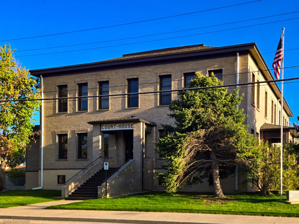
A convenient starting point for this tour is the Yuma County Courthouse Building at the corner of 3rd and Ash St (310 Ash St). Construction commenced in 1903, after the residents of Yuma County voted in a special election in 1902 to move the county seat from the town of Yuma, about 27 miles (43.5 km) to the east, to Wray.
The original courthouse building in the Federal style has been expanded and remodeled since that time.
Before moving on, take note of the Wray Museum (205 E. 3rd St.) across the street from the courthouse. We’ll return to the museum later in this article.
➡️ Continue west on 3rd Street one block to the intersection of 3rd & Main.
STOP 2 — Bank of Wray Building
3rd Street & Main Street (SW corner)
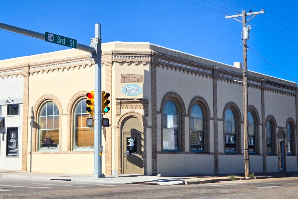
Many buildings in downtown Wray were destroyed in a 1908 fire, including Bank of Wray, which was established in1887. The Bank’s safe was spared by rolling it onto the sidewalk.
Rebuilt after the fire, the Bank of Wray Building now houses a bakery/cafe. Note the brick details, the lovely arched windows, and the corner entrance.
➡️ Turn left (south) on Main Street and walk one block to 4th Street.
STOP 3 — 4th & Main: Flirtation Point Viewpoint
Corner of 4th Street & Main Street
From the corner of 4th & Main, look due east along 4th Street toward the bluff at the edge of town. On a clear day, you can pick out the rocky promontory with the three crosses and a granite monument. That’s Flirtation Point, the hilltop overlook named by Peter Campbell in the late 1800s, when the town of Wray was being platted.
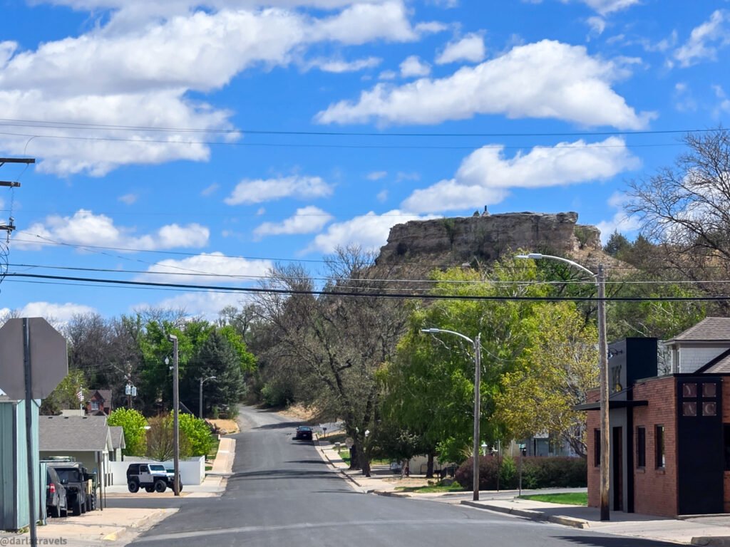
There is a fuller description of Flirtation Point later in this article.
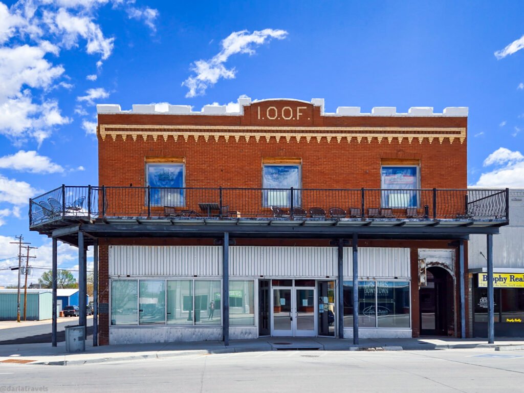
STOP 4 — IOOF Building / 4th & Main Downtown Grille
402 Main St (NE corner of 4th & Main)
On this same corner, look for the building with the “I.O.O.F.” abbreviation on the front. Construction of this Odd Fellows lodge hall began in 1915. The second floor retains an ornamental metal ceiling and plaster walls, and now houses the 4th & Main Downtown Grille.
➡️ Continue south on Main Street a few steps to 420 Main.
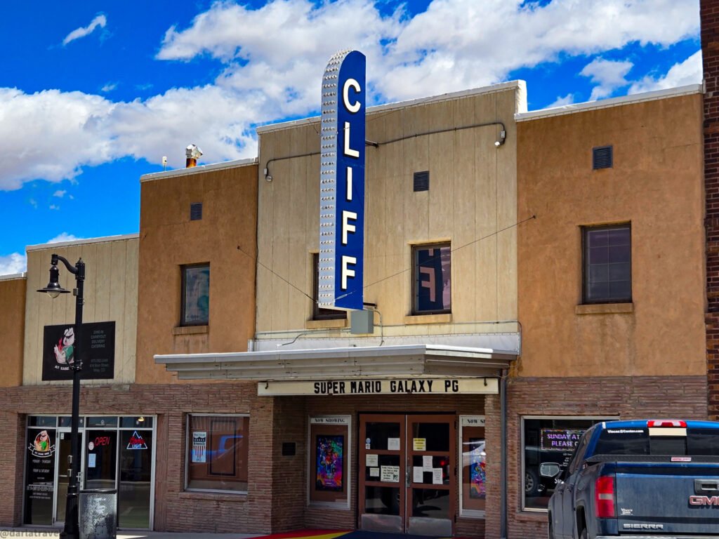
STOP 5 — Cliff Theater / Cliff Cultural Community Center
420 Main St (between 4th & 5th on Main)
The Cliff Theatre, now run by the non-profit Cliff Cultural Community Center, has been showing films in Wray since 1950. This movie house, listed on the National Register of Historic Places, has survived changing tastes and technology. Unlike some theatres in other nearby plains towns that have shut down, it still operates as a community cinema and event space.
➡️ Walk back north on Main Street to 4th Street. Turn left (west) on W 4th Street and walk approximately 1.5 blocks.
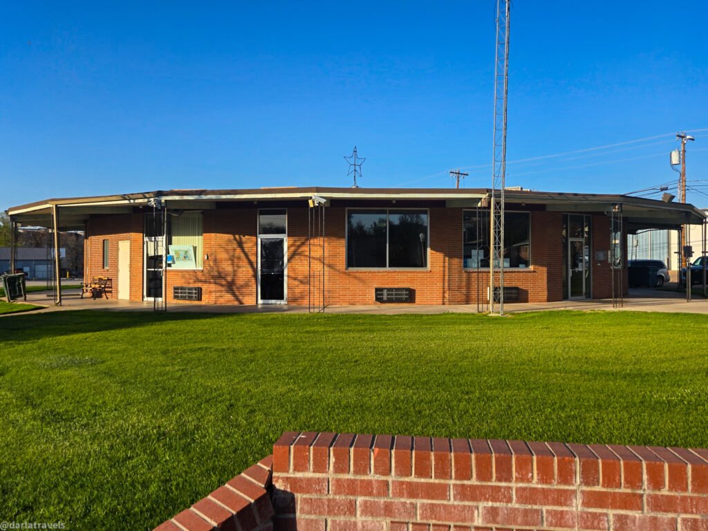
STOP 6 — Wray City Hall
245 W 4th Street
The Wray City Hall building, opened in 1963, is nearly circular with 21 sides! At the time of its construction, it was touted as an “ultra modern municipal building” and described as “spectacularly beautiful.” The number of doors on this interesting building is impressive.
Wray is actively planning to relocate City Hall and other city government and community resources to a new Civic Center Complex. So, this one-of-a-kind municipal building may have a different function when you visit.
➡️ Turn around and go back east on W 4th Street, pass Main Street, and continue approximately 2 blocks back to the corner of 4th & Ash.
STOP 7 — E. B. Borland Home/Grutter Home
SE corner of 4th & Ash St
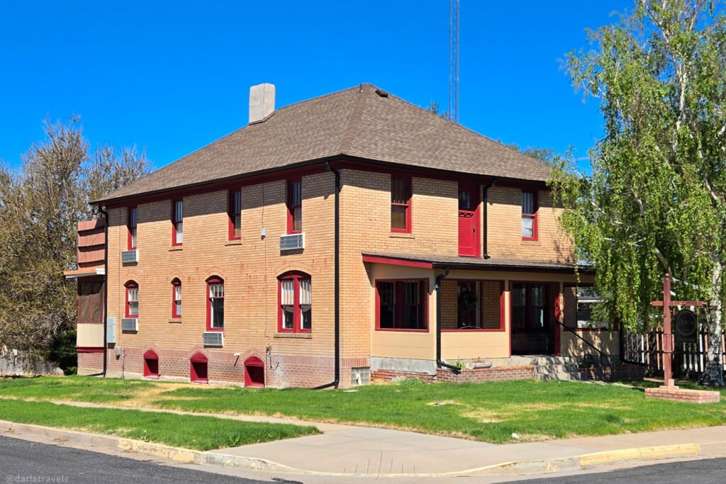
This historic residence was completed in 1904 for Emerson B. Borland, a general store owner, and his wife Eva. The Wray Gazette reported that the house was “among the handsomest” and “one of the most pleasant” in the city. Moreover, it was furnished with the latest conveniences, including running water piped directly from a nearby spring and a hot-water heating system.
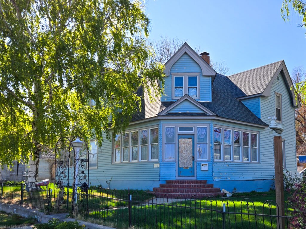
According to Ardith Hendrix, director of the Wray Museum, after E.B. Borland died in 1916, Eva Borland kept the house. She took in boarders, eventually marrying one of them, Walter Luke Grutter. After Eva’s death, Walter retained ownership of the home.
➡️ Continue east along 4th Street, remaining on the same block.
STOP 8 — First Presbyterian Church Building
250 E 4th Street
The first protestant church in Wray was the First Presbyterian Church, organized on April 17, 1887. This church building at the corner of 4th and Birch was dedicated on June 2, 1907. Be sure to look for an engraved stone with the words “First Presbyterian Church” on the lower front of the building.
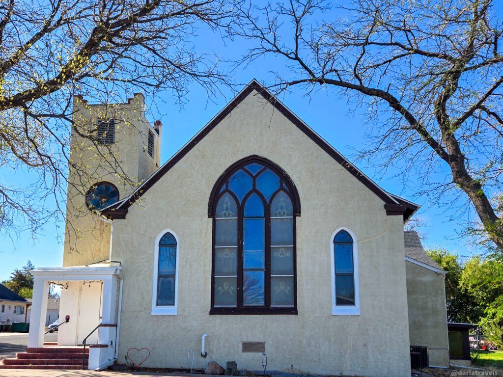
The church was the first in Wray to have electric lighting, a novelty at the time. The lights were installed as a special gift for the church’s first wedding ceremony on June 19, 1907, by Charles Pickett, the owner of the Wray Light Plant. Pickett was also the father of the bride, Pearl Pickett, who married Edward Broderick.
Ardith Hendrix, director of the Wray Museum, confirmed that this building is now privately owned, the Wray Presbyterian Church having been dissolved in 2013.
➡️ From the corner, turn left (north) on Birch Street and stop after crossing.
STOP 9 — Yuma County Health & Human Services
340 Birch St
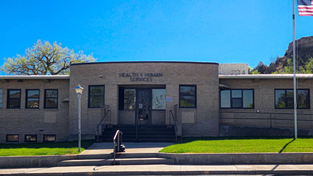
This building was opened as a hospital in 1952 to replace an old, increasingly inadequate facility. A true community project, it was constructed entirely with donations. Today, it functions as an administrative center for county human services and social programs.
➡️ Continue north on Birch Street one short block, then turn left (west) on E 3rd Street and walk approximately one block to Ash Street.
FINISH- STOP 10: Wray Museum — 205 E 3rd St
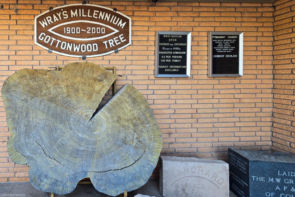
Finish your tour at the Wray Museum. It’s just across 3rd St. from the courthouse. Visiting the museum, either at the end of this tour or at another time during your stay, is a must! Among other reasons, the Wray Museum has one of only a handful of permanent Smithsonian Institution exhibits located outside Washington, D.C. I’ve included a longer description of the Wray Museum further down in this article. ⬇️
Wray Historic Downtown Walking Tour Map
Use this AllTrails Map to follow the Wray Historic downtown walking tour stops highlighted above.
The Wray Biking/Walking Trail & City Parks
There’s more to see on foot in Wray. The Wray Biking/Walking Trail is a paved, flat, multi-use path running along the Republican River. This lighted trail is family-friendly and suitable for walkers, joggers, and cyclists. The 1-mile (1.61 km) path spans the town of Wray and connects three city parks:
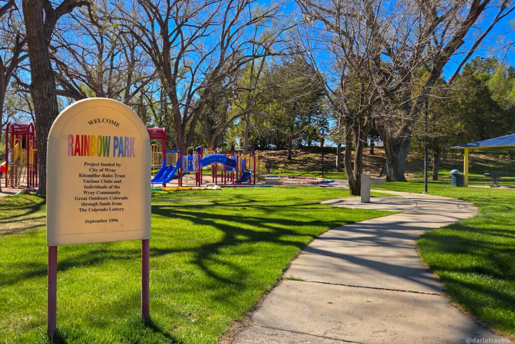
- Rainbow Park (Hwy 34 & Jackson St). Wray’s largest park, this shady spot is ADA accessible, has picnic tables, a playground, and parking. Restrooms available.
- Riverside Park (W 2nd & Clay). This park has a playground, picnic tables, and green space along the river corridor.
- Plaza Park (213 S Main). This centrally located park is ADA-accessible and connects the trail to downtown. Restrooms available.
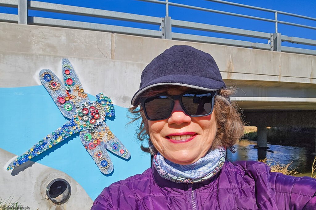
Wray Biking/Walking Trail + Town Loop Trail Map
I walked most of the path, omitting only the far northeast section. Instead of backtracking to the start, I made the walk a loop by circling Rainbow Park, passing through the hospital complex, heading east on the 7th Street sidewalk, and then returning to downtown via Blake and 5th Street. Altogether, this was a 2.2-mile (3.5 km) loop. See the map below.
Click here to see this map on AllTrails.
Wray’s 7th Street has a few additional points of interest marked on the map.
Mercado de Felicidad (424 W 7th St.) is a Central American grocery store. Stop in for some produce, drinks, snacks, or imported hot sauces to take home.
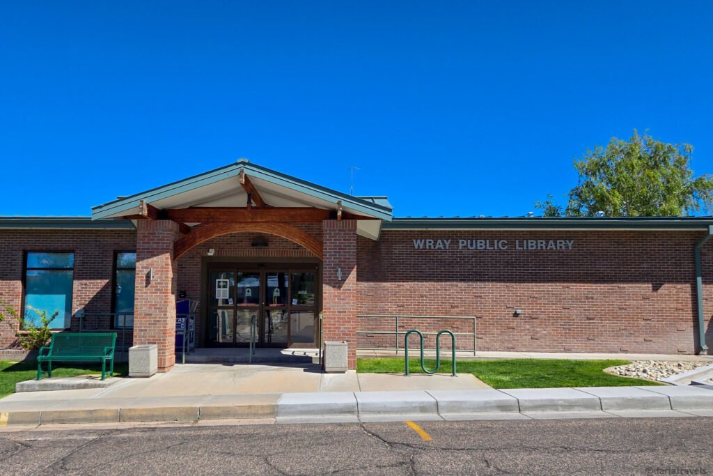
The Wray Public Library (301 W 7th St, Wray, CO 80758) opened early in 1969. The original plans for this building include a garage to house a regional bookmobile.
Next, the Wray Aquatic Center (240 W 6th Street) is a public pool complex open in the summer months.
Also, look for Doc’s Bed & Breakfast (443 Blake St.). This historic building was renovated in 2007.
Attractions in the Wray Area (Things to Drive To)
Outside of downtown, there are several places worth an additional drive. Let’s start at Wray’s most visible landmark, Flirtation Point.
Wray’s Flirtation Point
Rising above the Republican River Valley on the southern edge of Wray, Flirtation Point is the bluff we saw during the Historic Downtown Walking Tour. I found no wayfinding signs or markers to lead me to Flirtation Point, but it’s not difficult to get to.
📍 Approximate GPS coordinates: 40.077071, -102.216856
🧭From Wray take 4th St east. 4th St turns into S Douglas St. as it climbs up and around the bluff. Take the first right off of S. Douglas St. onto a gravel road.
I recommend driving because the road to the top is narrow and curving, with no safe place to walk. Additionally, note there are no railings or other safety features on the top of the bluff.
This bluff, and others in the area, is composed primarily of the Ogallala Formation, a Pliocene-age (5.3 million to 2.6 million years ago) unit of sands, silts, and gravels cemented to varying degrees by calcium carbonate. From the top of this promontory, there is an excellent view of the town, as well as the wider Republican River valley.
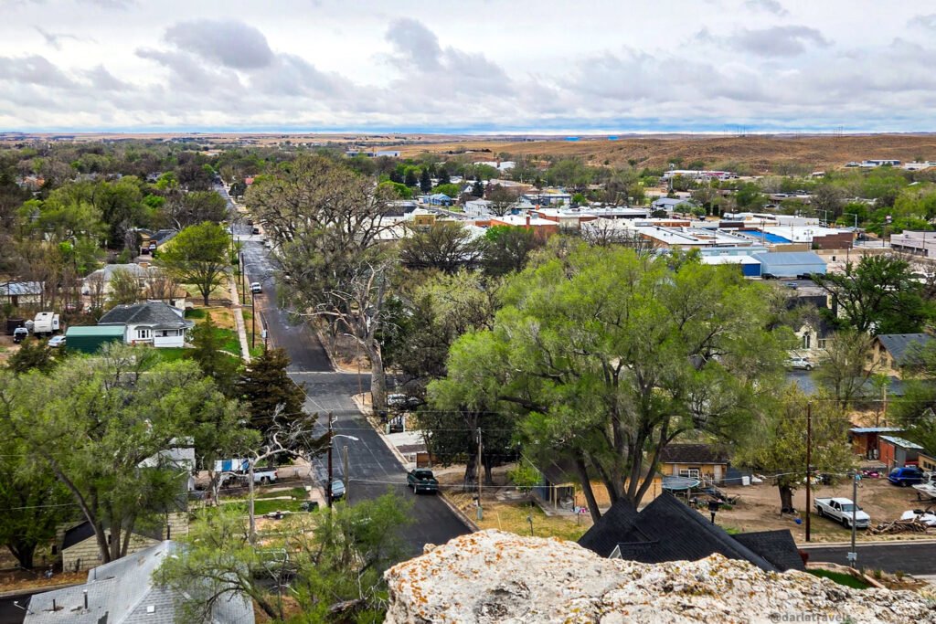
The Wray Masonic Lodge No. 71 became the owner of Flirtation Point in 1939 after the land was gifted to them. Coincidentally, the earliest Masons in Wray, not yet having a physical lodge, held their first meeting at Flirtation Point on July 2, 1886. The monument they placed on October 19, 1939, is still visible from downtown today.
Three crosses at the top of Flirtation Point were originally placed in 1954 for an Easter Sunday Sunrise Service organized by the Wray Ministerial Alliance, a cooperative organization of Wray’s churches.
Once you’ve seen the views from Flirtation Point, continue to the Grandview Cemetery.
Grandview Cemetery (Wray Cemetery)
📍1145 Cemetery Rd, Wray, CO 80758
GPS Coordinates: 40.068761783740236, -102.21471073655854
Wray’s Grandview Cemetery is located south of town off Cemetery Road on the bluff terminating at Flirtation Point. William Dorman, a Civil War veteran, homesteaded here with his family shortly after Wray’s founding. Dorman himself is buried here, along with other Wray pioneers and veterans from many wars over the decades.
History Buffs can research pioneer or veteran graves on the Yuma County, Colorado pages of the USGenWeb® Project.
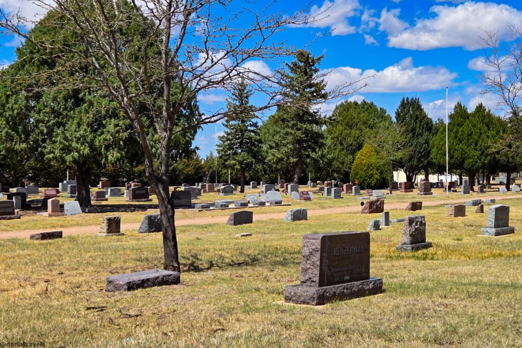
Even without a family connection to the area, the Grandview Cemetery is worth a visit. The grounds are serene and well-maintained. If you didn’t get in enough walking in town, you could spend quite a bit of time strolling here. The clear grid of ‘streets and lanes’ in the cemetery encourages a slow, meditative pace.
Beecher Island Battleground Monument
📍20697 County Road KK, Wray, CO 80758
GPS Coordinates: 39°52′13″N, 102°11′13″W
The Beecher Island Battleground Monument is approximately 18 miles (29 km) south of Wray. Listed on the National Register of Historic Places (1976), it’s the site of a nine-day battle that began on September 17, 1868. Fifty U.S. Army scouts under Lt. Col. George Forsyth were ambushed on the Arikaree River by Plains warriors they were tracking.
Because the site is rural and minimally developed, it’s well-suited to a contemplative, self-guided walking visit.
The Battle of Beecher Island
Upon being ambushed, Forsyth and his scouts retreated to the only spot in the area with cover in the form of trees and bushes, a sandbar in the Arikaree River, fortifying it to the extent possible. An estimated 600 warriors converged on the Arikaree and executed several massed charges. The scouts’ Spencer seven-shot carbines were a surprise to the attackers, who were only familiar with single-shot rifles. Roman Nose, the prominent Northern Cheyenne Dog Soldier leader, rode into the assault and was struck by rifle fire, dying from his wounds. Lt. Frederick Henry Beecher was killed in the fighting, giving the site its name. Five scouts were killed and at least 15 wounded, including Forsyth himself. Casualties among the Plains warriors are disputed.
The scouts were trapped on the island, visible to the warriors on the surrounding ridges. Over the course of the battle, their horses died, they were wounded and without medical supplies, and they were starving without food. The party was rescued on September 25 by Captain Louis Carpenter, who arrived from Fort Wallace with a company of the 10th Cavalry, an African American Army regiment known as the Buffalo Soldiers.
Significance of the Battle of Beecher Island
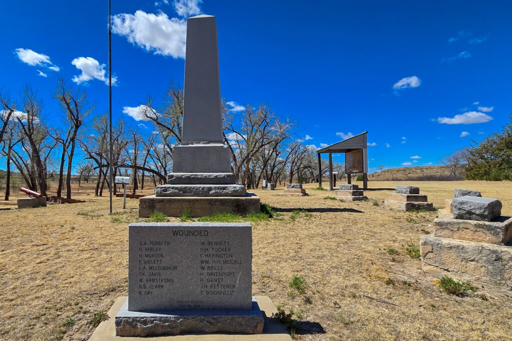
The Battle of Beecher Island is notable for several reasons.
- In its time, it was “one of the most publicized engagements fought between Plains Indians and the U.S. Army.” The sensationalism surrounding the battle directly contributed to the escalation of U.S. military operations in the Plains.
- The loss of Roman Nose was a significant blow to Cheyenne military leadership and resistance capability at a critical moment in the Plains Indian Wars.
- Rescue by the Buffalo Soldiers is an important moment in the history of Black military service in the American West.
- Historians specifically cite the battle as a microcosm of the entire Plains conflict. This one event brings together the political and economic forces driving western expansion, treaty violations, the legacy of Cheyenne retaliation after the Sand Creek Massacre, the role of the Cheyenne Dog Soldier warrior society, civilian scout culture, and the intersection of white and black military service.
- Numerous military lessons were gleaned from the Battle of Beecher Island. For example:
- the limits of small-scale military campaigns,
- the way repeated attacks followed by brief pauses affect a defender psychologically,
- the effect, both tactically and on morale, of losing a leader (Roman Nose) early in a conflict, and
- the effect of terrain on the outcome of the battle.
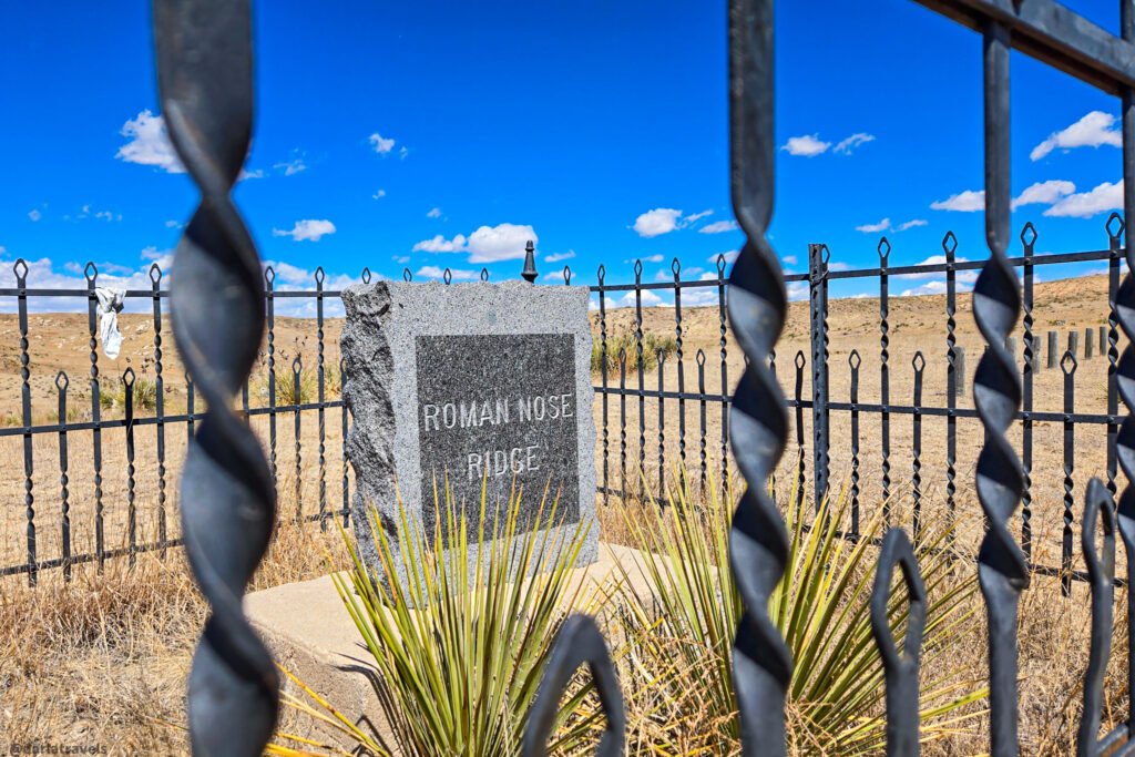
Things to see at the Beecher Island Battleground Monument.
The park was established in 1905 as a joint Colorado-Kansas historical site. Things to see include the following:
The Monument: The tall granite monument in the park today is not the original. That structure, erected in 1905 and located about 200 yards south of today’s marker, as well as the island itself, were washed away in the 1935 Arickaree River flood. Only portions of the original marker were recovered. For example, the obelisk is a recreation. The main granite block is engraved on all four sides with information about the battle and the scouts. Five smaller markers, each of which memorializes one of the scouts killed in the battle, surround the main monument.
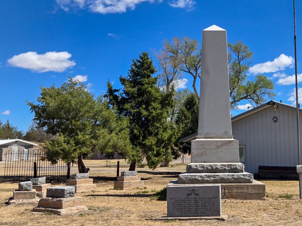
Interpretive sign: This detailed sign references many battlefield points of interest.
Campground, buildings and restrooms: The site also houses a primitive campground, an auditorium, a kitchen hall, a one-room schoolhouse, and a restroom building (the only public restrooms for miles around!).
Birding: Beecher Island Battleground and nearby Simmons State Wildlife Area also attract birders.
Annual Event: A commemoration of the battle is held annually. The Beecher Island Battleground is one of the most persistently commemorated battlefield sites in the American West, a distinction that itself speaks to the battle’s hold on regional and national memory.
👋🏻Another persistently commemorated battlefield in Colorado is the Sand Creek Massacre National Historic Site, which memorializes the 1864 massacre of Cheyenne and Arapaho people.
Trails and Walking: You can walk the Roman Nose Trail to find the memorial stone on Roman Nose Ridge. From the edge of the ridge, Cheyenne, Arapaho, and Lakota warriors watched over the U.S. Army scouts during the battle. Out and back, it’s only a 0.6-mile (1 km) walk. See the map below.
Other Things to Do in Wray
Visit the Wray Museum
As mentioned in the Downtown Walking Tour section above, the Wray Museum is a must-visit while in town. It might not be the largest museum you’ve visited, but the quality of the exhibits here is excellent. Founded in 1969, it has grown steadily and includes rotating exhibits and permanent galleries.
Jones-Miller Archaeology exhibit
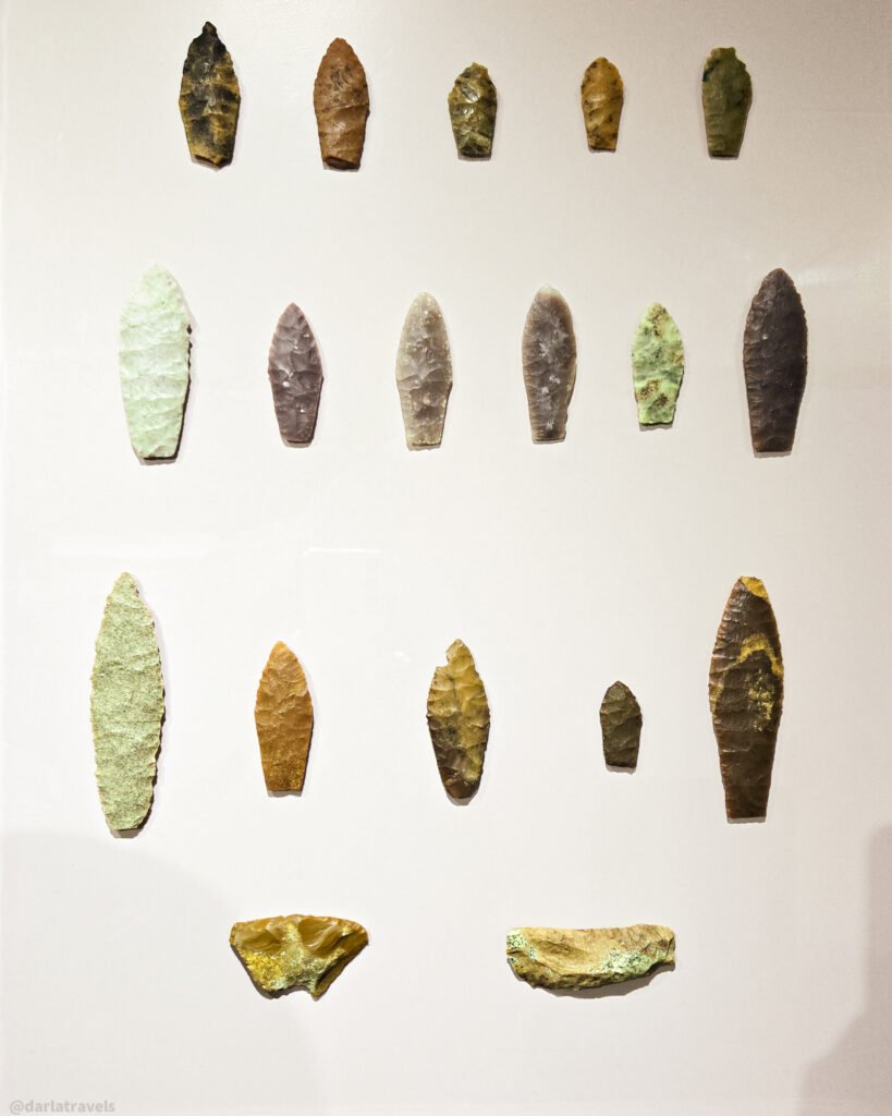
The museum’s anchor is its Jones-Miller Archaeology exhibit. Developed in partnership with the Smithsonian Institution. It’s one of only a few Smithsonian exhibits outside of Washington, D.C. The Jones-Miller site, located just outside Wray, was just one of hundreds of archaeological sites in the area. But a dig here revealed one of the most significant Paleo-Indian archaeological finds ever uncovered. The museum exhibit includes part of the original bone bed from an ancient bison butchering site, which dates to approximately 9,500 BC. Over 40,000 bones of the now-extinct Bison antiquus were found in this dig. Photos from the excavation, hundreds of stone tools and spear points, and a Bison antiquus replica (by sculptor Lance Bohall) are also on display.
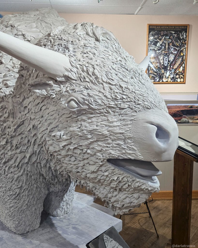
Additional Exhibits
Other exhibits in the Wray Museum are just as intriguing.
For example, the Battle of Beecher Island Room provides important interpretive context for this 1868 battlefield located 18 miles (29 km) south of Wray. Review the maps, artifacts, and descriptions in this exhibit before visiting the actual Beecher Island Battleground Monument, described later in this article.
The Shady Rest Country Store is a meticulous reconstruction of a 19th-century general store. It’s chock-full of period goods and fixtures that you can walk around and ponder.
Finally, the William B. Coston Photography Collection covers everything from Main Street streetscapes to farm families in Wray and Yuma County from the late 19th century onward.
Visit the museum website for admission information and hours of operation.
Recreation
Wray punches well above its weight in recreation infrastructure, and visitors who like to keep moving will find more here than they might expect.
Golfing – Outdoor and Indoor
Wray Country Club (36357 US-385) (also called Wray Golf Course) is a 9-hole, semi-private/public course just north of Wray, off US Highway 385. This course plays to a par 35 at 3,106 yards, with a USGA Course Rating of 34.1 and a Slope Rating of 123 from the Blue tees.
If you’re not up for the full course, head into town to visit The Back Nine, Wray’s Golf Simulator Lounge (336 Main Street, Suite C). The Back Nine has state-of-the-art HD golf simulators with access to 40+ courses. It also serves as an upscale whiskey-and-cocktail bar while remaining family-friendly.
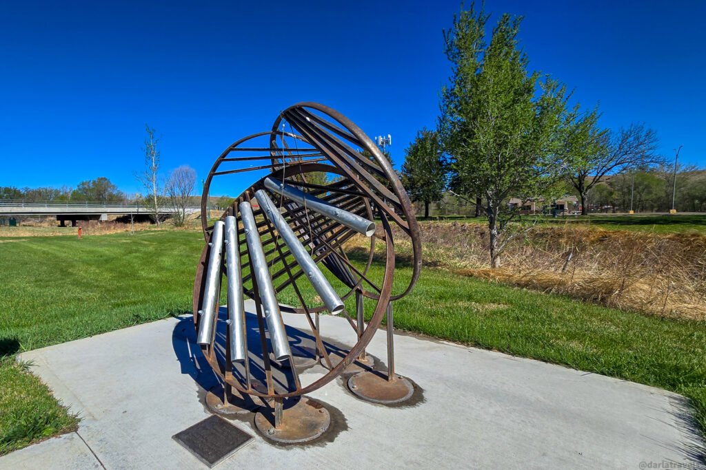
Swimming
We saw the Wray Aquatic Center (240 W 6th St) on the Town Loop Walking Tour. This community outdoor pool is open each summer from late May through August. With daily open swim and designated lap swim times, this is a prime amenity for adults and families stopping in Wray.
Gym and Exercise
For year-round fitness, the WRAC — Wray Rehabilitation & Activities Center (700 Main St) is the standout. The WRAC offers an indoor track, full- and half-court basketball courts, a racquetball court, a suite of Nautilus and cardio equipment, a free-weight room, and a full spa area. For a traveler who likes to start the day with a workout or unwind after a long drive, the WRAC offers day passes.
Fishing and the Wray Fish Hatchery
Three miles (4.8 km) northwest of town, the Wray State Fish Hatchery offers one of the more unexpected stops on any visit to eastern Colorado. Originally constructed in 1937, this Colorado Parks and Wildlife warm-water facility produces more than 10 fish species, including walleye, that are stocked in lakes and reservoirs across the state. The hatchery is open daily from 8 a.m. to 2 p.m. and welcomes visitors year-round, with guided tours available April through September.
The recently improved Stalker Lake, one of the best bass and sunfish fisheries in the state, sits adjacent to the fish hatchery.
Seasonal Events in Wray, Colorado
Wray has many seasonal events. Here are a few of the top happenings.
Greater Prairie Chicken Tours take place in March/April of every year. Greater prairie chickens thrive near Wray, thanks to habitat restoration and community-led conservation efforts that have reversed their population decline. Guided tours are offered to view the greater prairie chicken’s mating dance on private ranch land. The tours include an afternoon orientation at the Wray museum with an opportunity to view the exhibits, followed by the prairie chicken viewing the following morning.
🪧Click here to read my detailed article on attending a Greater Prairie Chicken Tour in Wray
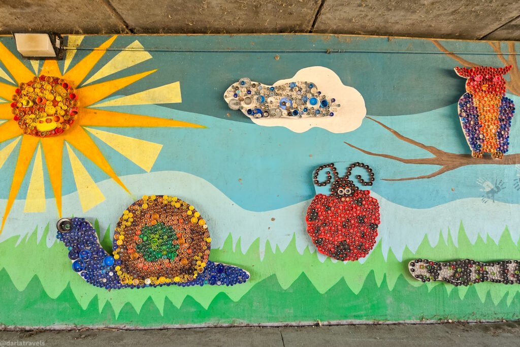
Wray Daze is a summer community festival weekend held on the last full weekend of July each year. Past events have included a parade, a mud volleyball tournament, a Battle of the Bands, a farmers’ and artisans’ market at Plaza Park, food vendors, a beer garden, a car show, and a family fun night.
Quilts of the Plains is an annual open-air quilt show and event organized by the Chamber of Commerce.
Where to Eat in Wray
Wray has a variety of places to eat and drink. Here are just a few that are highly rated. To avoid disappointment, confirm opening hours before your visit.
Coffee, Breakfast and Lunch
Canyon Coffee and Cafe (345 Main St) is a Wray cafe serving coffee, breakfast, and lunch. Choose from premium espresso and coffee drinks, bagels, croissants, deli meats, homemade cream cheeses and chicken salad, ice cream, smoothies, and freezes.
Try the Spicy Delight Bagel Sandwich: roast beef and turkey on a sun-dried tomato bagel with jalapeno cheddar cream cheese, lettuce, tomato, and red onion.
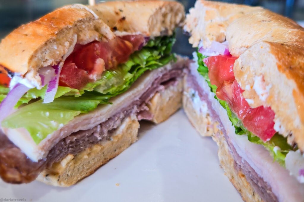
LaLa’s Bakery & Espresso Bar (301 Main St) is in the Bank of Wray Building we saw on the downtown walking tour. LaLa’s serves pastries, savory breakfast sandwiches, biscuits, fresh salads, and a full espresso menu.
Finally, RFYP’s Smokehouse. Open for breakfast and lunch. Try a classic breakfast burrito or one with brisket, pulled pork, or rib meat. BBQ meat sandwiches and platters are served at lunchtime.
Dinner in Wray
The 4th & Main Downtown Grille (402 Main St) is upstairs in the IOOF building we saw on the downtown walking tour. I daresay it’s the most atmospheric dining option in town. The restored lodge hall still has a stamped metal ceiling and well-worn wooden floors. The extensive menu includes appetizers, dinner salads, burgers, steaks and chops, southwest dishes like tacos and fajitas, seafood, sandwiches, pasta and pizza, plus a noodle bowl and a kids’ menu.
We enjoyed the 4th St. Poppers appetizer: a stuffed Anaheim pepper wrapped in bacon and topped with cilantro cream. The beef here was excellent (this is cattle country after all). You can’t go wrong with a burger, but get the prime rib if they have it on special.
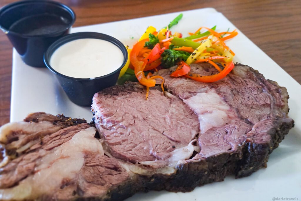
El Vaquero Mexican Restaurant & Cantina (29231 County Road 35) is highly rated and serves authentic Mexican cuisine.
Rounding things out, Flirtation Point Pizzeria (220 Main Street) is a self-described “hometown pizza joint with fresh-made dough and the best ingredients we can source!” Try one of their creative pizzas, subs, or salads.
Where to Stay in Wray, Colorado
Cobblestone Inn & Suites
The Cobblestone Inn & Suites just outside of Wray’s downtown is highly rated. The Cobblestone chain is built around the philosophy of “Big City Quality, Small Town Values.” The hotel features a complimentary hot breakfast, free Wi-Fi, a fitness center, an on-site beer-and-wine bar, guest laundry, and a 24-hour convenience store. In April of 2026, I paid $129.11 per night (including taxes and fees) for a double queen room.
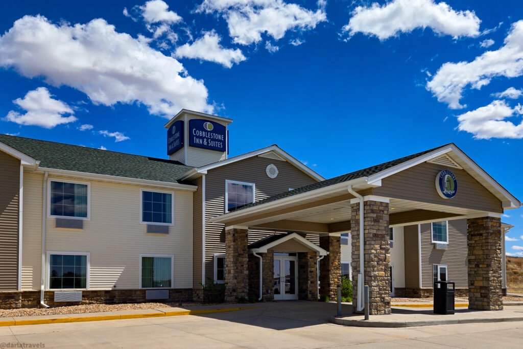
My spacious and comfortable double queen room, like all Cobblestone rooms, had a microwave and refrigerator, and Seattle’s Best Coffee.
Video walkthrough of a double queen room a the Cobblestone Inn & Suites Wray
Other Options
For a cheaper option close to downtown, look at the Butte Motel (330 E 3rd Street). Reviewers say it’s slightly dated, but clean and comfortable with a helpful front desk.
Finally, the historic Doc’s Bed & Breakfast (443 Blake Street) has six queen suites and two cottages available for travelers.
Book Now
Use the map and links below to book your Wray lodging:
Book now at Booking.com ♦ Book now at Expedia ♦ Book now at Hotels.com
Pin It for Later: Exploring Wray, Colorado
I created this images of Wray, Colorado for your Pinterest Boards:
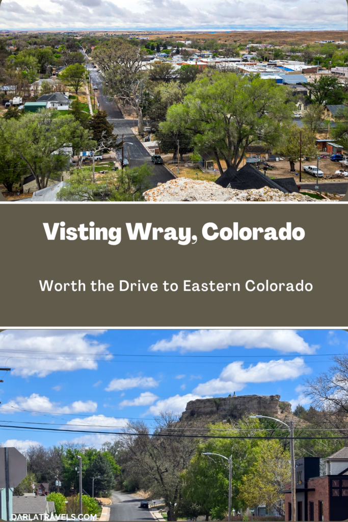
The Bottom Line: Wray Is Worth the Drive
Wray, Colorado will not overwhelm you with crowds, admission fees, or manufactured experiences. For generations, this High Plains community has quietly gone about the business of ranching, farming, and preserving its notable history. At the same time, Wray is welcoming to travelers who take the time to stop and explore.
In a single visit, you can walk the town, stand on a battlefield that the U.S. Army still uses to teach military strategy, visit a museum with top-notch exhibits, eat a meal that would satisfy in any city in Colorado, and end the evening at a 70-year-old movie theater. That is a remarkably full day for a town of about 2,300 people on the High Plains.
The drive from Denver runs about three hours each way. It’s long enough to feel like a real trip, but short enough for a weekend. Come for one of the annual events, like the Beecher Island commemoration or a Greater Prairie Chicken tour, or just to take a walk along the River and view the town from Flirtation Point. Either way, you’ll be one of the fortunate to experience this quiet, underrated Eastern Plains gem.
Adding Wray to our travel list. It would be fun to explore Wray on our next Colorado-Nebraska drive.
That’s great!
I love discovering underrated destinations like this! The combination of frontier history, a historic downtown, the Beecher Island Battlefield, and that beautifully preserved 1950s movie theater makes Wray sound like a place that’s well worth the detour. Thanks for shining a light on one of Colorado’s hidden gems!
Glad you enjoyed the article-it’s good to find another fan of underrated stops!
I’m planning a trip to Denver next summer, so this looks like a great add-on destination. I love small towns!
Fantastic-I hope you get a chance to stop in Wray!
Wray is an amazing city! Friendly people everywhere. Excellent medical facilities. Always something special happening at one of the great businesses, many have longevity due to great customer service.
New are Flirtation Point pizza and The Back Nine.
I love hearing this and glad you liked the post. Thanks so much for sharing more about what makes the town special
You should come back for the annual Wray Fire Department BBQ Competition at the end of every March! It’s a whole weekend of festivities!
Who doesn’t love BBQ–That does sounds like a fun weekend!
Going North on Main Street toward the railroad tracks, you will find the Depot that has served out community for many years. The last building on the west is currently Wray Machine Shop, oldest family owned business in town. The building housed many businesses before WMS, with the fromt being remodeled following the Main Street Tornado.
Thank you so much for sharing this! I didn’t make it up to the Depot on my visit, so I really appreciate the extra history and context. This information adds a whole new layer to Wray’s story.
Thank you for this very descriptive information on Wray. Your walking guide is vividly detailed with historical facts allowing the visitor insight to realize the necessary value in founding Wray in this location. Wray sounds like a still growing and thriving community away from the hustle and bustle of city life and a good community to raise a family.
Thank you so much for this generous comment. I’m really glad you enjoyed the post as much as I enjoyed writing it.