While Moab’s marquee parks draw the biggest crowds, this guide describes quieter hiking spots near town. Walk to the stunning Corona and Pinto Arches, discover over 200 dinosaur footprints at the Dinosaur Stomping Grounds, and take in the historic Richardson Amphitheatre.
These alternative spots still offer dramatic scenery, but with more solitude and with some unusual features. Each destination is a day trip, and each itinerary pairs a shortish trail with a nearby “bonus” stop that offers insight into a historical aspect of the area with little extra effort.
Planning to visit the major parks too? See my companion guide: Short Hikes Near Moab’s Major Parks with Bonus Stops: Arches, Canyonlands, and Dead Horse Point.
Impressive hikes near Moab don’t require crowded trails or national park entry lines. These destinations will reward walkers who value the quiet side of Moab and are keen to delve deeper into the Moab area’s red-rock canyons, history, and paleontology.
** Darla Travels is reader-supported.
When you buy through our links, we may earn a commission. **
Find a great place to stay in Moab:
- Notes and Essential Tips for Hiking in Moab’s Desert Landscape
- Corona Arch, Bowtie Arch, and Pinto Arch with Bonus Stops on Potash Road
- Colorado River History: Amphitheatre Hiking Loop, Dewey Bridge, and Hittle’s Bottom
- Dinosaur Day near Moab: Tracks, Bones, and Trails
- Quiet Moab Hikes with bonus petroglyphs, dinosaur tracks, and history-Pin It for Later!
- Where to Stay in Moab
- Final Thoughts on Quieter Moab Hikes with Bonus Stops
Notes and Essential Tips for Hiking in Moab’s Desert Landscape
Before heading out on a Moab-area hike, it helps to start the day well-fed and ready for the desert. If you need breakfast ideas, see my guide to the best breakfasts in Moab.
📍Trail distances and elevation gains in this guide are approximate, and I’ve included AllTrails links for easy navigation. Open the map and use the driving directions feature to find each trailhead.
Moab’s desert environment calls for careful planning. Check the forecast before you go, and in hot weather, try to begin your hike early in the day before temperatures climb. Even short walks can feel much harder under intense sun with little shade.
Carry plenty of water and a snack or light meal, and protect yourself from the sun with a hat, sunscreen, and sunglasses. A map is also useful, since slickrock terrain can be confusing and trail markers are not always obvious.
Cell coverage can be spotty, so it’s wise to have a backup way to communicate if needed.
Binoculars are a nice extra, too, especially for spotting distant arches, petroglyphs, or even dinosaur tracks.
Corona Arch, Bowtie Arch, and Pinto Arch with Bonus Stops on Potash Road
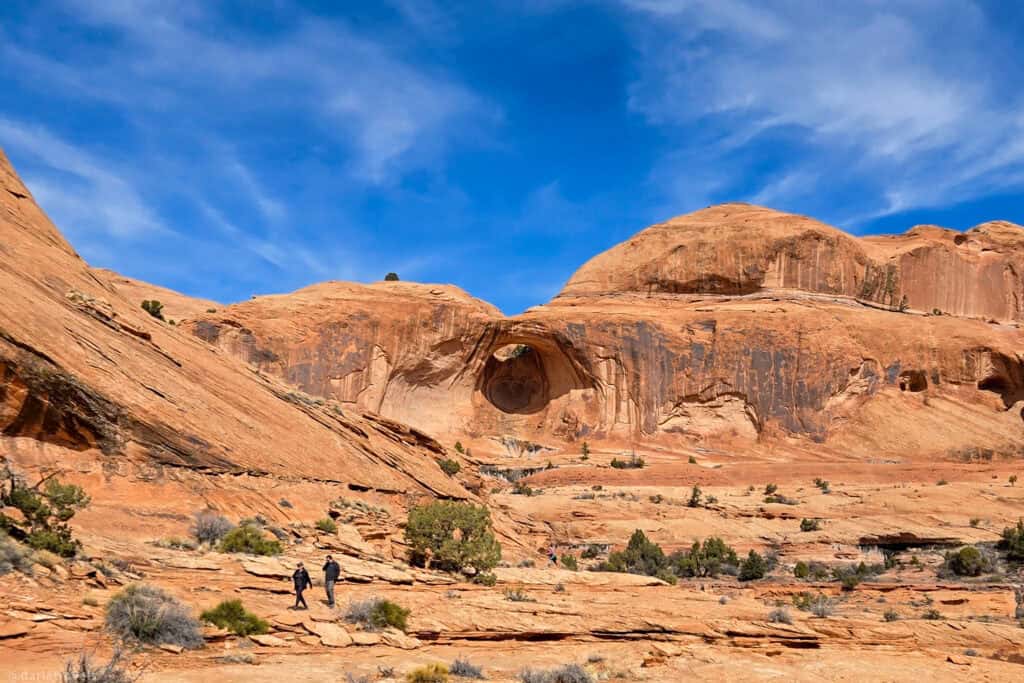
The Corona Arch Trail is a must-do hike just outside of Moab. Getting there on Potash Road, also known as Scenic Byway 279, is half the fun. With high cliffs on one side and the Green River on the other, this picturesque route curves through the landscape, making a pleasant drive to the trailhead.
Unlike some of the busier trails in Arches National Park, the Corona Arch trail offers a sense of solitude while still delivering an impressive natural arch at its end. The dirt path climbs and then becomes a well-marked route across the slickrock, with sections of sand and low desert vegetation. On the way, you’ll pass the Bowtie Arch, a smaller photogenic counterpart. A few short ladders and chains on the trail help you along without requiring technical climbing skills.
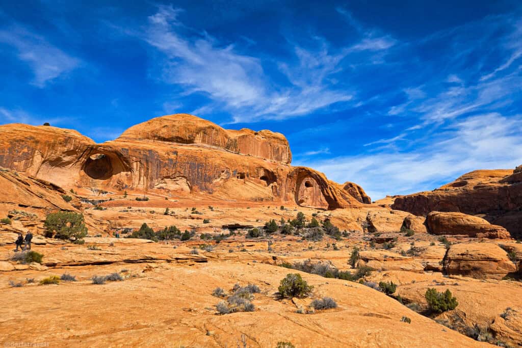
At a fork in the trail, you can return to the start, but why not follow the sign to Pinto Arch? It’s yet another fascinating natural arch tucked into a quiet alcove.
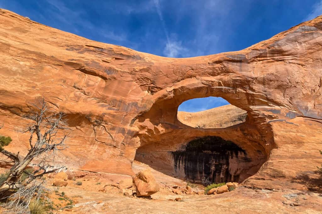
On the hike back to the trailhead, don’t miss the views across the Green River.
Corona and Bowtie Arch Hiking Trail
Pinto Arch Hiking Trail
Length: 2.1 miles (3.4 km) round trip out and back
Elevation gain: 518 feet (158 m)
Difficulty: Moderate
Bonus Hike: Potash Road Dinosaur Tracks and Petroglyphs
This bonus stop on the way back to Moab is a very short hike and scramble to view both fossilized dinosaur tracks and rock art panels. As you return to Moab on Potash Road/Utah Highway 279, look for the signs pointing to the Poison Spider Trail and Dinosaur Tracks.
You’ll need to do a short but moderately steep scramble up slickrock from the trailhead. The climb is brief and manageable for most active travelers. Sturdy shoes with good traction are essential.
An informational sign alerts you to the location of the fossilized dinosaur tracks, preserved in the sandstone and dating back more than 100 million years.
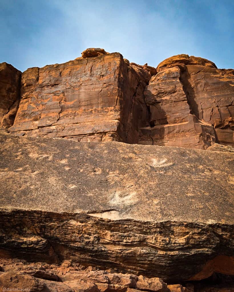
Slightly further up, numerous petroglyph panels add another layer of history, with figures and symbols carved into the rock by ancient inhabitants.
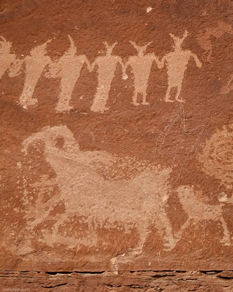
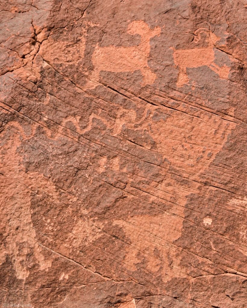
Together, the dinosaur footprints and rock art make for a thought-provoking site, linking to prehistoric life and evidence of more recent human presence in the desert.
Length: 0.3 mile (0.5 km) out and back.
Elevation Gain: 72 feet (22 m)
Difficulty: Moderate to Strenuous
Bonus Stop: Highway 279 Petroglyph Site
This second bonus stop is just a little further up Potash Road/Highway 279 on the return to Moab. This site offers an excellent introduction to Moab’s rich rock art heritage without requiring extra time or effort. It’s an ideal bonus stop to investigate the region’s cultural history after a hike at Corona Arch.
📍GPS coordinates: 38.544786395306325, -109.60010191424364
📍Google Plus Code: G9VX+QX Moab, Utah
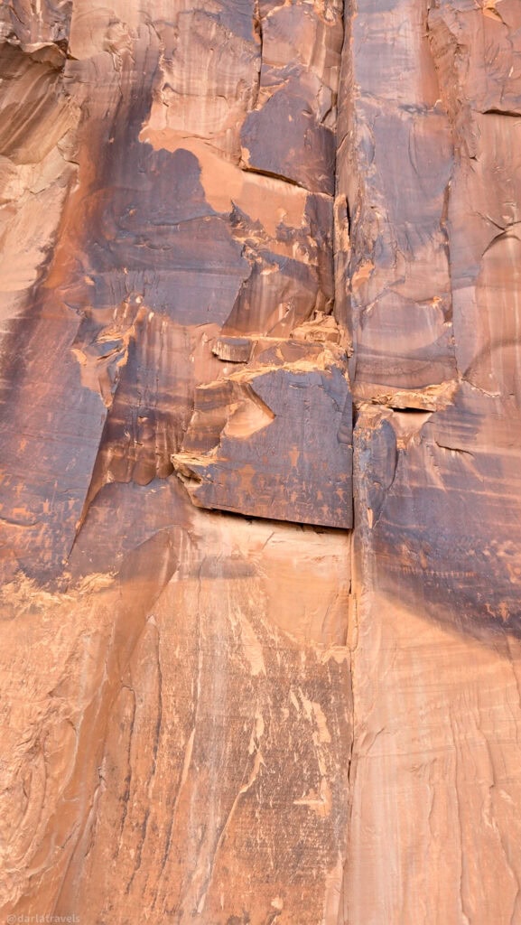
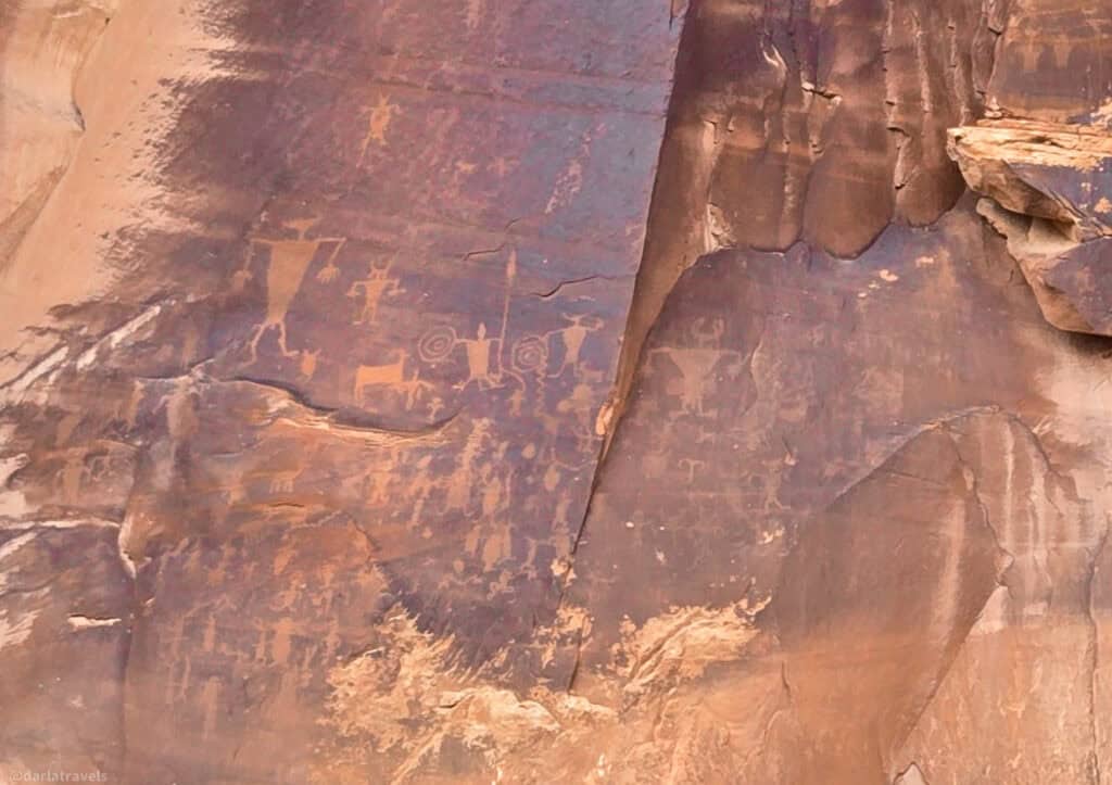
Just pull off, and spend as long as you like looking at the petroglyphs on multiple rock panels on the other side of the road. No hiking or scrambling is needed!
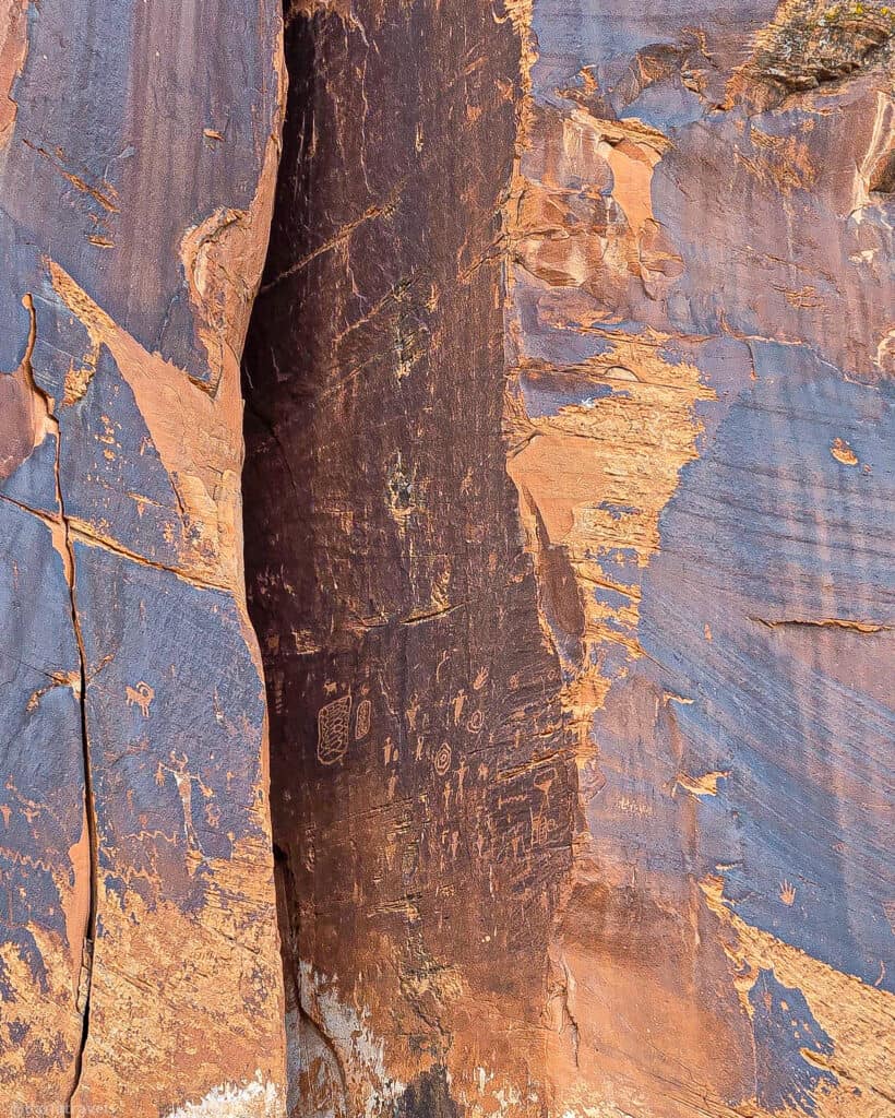
The petroglyphs include human-like figures, animals, and abstract designs attributed to the Fremont and ancestral Puebloan cultures. Most of the carvings are positioned above eye level, which adds to their visual impact. Binoculars will be helpful.
Colorado River History: Amphitheatre Hiking Loop, Dewey Bridge, and Hittle Bottom
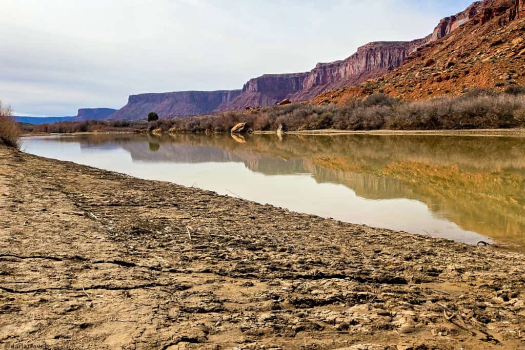
Richardson’s Amphitheatre is the broad, flat valley between the town of Castle Valley and the Colorado River along Utah Highway 128 (the Upper Colorado River Scenic Byway). It’s named for Sylvester Richardson, a professor who settled there in the 1880s. He founded the small town of Richardson near the mouth of Professor Creek and tried to attract additional settlers. The trailhead for the Amphitheatre Loop trail is at the Hittle Bottom Recreation Site.
Hittle Bottom has a campground, river access, and a boat ramp. Additionally, you can still see the remains of an early 1900s homestead right by the campground. The main visible feature is a small rock‑walled dugout built into the earth, originally the home of mail carrier Tom Kitsen and his family.
The hike begins by crossing the highway (carefully), then descends gently into the amphitheater. At the fork in the trail, I recommend taking the trail counterclockwise. This direction includes a short rock scramble at the far point of the loop. Impressive views of the amphitheatre and beyond can then be had as the trail gently slopes down to the starting point.
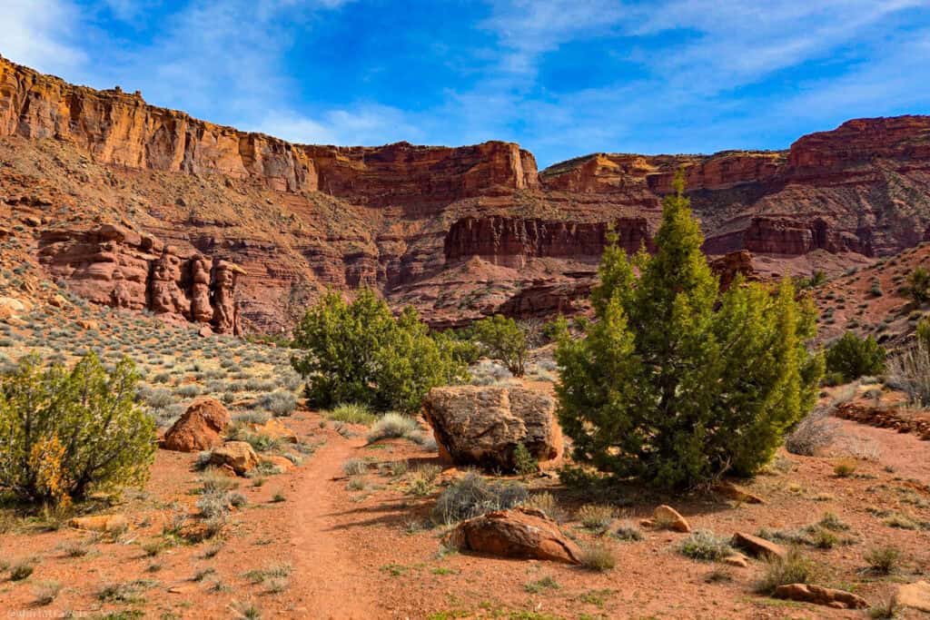
This hike is particularly rewarding for walkers who appreciate solitude and geology.
Amphitheatre Loop Hike
Length: 2.3 miles (4.8 km) loop hike
Elevation gain: 423 feet (129 m)
Difficulty: Moderate
Bonus Stop – Dewey Bridge
As mentioned above, this hike is off of Utah Highway 128. From Moab, the highway follows the Colorado River through a striking corridor of red rock cliffs on one side and the Colorado River on the other, making the drive itself part of the experience.
There are many points of interest along the highway. For example, the stunning red rock spires named Fisher Towers, the Morning Glory Natural Bridge, and Castle Valley.
For today’s bonus stop, I’ll suggest that you drive on Highway 128 about 29 miles (47 km) from the turnoff on Highway 191, past the trailhead at Hittle Bottom, and continue to the remnants of the Dewey Bridge.
📍GPS: 38.81214411133896, -109.30312975863598
📍Google Plus Code: RM7W+9R Moab, Utah
When built in 1916, Dewey Bridge was the second-longest suspension bridge west of the Mississippi River. It was also significant at its construction because it provided the first direct crossing of the Colorado River in remote southeastern Utah.
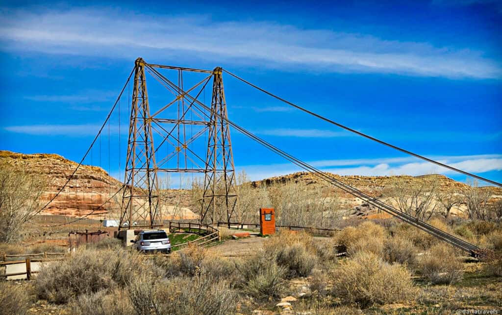
Replaced by a modern bridge in 1984, Dewey Bridge was restored in 2000, but was destroyed when its wooden deck caught on fire in 2008. The main suspension cables and towers remain, as do the vertical suspenders (hangers) that connected the deck to the cables. Today, they hang in midair, waiting for a new restoration. Nonetheless, it’s an impressive structure worth a stop.
Second Bonus Stop – Fisher Towers
On the way to the Amphitheatre Loop Hike Trailhead, you passed the Fisher Towers, a striking rock formation with towering spires of soft, deep red sandstone. You can see them from the trailhead, but why not get a little closer? This easy roadside stop pairs perfectly with the Amphitheatre hike, adding another dose of geologic grandeur without crowds.
From Highway 128, look for the signs to Fisher Towers/Fisher Towers Campground. The trailhead is about 2.2 miles (3.5 km) down a gravel road.
📍GPS: 38.72485963861819, -109.30884843800841
📍Google Plus Code: PMFR+WF Moab, Utah
Zero hiking is required to enjoy the views of Fisher Towers from the parking lot. See if you can spot any climbers scaling the sheer faces of the rock spires–binoculars will help.
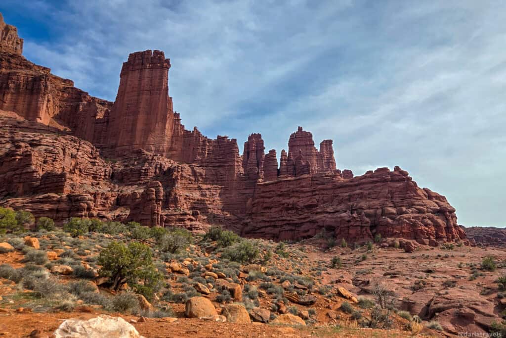
Possible Bonus Hike: But if you’re up for it, the 4.5-mile (7.2-km) long Fisher Towers Trail takes you through stunning red rock geology and around the base of the towers.
Dinosaur Day near Moab: Tracks, Bones, and Trails
If you like dinosaurs and all things prehistoric, you’ll love these dinosaur-related walks. What is here is only a small selection of prehistoric sites in the Moab area, but these two hikes and a bonus stop are doable in a day.
Dinosaur Stomping Grounds
This hike is in the Klondike Bluffs area, about 24 miles (38.6 km) north of Moab. This BLM land is popular with mountain bikers and has a campground. Use caution on the bumpy access road to the Mega Steps Trailhead, where the Dinosaur Stomping Grounds trail starts.
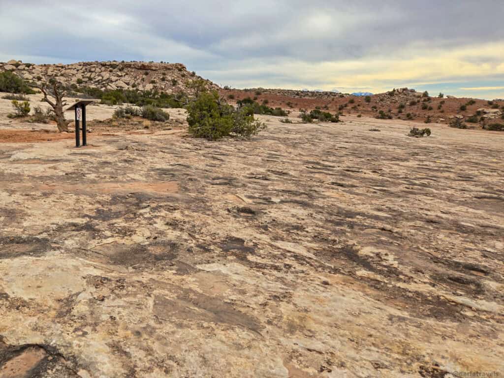
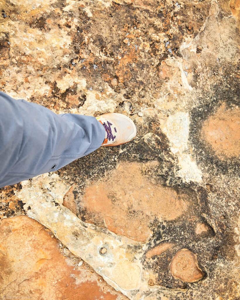
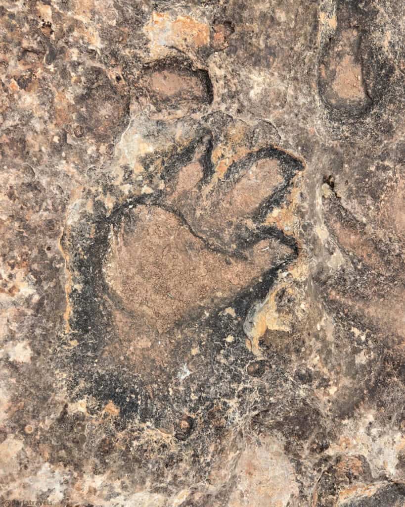
In contrast to the red rock towers and arches, the Klondike Bluffs area has few tall features, and the landscape is more rolling hills. This hike takes you through desert vegetation to an open area of slickrock. As you approach the end of the trail, tracks from multiple dinosaur species can be seen embedded in the sandstone. Interpretive signs provide further information and context for the types of dinosaur tracks here.
Length: 3.1 miles (5 km) round-trip out and back
Elevation gain: 236 feet (72 m)
Difficulty: Moderate
Bonus Stop: Mill Canyon Dinosaur Trailhead Interpretive Site
Backtracking down Highway 191 toward Moab, turn right on Mill Canyon Road and follow the signs to find the Mill Canyon Dinosaur Tracksite.
📍GPS: 38.72120703469459, -109.73405092786601
📍Google Plus Code: P7C8+8C Moab, Utah
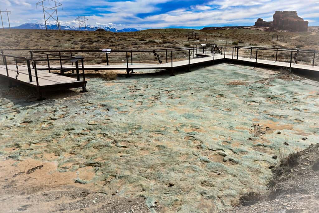
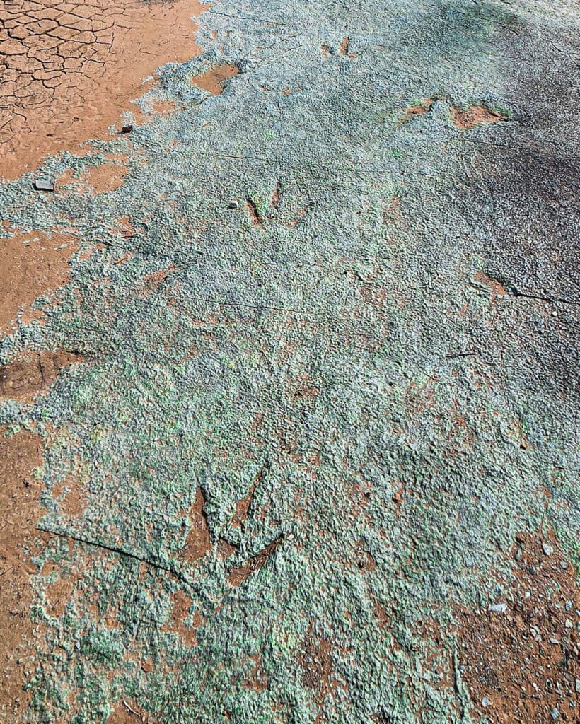
A short raised boardwalk trail guides you around the small site in about 20 minutes, allowing close viewing of the tracks without damaging the delicate surface. What makes this site worth stopping for are the number, over 200, and variety of tracks from the Early Cretaceous Period. There is evidence of theropods, sauropods, ornithopods, ankylosaurs, birds, and even crocodilians. Numerous interpretive signs make it easy to pick out the various fossilized tracks. It’s a fascinating glimpse into ancient life. Binoculars help pick out the finer details in the layered impressions.
Bonus Hike: Mill Canyon Dinosaur Bone Trail Hike
The last stop for this Dinosaur Day is the Mill Canyon Dinosaur Bone Trail. This short track allows up-close viewing of fossilized dinosaur bones partially embedded in the sandstone. Interpretive signs describe the types of bones, how to identify them, how they were preserved, and what they reveal about the region’s ancient ecosystems.
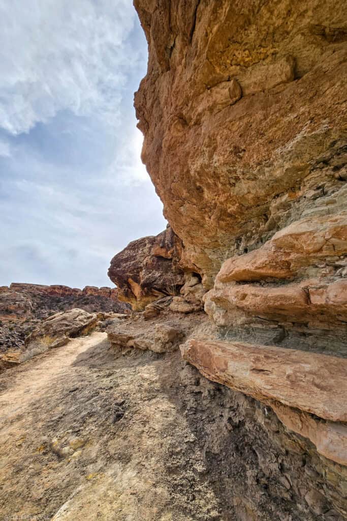
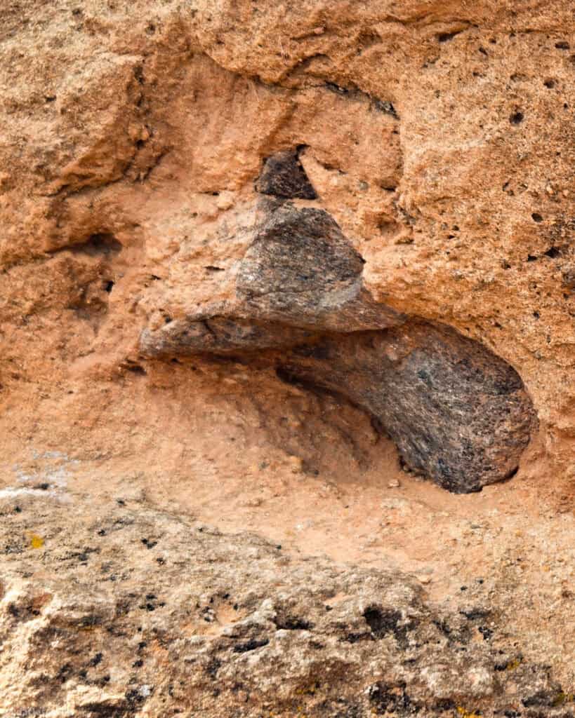
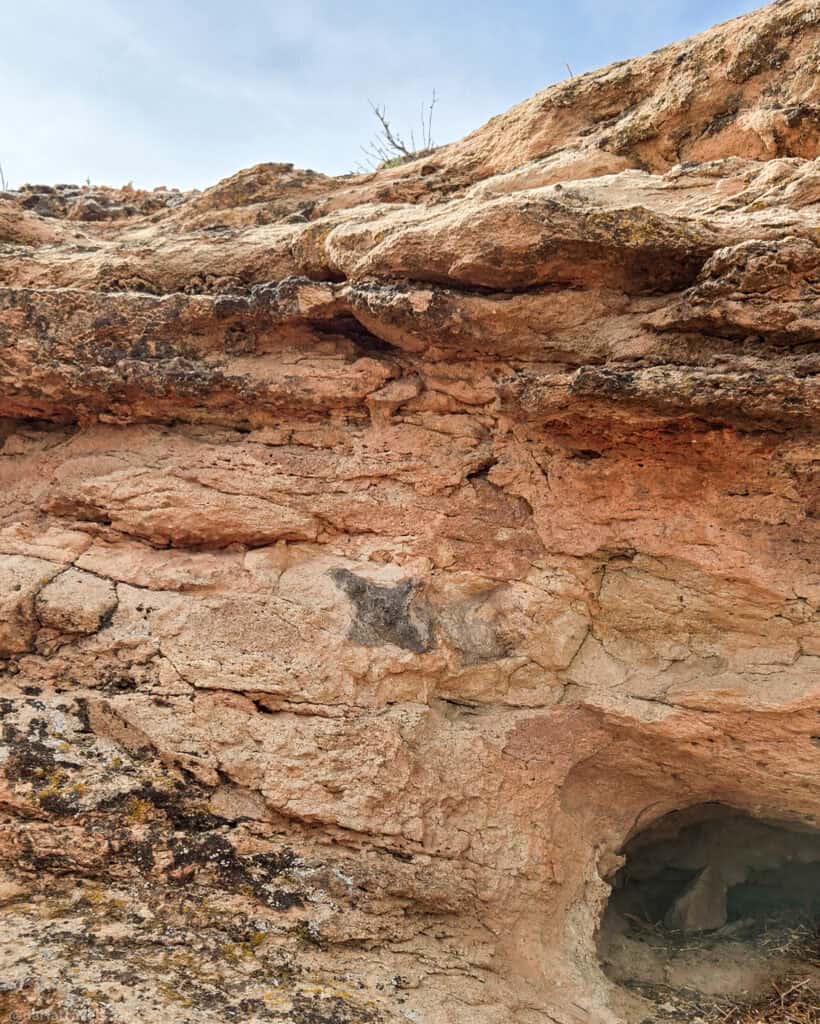
Unlike most other sites of this nature, it’s OK to touch the embedded fossils on this trail. Just don’t alter or remove them The offering of a hands-on experience can’t be beat.
Note: A sign along the way to the trailhead warns of deep sand and recommends a 4-wheel-drive vehicle. We parked farther away and walked to the trailhead to avoid wet sand and puddles on the road from recent snowmelt.
Length: 1.8 miles (2.9 km)
Elevation gain: 101 feet (31 m)
Difficulty: Moderate
Quiet Moab Hikes with bonus petroglyphs, dinosaur tracks, and history-Pin It for Later!
I created these images for Moab’s quiet hikes for your Pinterest Boards:
Where to Stay in Moab
A good day of exploring starts with a restful night. Fortunately, Moab has an abundance of lodging for curious hikers, and many properties cater specifically to outdoor travelers, offering early breakfast options, gear storage, and easy access to trailheads.
I found the MainStay Suites Moab near Arches National Park on South Main to be a cozy and convenient option. My roomy suite had a kitchenette, generous seating, and a bathroom equipped with everything needed for a comfortable stay. Additionally, a complimentary breakfast buffet hit the spot before heading out for hiking. Finally, as an extended-stay hotel, you may be eligible for a discount on longer trips.
🎥 Video walkthrough of a king suite at the MainStay Suites Moab near Arches National Park
Use the map and links below to research and reserve your lodging in Moab.
Book now at Booking.com ♦ Book now at Expedia ♦ Book now at Hotels.com
Final Thoughts on Quieter Moab Hikes with Bonus Stops
Extreme outdoor recreation is part of Moab’s DNA. At the same time, it’s a place that rewards slowing down, looking closer, and lingering. Find a quieter, more contemplative side of Moab by seeking out lesser-visited trails.
Pairing these trails with nearby cultural and natural stops deepens the experience, whether along the Colorado River corridor, at Mill Canyon, or Klondike Bluffs. Make sure your time in Moab becomes more than a checklist of hikes; get connected to the land with petroglyphs carved centuries ago, ancient dinosaur tracks, geological wonders, and historical sites to augment your treks.
I love those arches! It’s good to know that there is an “abundance of options” to choose from! Especially, that they offer early breakfasts!
I’m right there with you on the arches! And early breakfasts make it so much easier to hit the trail well-fueled!
This is exactly the kind of Moab guide I love—getting away from the crowds but still seeing incredible landscapes. The mix of quieter hikes with bonus stops like petroglyphs and dinosaur tracks makes the experience so much more interesting. Corona Arch is such a great alternative to the busy spots in Arches. Definitely saving this for our next trip to Moab!
Thanks for the comment, I’m glad you enjoyed the post!
I’m going to Utah, the SLC area, in June, but don’t have enough time to visit the National Parks. I will save this for a return trip. I’m not able to hike, but would love to see the arches.
Thanks for stopping by, and enjoy your trip!