This Julesburg road trip explores sites that document westward migration in the United States. Because history doesn’t stop at a state border, the route follows the Oregon Trail, Pony Express, telegraph, and railroad routes that shaped the American West through four Nebraska towns before returning to Julesburg. Chappell and Brule have historic markers, and Sidney and Big Springs also offer walking tours.
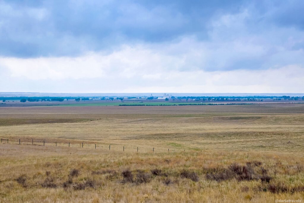
The open prairie with few buildings can feel remote, but historical markers along the way show that people and information moved west in the 1860s and that the infrastructure evolved quickly.
Starting and ending in Julesburg, the route covers about 137 miles (220 km) and takes roughly 2 hours and 30 minutes of driving, not counting time to read the markers, stretch your legs, and explore further.
If you haven’t read my guide to Julesburg yet, start there. It covers Julesburg’s history and provides context for the Oregon Trail and other overland routes, the Pony Express, and the transcontinental telegraph and railroad lines. This article is the next chapter. Together, the two will give you a fuller picture of how this small corner of the Plains fit into the settlement of the American West. So let’s hit the road.
** Darla Travels is reader-supported.
When you buy through our links, we may earn a commission. **
Click to Book the Julesburg Cobblestone Inn & Suites
Or find another great place to stay :Table of Contents – Julesburg Road Trip
[show]- Oregon Trail, Pony Express, and Railroad History
- Julesburg Road Trip Route, Mileage, and Map
- Historical Stops on the Julesburg–Nebraska Loop
- Begin with Julesburg’s Historical Markers
- Markers on US 385 toward Sidney, Nebraska
- Sidney, Nebraska: National Pony Express Monument
- Return to Chappell: Downtown History and Murals
- West of Brule: Pony Express Stations, California Hill, and a River Crossing
- Big Springs, Nebraska: Historic Sites and Walking Tour
- Return: Big Springs to Julesburg
- Where to Stay for Your Julesburg Road Trip
- Road Trip Tips and Practical Notes
- Pin It for Later – Julesburg and Nebraska Road Trip
- A Road Trip Through Layers of Plains History
Oregon Trail, Pony Express, and Railroad History
- Oregon Trail, Pony Express, and Railroad History
- Julesburg Road Trip Route, Mileage, and Map
- Historical Stops on the Julesburg–Nebraska Loop
- Begin with Julesburg’s Historical Markers
- Markers on US 385 toward Sidney, Nebraska
- Sidney, Nebraska: National Pony Express Monument
- Return to Chappell: Downtown History and Murals
- West of Brule: Pony Express Stations, California Hill, and a River Crossing
- Big Springs, Nebraska: Historic Sites and Walking Tour
- Return: Big Springs to Julesburg
- Where to Stay for Your Julesburg Road Trip
- Road Trip Tips and Practical Notes
- Pin It for Later – Julesburg and Nebraska Road Trip
- A Road Trip Through Layers of Plains History
The stops on this loop tell a connected story. You’ll see how people, mail, and information crossed the plains. Follow three threads as you explore:
- Wagon and stage routes: The Oregon, California, and Overland trails, along with stagecoach lines, form this trip’s overland travel thread. Their routes weren’t a single continuous road; they overlapped or branched toward different destinations.
Julesburg, Colorado (Julesburg 1) was a major junction; wagon traffic and stagecoach routes converged there before travelers continued on different routes.
- The Pony Express: From April 1860 to October 1861, riders carried mail through a network of stations, changing horses along the way for rapid delivery.
Julesburg, also called “Overland City” for a short time, was home to a Pony Express Station.
- Telegraph, then rails: Completed in October 1861, the first transcontinental telegraph made the Pony Express obsolete. The transcontinental railroad followed in 1869, transforming the movement of people and goods as dramatically as the telegraph had changed communication.
The telegraph line was built west from Julesburg starting around September 1861. Julesburg was burned in 1865 and relocated in 1866 (Julesburg 2). Julesburg moved to accommodate railroad construction and became Julesburg 3, a rowdy, dangerous “end of track” town called the “Wickedest City in America.”
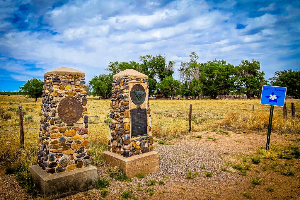
The current Julesburg location is Julesburg 4. Julesburg moved one final time in 1881 to the junction of the Denver branch and the transcontinental railroad route.
Julesburg Road Trip Route, Mileage, and Map
This road trip starts and ends in Julesburg and loops through four Nebraska towns: Chappell, Sidney, Brule, and Big Springs. Allow a half day for the drive and selected marker stops, or make it closer to a full day if you include both walking tours, a meal, and longer visits.
You don’t need to be a history buff to enjoy this drive, but a little inquisitiveness will go a long way. At times, spotting historic markers can feel like an Easter egg hunt. But once you find one, you’ll undoubtedly have questions and will want to know more.
Driving Route Breakdown
- Julesburg, CO to Chappell, NE: Head north out of Julesburg on US-385 N to connect toward Sidney.
- Chappell, NE to Sidney, NE: Take I-80 heading west toward Sidney.
- Sidney, NE to Chappell, NE: Take I-80 heading east back toward Chappell.
- Chappell, NE to Brule, NE: Take US 30 heading east.
- Brule, NE to Big Springs, NE: Cross the South Platte River and continue west/southwest along I-80 to the Big Springs exit.
- Big Springs, NE back to Julesburg, CO: A drive south via US 138 returns you right across the state line into Julesburg. A detour for a scenic view on I-80 is included.
Route Map
I created the following route on Google My Maps to show the loop route I took. This route is just a suggestion. It’s not the neatest loop due to the location of the markers, so some backtracking is inevitable. You can split this route into two days or modify it based on your preferences and available time.
The drive covers about 137 miles (220 km) and takes about 2.5 hours, not counting stops.
Historical Stops on the Julesburg–Nebraska Loop
The suggested route leaves Julesburg from the Colorado Welcome Center, skirts downtown Julesburg on 1st St. and continues on US-385 N into Nebraska.
Begin with Julesburg’s Historical Markers
Be sure you’ve seen the Pony Express Statue at the Colorado Welcome Center, and the following historic markers in downtown Julesburg before continuing the drive:
- The COLORADO Sign in front of the Julesburg Water Tower (218 East 1st Street) explaining the westward migration of gold-seekers and settlers in the South Platte River Valley.
- The 1931 Oregon Trail Marker (intersection of 1st and Cedar) in the grass of the Union Pacific Railroad Park. The marker also mentions “Old Julesburg’s” stage and Pony Express station.
- The Pony Express Marker in front of Julesburg’s Depot Museum (201 West 1st St.). Near the museum is also a trio of interpretive signs describing the four Julesburg sites and other things to do in the Julesburg area.
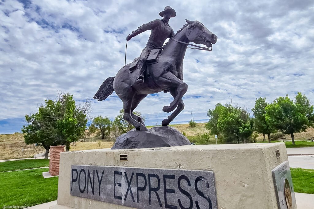
For a walking tour that includes these markers, plus a description of additional markers along the South Platte River Scenic & Historic Byway driving route, see my companion article on a history-focused exploration of Julesburg.
Leaving downtown Julesburg, continue on 1st St., which becomes US-385 N and travels into Nebraska.
Markers on US 385 toward Sidney, Nebraska
Hughes’ Ranch Pony Express Station
The first marker is alongside US-385 just before I-80 crosses overhead (41.0539, -102.4150).
The stone marker commemorates the Hughes’ Ranch Pony Express Station. Hughes’ Ranch wasn’t part of the original route; it was added when a mail contract expanded both stagecoach and Pony Express service.
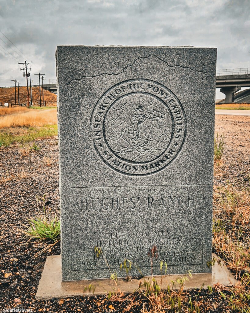
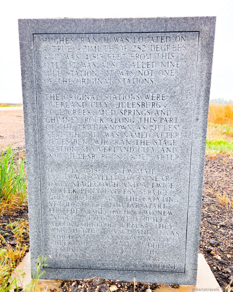
Even at this first marker, it’s inspiring to think about how long it would take stagecoach traffic and Pony Express riders to get from Julesburg station to here.
From here, continue toward Chappell, NE. At the T-junction with the NE-25A Link, turn left, then turn left again onto Airport Road to get to the Chappell Pony Express Park next to Chappell Lake.
Chappell Pony Express Park
The Chappell Pony Express Park is just outside the town of Chappell, which we’ll pass through again later in this tour. There are three markers to see here.
First, a sign marks the Historic Lodgepole Creek Valley (41.0837, -102.4710). It gives a short history, indicating that the valley was a route for
- Historic trails
- The Pony Express
- Stagecoach lines.
- The first transcontinental telegraph line, and
- The Union Pacific railroad
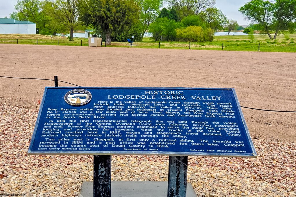
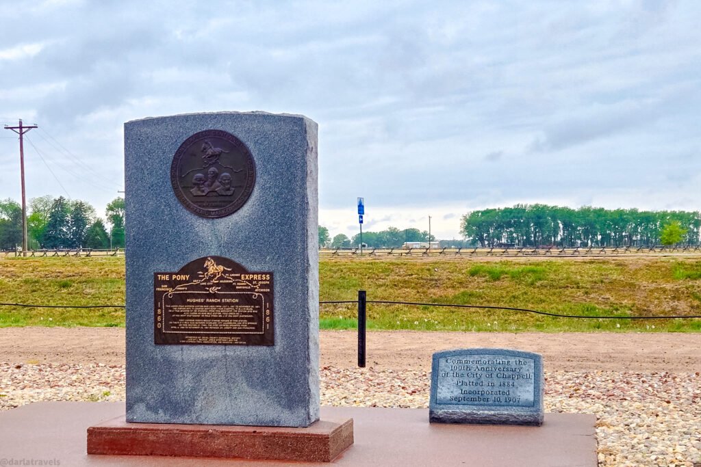
This site also has another marker for the Hughes’ Ranch Pony Express Station, noting that the station was 2.78 miles (4.5 km) from the sign. Riders would change horses at Hughes’ Ranch when traveling from the Julesburg station to the Mud Springs station (north of Sidney, NE).
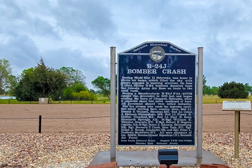
Also look for the B-24J Bomber Crash sign and model plane here. This Nebraska Historical Marker commemorates the crash of a B-24 Bomber about 2 miles (3.2 km) away during World War II. The accident occurred on June 7, 1944, during a training exercise while en route to the West Coast.
Sidney, Nebraska: National Pony Express Monument
After you’ve soaked up all the information at the Chappell Pony Express Park, continue south to I-80 and take it to Sidney, Nebraska, where you’ll find the National Pony Express Monument 41.1158, -102.9543).
Sidney didn’t exist as a town when the Pony Express came through this area. Its origins are in Fort Sidney, built in 1867 to protect Union Pacific Railroad infrastructure and employees from Native American attacks.
The focal point of the National Pony Express Monument is a large bronze statue of a Pony Express rider on his horse. Named “Hard and Fast All the Way,” this tension-filled statue was sculpted by Peter M. Fillerup in 2011.
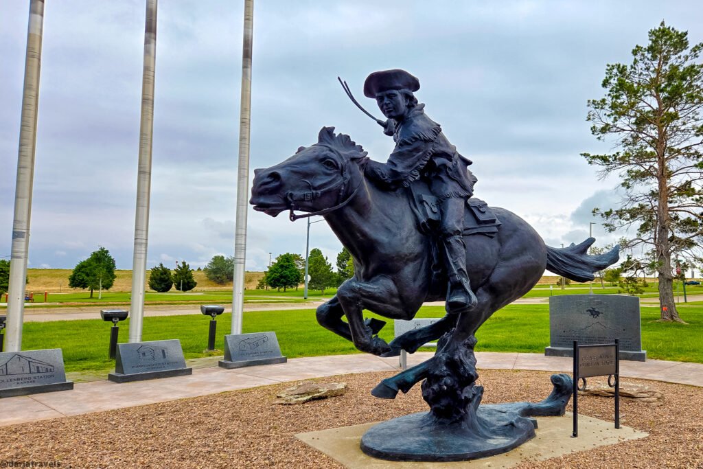
The statue is surrounded by:
- A circle of flags of the eight states of the Pony Express route;
- Interpretive markers for each station stop. Sources say this is the only National Pony Express monument with a marker and flag for every state on the route;
- A bench inscribed with the rider’s oath;
- Another bench depicting Israel Landis, creator of the Pony Express mochila (mailbag);
- A marker showing the Pony Express founders Russell, Majors, and Waddell; and
- A marker identifying the National Pony Express Association
Fun Fact: The Monument is right outside the 85,000-square-foot (7,897 sq m) Cabela’s flagship store. Cabela’s sells hunting, fishing, camping, boating, shooting sports, and outdoor recreation merchandise in a superstore format. It was founded in 1961 by Dick and Jim Cabela in Chappell and moved to Sidney in 1969.
Across Cabela Drive from the monument, look for the Gold Rush Byway set of interpretive signs. The Nebraska portion of US 385 is called the Gold Rush Byway, and links Sidney to the Nebraska towns of Bridgeport, Alliance, and Chadron. The highway roughly follows the Sidney-Black Hills Trail route. The Trail connected Sidney with the Black Hills goldfields during the late-1870s gold rush.
Sidney Guided Audio Walking Tour
Explore more of historic Sidney with the TravelStorys mobile audio tour app. Search for the engaging tour entitled Sinful Sidney: Toughest Town on Tracks. Most of this tour in downtown Sidney is walkable.
With TravelStorys, you focus on the journey, and the GPS-triggered narration plays automatically as you approach a story location. Remember to download the app and tour before setting out so you can listen without cell service.
Briefly, the Black Hills Gold Rush brought huge numbers of travelers through the small town of Sidney. Brothels, saloons, and other businesses lined Front Street, now named Hickory Square, in the 1800s. Sidney experienced over 1,000 murders between 1876 and 1881. With a crooked sheriff and a vigilante culture, it became Nebraska’s “lynching capital.” The “wicked” town didn’t clean up until the Union Pacific Railroad threatened to bypass it.
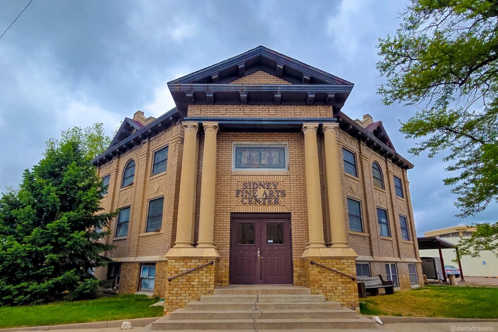
Sidney’s railroad-town history, explained in this “Sinful Sidney” tour, is good for a “compare and contrast” exercise with Julesburg. You might remember that the third incarnation of Julesburg (Julesburg 3) was known as the “Wickedest City in America” during railroad construction in 1867.
Bonus Stop: The Pole Creek Pony Express Station marker on the old Lincoln Highway (US 30; 41.1495, -102.9058) east of Sidney is slightly off the loop route shown above but is worth stopping at for completeness if you have extra time. The marker indicates that this spot was part of a “new” route on the Oregon-California Trail starting in 1849. It must have been a good one, because the Pony Express also had a station nearby, and the Overland Stagecoach service and the Transcontinental Telegraph line followed the same route.
Return to Chappell: Downtown History and Murals
Retrace your route on I-80 back to Chappell via Exit 85. Pass the Chappell Pony Express Park you visited earlier, then continue into Chappell. To continue the tour, you’ll head east on Chappell’s 2nd Street, which becomes US 30.
Downtown Chappell
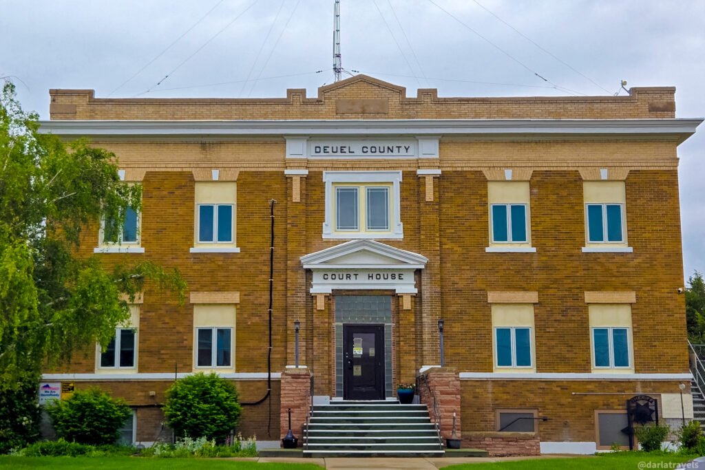
Chappell started as a railroad siding. The townsite was surveyed in 1884, and it got a post office two years later. In 1894, Chappell became Deuel County’s county seat. There are a few things in Chappell unrelated to the overland trails or the Pony Express that are worth a short detour:
The Deuel County Courthouse (718 3rd St.). This 1915 building was built in the Classical Revival style. Still functioning as a courthouse and city offices, it was added to the National Register of Historic Places in 1990.
Murals (Chappell Plaza, about 634 2nd St.) Yesteryear (2022) is a historical mural depicting the original Chappell railroad depot, the WWII B-24J Bomber, and heads of wheat, among other historic images associated with Chappell. Moment in History (2021) shows a Cabela’s fishing lure, a Pony Express stamp, and several portraits with Chappell ties. Lauren Olson painted both murals.
After this detour, head east on Chappell’s 2nd Street / US 30.
West of Brule: Pony Express Stations, California Hill, and a River Crossing
Along U.S. 30, west of Brule, four roadside markers convey different experiences of crossing the plains.
The first one you’ll come to on this route is the marker for California Hill (at County Road M, 41.0910, -101.9787).Thousands of emigrant wagons ascended this hill, a climb of about 240 feet (73 m) over 1 1⁄2 miles (2.4 km), then continued northwest. Oregon-bound travelers came this way, but after the 1848 gold discovery, most travelers on this route headed to California. Note that this marker and the next one are on the opposite side of the road from the suggested direction of travel.
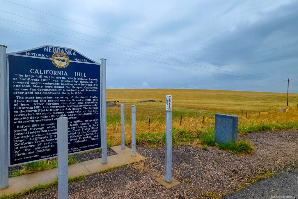
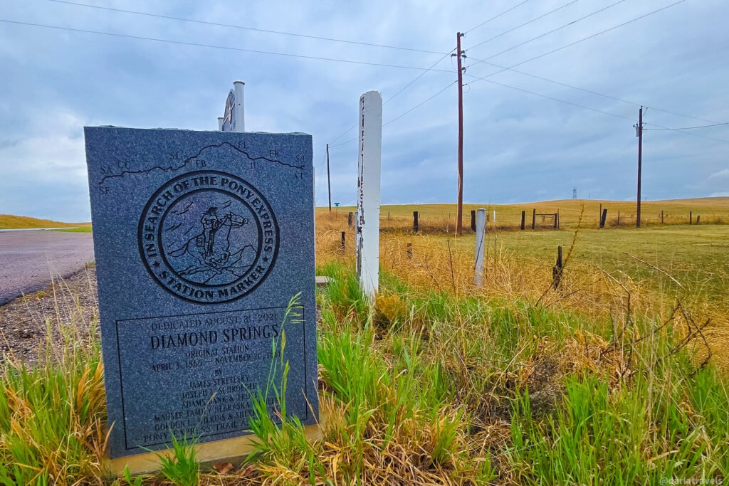
Next to the California Hill Marker, the Diamond Springs Original Station marker also marks a Pony Express relay station. The marker indicates the station was about 4 miles (6.4 km) east and slightly south of the marker.
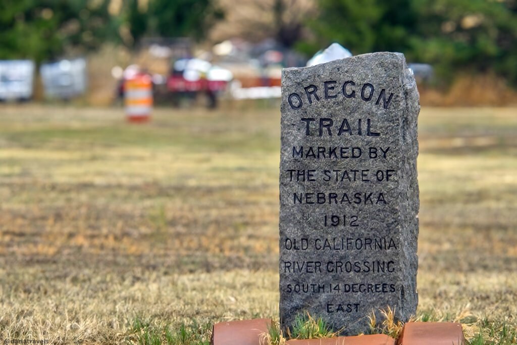
Further down US 30, the weathered Oregon Trail– Old California River Crossing (41.090967, -101.969467) monument has been sitting in this spot (on the opposite side of the road from the suggested direction of travel) since 1912. We’re traveling east, but westward wagon travelers would have crossed the South Platte River before tackling California Hill. The marker isn’t at the river crossing site, but indicates it’s almost due south and slightly east of this spot.
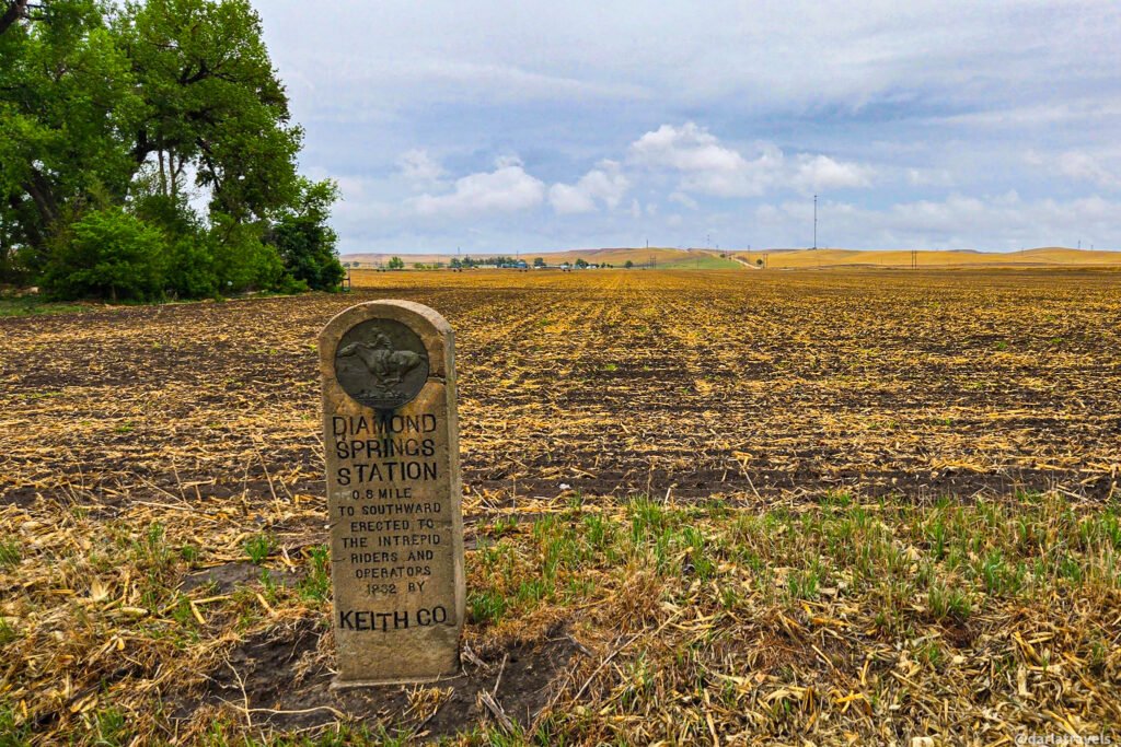
Continuing down US 30, another Diamond Springs Station marker from 1932 is about a mile (1.6 km) west of Brule, Nebraska. Sitting in front of a field, this marker notes the direction of the Pony Express relay station. It has a Pony Express Medallion and a dedication from Keith County.
After viewing these four markers, continue the drive toward Brule and turn right (south) on S State Street. Drive over the South Platte River and then take the ramp to I-80 westbound to head to Big Springs, NE.
Big Springs, Nebraska: Historic Sites and Walking Tour
The route stops at the Flying J Travel Center; there is a Pony Express marker in the parking lot (approximately under the Flying J sign). After viewing this marker, continue on to Big Springs and cross the South Platte River again.
The Union Pacific Railroad built the Big Springs station in 1867, but no permanent settlement existed here until 1883, with a town plat filed the following year. Big Springs is named, not surprisingly, for a nearby spring. This water source supplied all the water needed for the railroad’s steam-powered locomotives.
Short Walking Tour of Big Springs, Nebraska
Big Springs is a small town, so you can park and walk to the historic markers. The route here is just a hair over a half mile (0.9 km), starting at the markers in Eiker Park, on the left after you cross the railroad tracks.
Here’s a map so you can follow along.
The original map on AllTrails is here if you want to save it: Big Springs Historical Walking Tour Map
Stop 1. Eiker Park has two historic markers. The first marks the Waterman Sod House (41.0620, -102.0752), a historic homestead about nine miles (14.5 km) north of Big Springs. Built in 1886, it’s a rare, well-preserved example of pioneer sod architecture in the Nebraska High Plains.
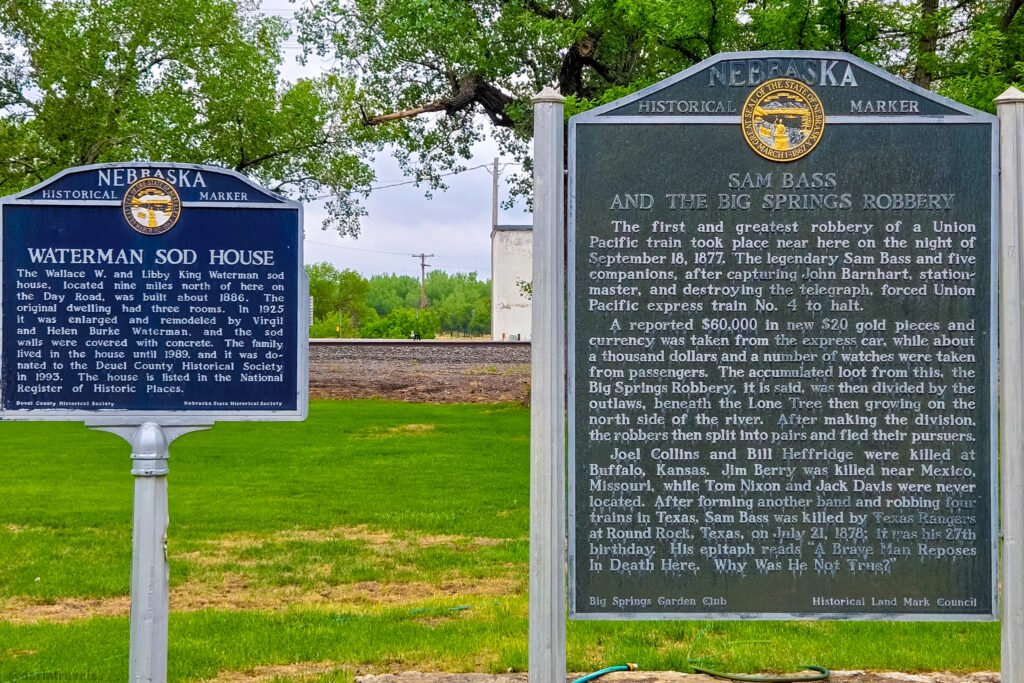
The second marker, entitled Sam Bass and the Big Springs Robbery (41.0619, -102.0752), recalls Big Springs as the site of Nebraska’s most famous train robbery. Sam Bass and five others captured the station agent, destroyed the telegraph, then robbed the Union Pacific Express Train No. 4 on September 18, 1877. Not only did they take $60,000 in gold coins, but the individual passengers were relieved of their money and jewelry. Remember this story, as it will come up later in the tour.
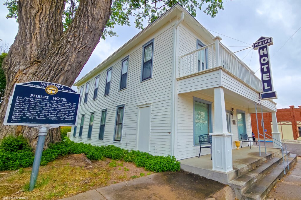
Stop 2. From Eiker Park, walk 1 block north on Pine Street and cross 2nd Street to see the former Phelps Hotel (401 Pine St.) and the historic marker next to it. Built in 1885, the hotel is considered to be one of “the most important nineteenth-century landmark[s] in Deuel County.” Believed to be the oldest commercial building standing in Big Springs, this modest two-story building was more than a place for travelers to rest in the early days; it became a community center and even held church services for a time.
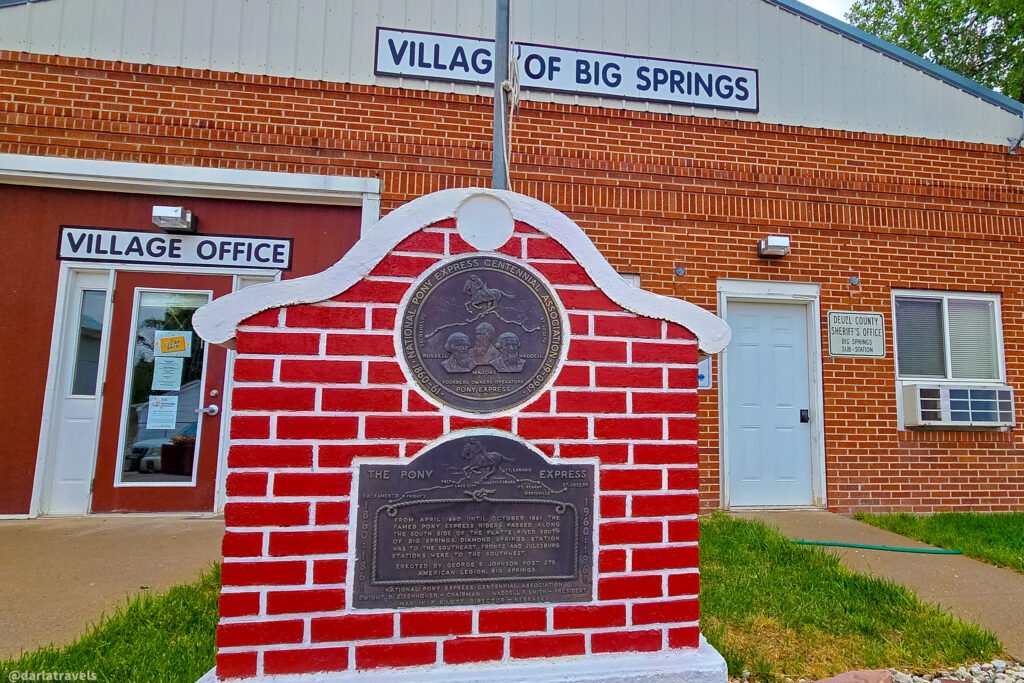
Stop 3. Just a few steps north on Pine Street, in front of the Village of Big Springs government offices (403 Pine St.), you’ll find a Pony Express Marker explaining that Pony Express rode along the south side of the South Platte River south of Big Springs.
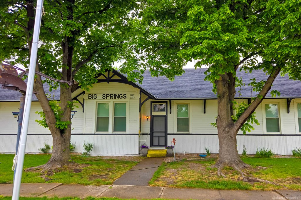
Stop 4. Return to 2nd St. and turn right (east) and walk one block to approach the Big Springs Depot Museum (206 W 2nd St.). Note: The museum wasn’t open when I visited, and online information appears unreliable. Contact the Village of Big Springs for current opening information.
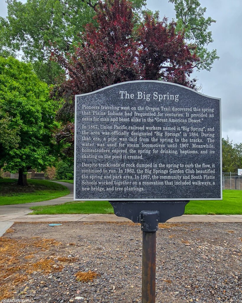
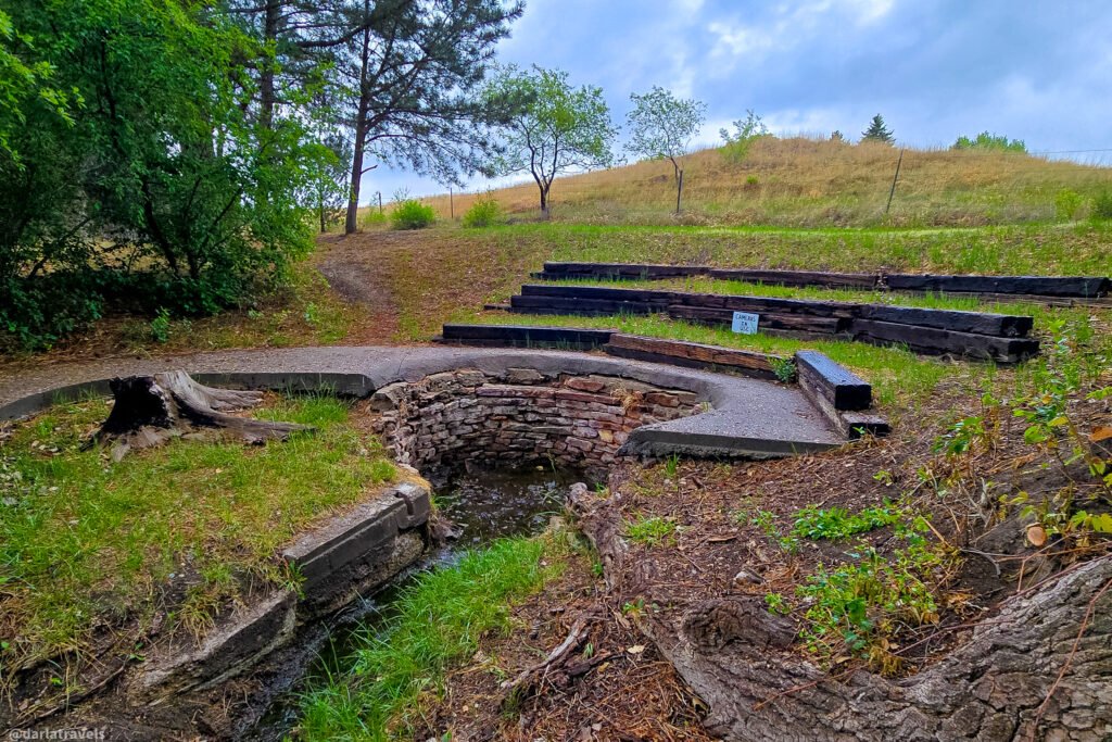
Stop 5. Turn right after the museum and walk toward The Big Spring and its interpretive sign. The same spring that supplied the Union Pacific Railroad is still active and was enhanced by the Big Springs Garden Club in 1962. The site underwent a further renovation in 1997, adding walkways and a bridge.
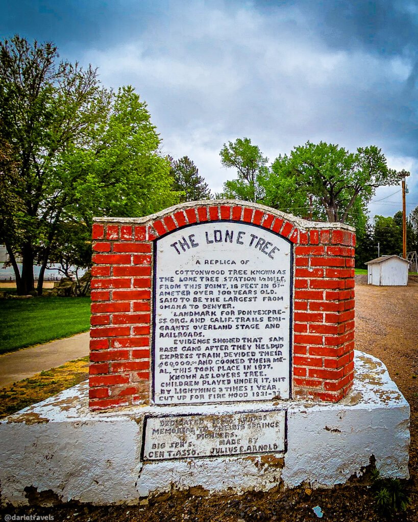
Stop 6. Returning toward 2nd Street, stop at a marker for The Lone Tree (41.0632, -102.0768). The marker indicates it’s a “replica” of a large cottonwood tree that once stood 0.5 miles (0.8 km) from this spot. The Lone Tree is significant for 2 reasons.
First, the tree was estimated to be approximately 100 years old when pioneers first arrived. It was a visible landmark for people traveling the Oregon and California trails, as well as overland stagecoaches and Pony Express riders. Big Springs was originally named “Lone Tree” for this reason.
Second, do you remember Sam Bass and his gang of train robbers? After they looted the train in 1877, they divided the booty under the Lone Tree and cooked a meal there before splitting up.
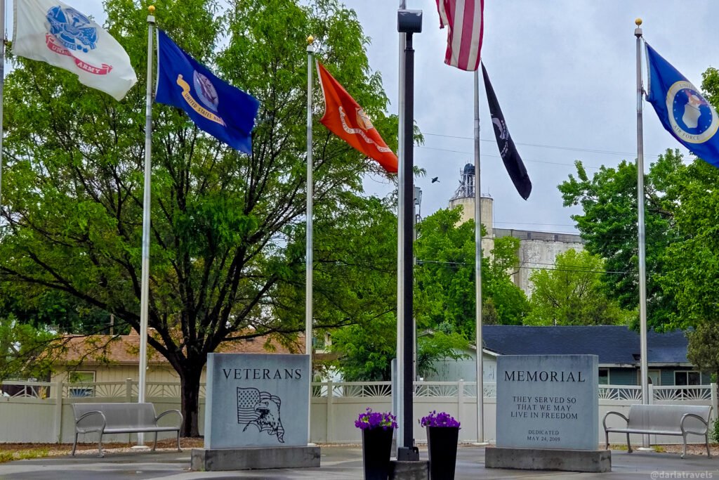
Stop 7. Optionally, upon returning to 2nd Street, turn right (west) and continue walking for about a block to see the Big Springs Veteran’s Memorial (corner of 2nd and Maple).
After your last stop, you can return to your parked car for the final leg of this historic driving loop.
Return: Big Springs to Julesburg
After leaving Big Springs, you can make two more stops on this historic driving tour before returning to Julesburg. Depart Big Springs on US 138 toward Julesburg.
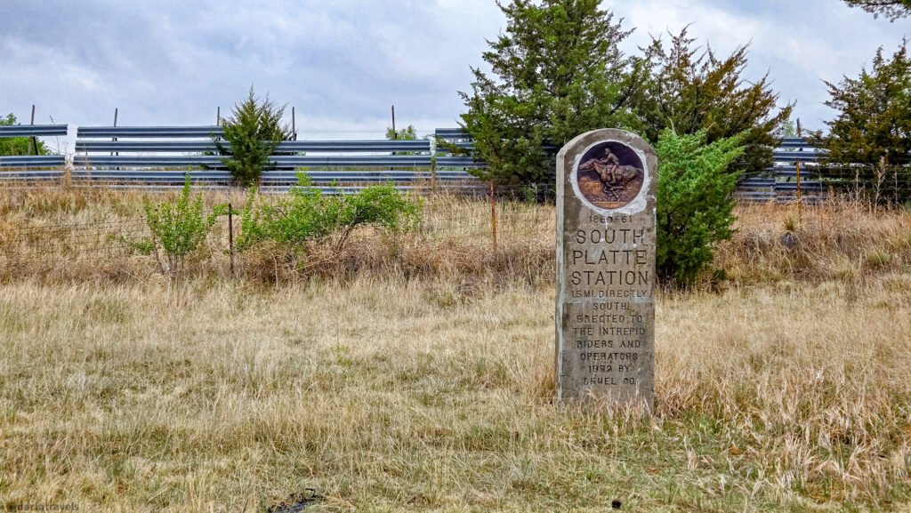
In about 4 miles (6.4 km), look for the South Platte Station Pony Express marker on the other side of the road. Deuel County placed this marker in 1932; it features a Pony Express medallion and indicates the Station was 1.5 miles (2.4 km) directly south of the marker.
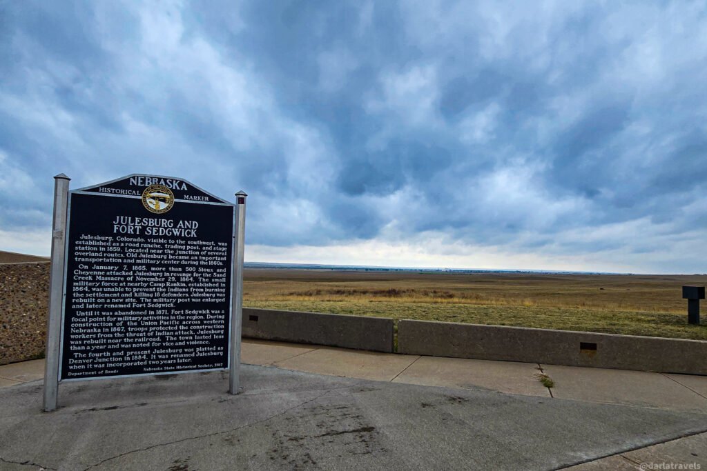
The last stop is a slight detour to a Scenic View Point (41.0342, -102.2108) on I-80. Because the overview site is on the opposite side of the interstate, you will need to drive to the next exit, cross over, and drive back to stop here. The site offers views of the vast prairie (with Julesburg visible to the southwest) and includes three informative markers. The Great Platte River Road explains the Platte River Valley’s role in westward migration. Another sign gives a short history of Big Springs. Finally, the Julesburg and Fort Sedgwick Historical Marker notes Old Julesburg’s importance as a junction point and Fort Sedgwick’s role in protecting the settlement from attacks by Native American Plains Tribes.
From here, continue along I-80 to the exit to US 138, heading southwest. It’s a short drive back across the state line and into Julesburg. I’ve ended the route in downtown Julesburg in case you didn’t see the historic markers here earlier or are ready to stop for a meal.
Where to Stay for Your Julesburg Road Trip
Julesburg has one boutique-type hotel downtown, Timeless Suites (107 Cedar St.). Next to the Colorado Welcome Center and close to I-76, the Cobblestone Inn & Suites (21365 County Road 28) is a modern, comfortable, well-equipped chain hotel with a complimentary hot breakfast.
Sidney, Nebraska, the largest town on this loop drive, has more hotel options, including multiple chain properties.
Video Walkthrough – Cobblestone Inn & Suites
Take a look at a Cobblestone double queen room. The video is from the Cobblestone in Wray, Colorado. The room is about 99% identical to the same room in Julesburg.
Use the map and links below to research and book your Julesburg to Sidney lodging. (Zoom out to see Sidney options)
Book now at Booking.com ♦ Book now at Expedia ♦ Book now at Hotels.com
Where to Eat on your Julesburg Road Trip
Sidney has the most food and drink options, with many fast-food chains, some independent restaurants and cafes, and a Walmart near the highway exit. Downtown Sidney offers more options.
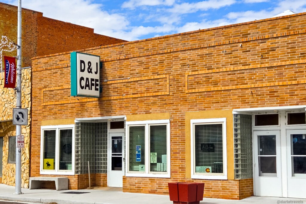
If you decide not to eat until you return to Julesburg, your in-town options include the D & J Cafe (114 Cedar St.) and the Julesburg Tavern (215 Pine St.) for bar food. Near the Colorado Welcome Center, find The Pony Espresso Drive-Thru Café (15177 US-385), Subway sandwiches, and a limited selection of bites in the Cobblestone Inn & Suites lounge.
See my Julesburg guide for more details.
Road Trip Tips and Practical Notes
A little preparation will help you enjoy this route. The wide-open stretches between towns can have a “middle of nowhere” feel, so plan fuel, food, and restroom breaks around town stops.
Most of the markers are not developed visitor areas. Some have roadside pull-offs, while others require you to stop on the shoulder. Pull completely clear of traffic, watch your footing when you step out, and stay aware of your surroundings at all times.
The usual advice applies: pack sunscreen, sunglasses, a hat, and layers. Additionally, check the forecast before you head out. Finally, check CoTrip and Nebraska 511 for road closures, construction, and even winter driving conditions.
Pin It for Later – Julesburg and Nebraska Road Trip
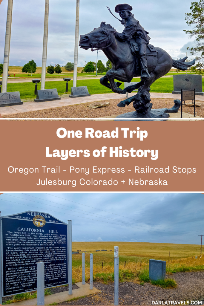
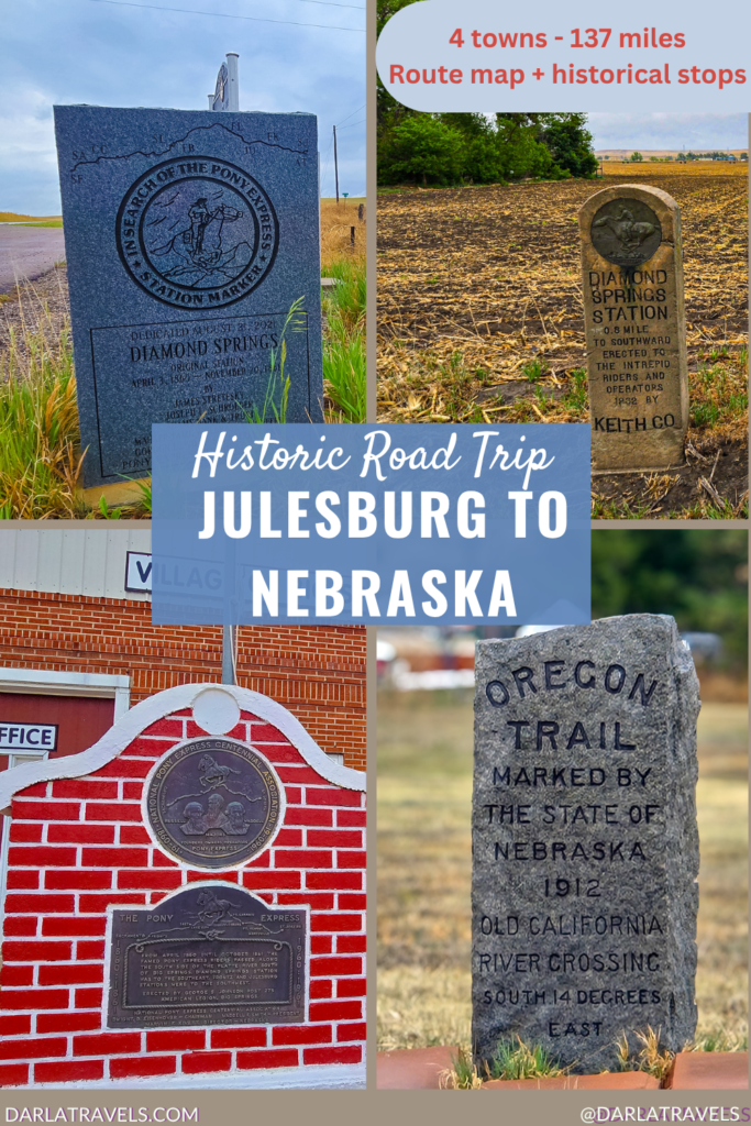
Ready to follow this Julesburg road trip into Nebraska for Oregon Trail landmarks, Pony Express markers, railroad history, and short historical walks in Sidney and Big Springs. Save these Julesburg road trip pins to your favorite Pinterest Board.
A Road Trip Through Layers of Plains History
The open plains of northeast Colorado and the Nebraska panhandle may look a little sleepy, but they hold layers of history from the buildup of the western United States. Historical markers show that pioneer wagon routes were repurposed for stagecoach lines and Pony Express mail delivery, then for telegraph lines and railroad tracks.
You can pair this Nebraska loop with my Julesburg guide for a fuller picture of the history on both sides of the state line.
Leave a Reply