Short to medium hikes at Moab, Utah’s major parks are paired with meaningful bonus stops in this guide. It’s designed to help you see more in your limited time in the area. Moab is famous for big adventures, but you don’t need extreme hikes to experience its most memorable landscapes.
Here, I’ll describe hiking in two National Parks and one State Park near Moab, where you’ll explore iconic arches, sweeping canyon viewpoints, and striking rock formations. Outside of the hikes, there will be stops at nearby “bonus” locations to enrich the day’s experience: petroglyph panels, dinosaur footprints, and historic sites. The “bonus stops” allow more variety, context, and discovery.
From Arches National Park to Canyonlands National Park to Dead Horse Point State Park, each day is structured as a standalone trip you can mix and match or follow in sequence.
For quieter alternative hikes like Corona Arch and dinosaur tracksites, check my companion guide: Quieter Moab Hikes: Corona Arch, Dinosaur Tracks, and Richardson Amphitheatre.
If you enjoy walking, learning, and discovering the layers beneath a destination, and not just checking off the highlights, this approach to Moab will feel especially rewarding.
** Darla Travels is reader-supported.
When you buy through our links, we may earn a commission. **
Find a great place to stay in Moab:
- Notes and Essential Tips for Hiking in Moab’s Desert Landscape
- Short Arches National Park Hikes with Bonus Stops
- Canyonlands National Park Island in the Sky: Short Walks plus Petroglyphs
- Dead Horse Point State Park Rim Hike plus a Classic Viewpoint Bonus
- Where to Stay in Moab
- Hiking in Moab’s Parks with Bonus Stops – Pin It for Later!
- Final Thoughts on Moab Area Park Hikes with Bonus Stops
Notes and Essential Tips for Hiking in Moab’s Desert Landscape
Fueling up before a day of hiking and sightseeing is key, especially in a place like Moab. For ideas on where to start your morning right, check out my guide to the best breakfasts in Moab.
📍 All trail distances and elevation gains in this guide are approximate. For navigation, you’ll find links to AllTrails maps. Simply open the map and select the driving directions option to get to each trailhead.
Desert conditions require a bit of extra planning. Always check the weather in advance. High heat, intense sun, and limited shade can make even short hikes more challenging than expected, or even dangerous. In warmer months, it’s often best to start early in the morning to avoid the heat of midday.
Bring plenty of water, along with snacks or a light meal, and don’t forget sun protection such as a hat, sunscreen, and sunglasses. Navigating on slickrock can be confusing, so carrying a map (digital or paper) is important, as trails are not always clearly defined.
Cell service can be unreliable, so make sure you have a way to communicate in case of an emergency.
And finally, consider packing binoculars. They’re especially helpful for spotting distant rock formations, petroglyph panels, and even dinosaur tracks.
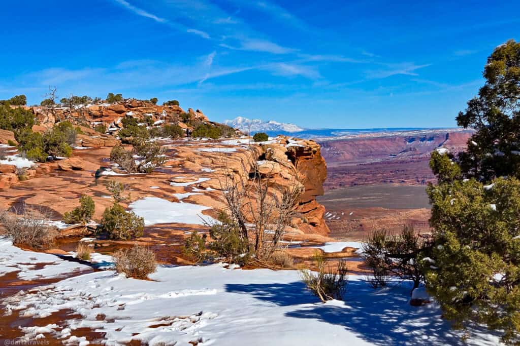
Short Arches National Park Hikes with Bonus Stops
The entrance to Arches National Park is less than 5 miles (8 km) from Moab. It’s so close and so spectacular, I’ve suggested two days of short hikes in this park. The listed hikes are just a few of the many hikes available, so you can easily customize your day.
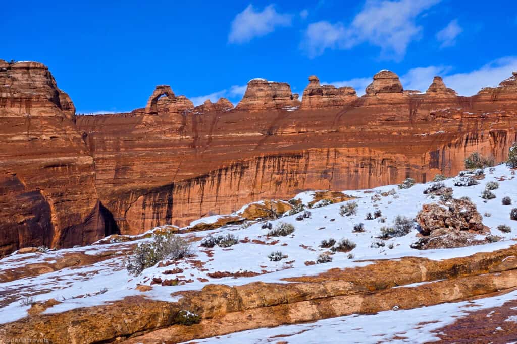
The park is so-named for the more than 2,000 natural sandstone arches within it. including the iconic Delicate Arch, which you’ll read about below. A large diversity of other geological resources and formations is also present in the park.
Notes: Dogs are not allowed in Arches National Park.
Arches National Park charges an entrance fee. For current rates on different types of passes, visit https://www.nps.gov/arch/planyourvisit/fees.htm.
Day 1 Trails in Arches Plus a Moab History Bonus Stop
Delicate Arch Viewpoint Trail
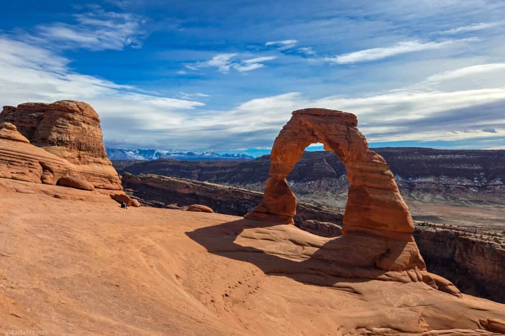
Delicate Arch is probably the most famous of the arches in Arches National Park. This elegant sandstone formation appears on the Utah license plate and is the subject of countless photos. I’ve put the hike to Delicate Arch on Day 2’s list, but for Day 1, take the Delicate Arch Viewpoint trail as a warmup. On this short hike from the Delicate Arch Viewpoint Trailhead, you’ll see the back side of the Delicate Arch from a distance. There is a lower viewpoint and, after a short, moderately steep uphill climb, an upper viewpoint.
Pro tip: Bring binoculars for a better view of the arch.
Hike Length: 1 mile (1.6 km) out and back; most can finish this hike under one hour
Elevation gain: 187 feet (57 m)
Difficulty: Easy to Moderate
The Windows Loop and Turret Arch Trail
Next, the Windows Loop and Turret Arch Trail is a rewarding, short hike and family-friendly, too. In just a little over a mile (1.6 km), you can see the North Window Arch, the South Window Arch, and Turret Arch. There are also short spurs that take you right into the arches. The trailhead is in the Windows Section of the park, accessed from the main park road via the signed turnoff to The Windows.
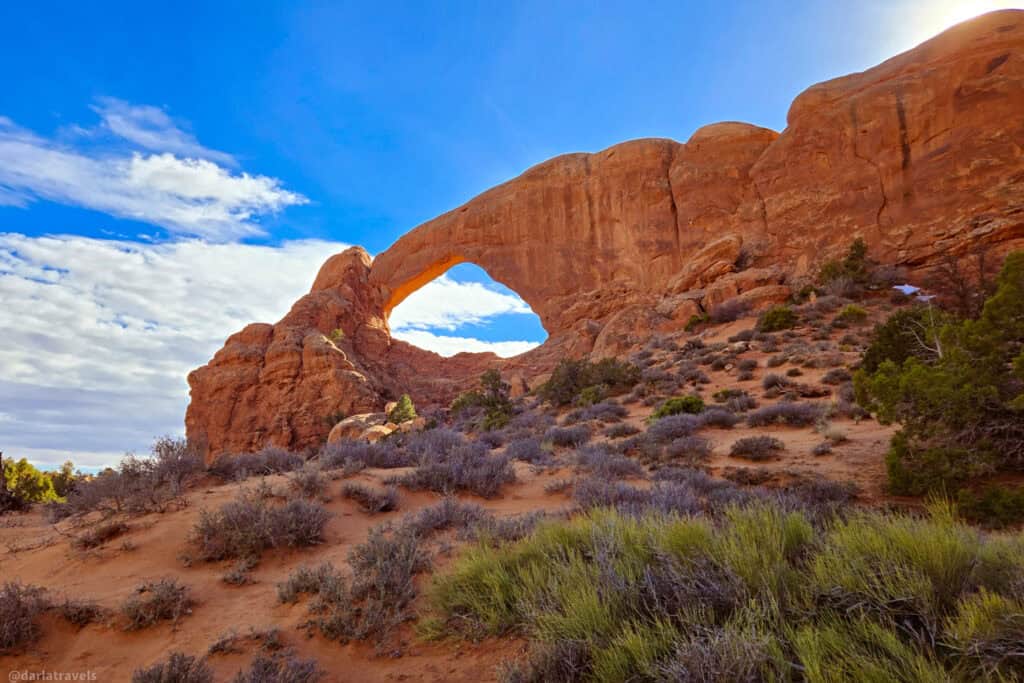
Length: 1.1 mile (1.8 km) loop; most can finish within 30 minutes to one hour
Elevation gain: 154 feet (41 m)
Difficulty: Easy to Moderate
Double Arch Trail
The final Day 1 trail is adjacent to the Windows Loop. The Double Arch Trail is a very short walk that leads to a dramatic sandstone formation. This remarkable site has two side-by-side arches joined at a common base. The arches have the tallest opening in the park at 104 feet (32 m) high, as well as the second-longest span, which is 148 feet (45 m). Fun fact: the Double Arch area served as the backdrop for the opening scene of Indiana Jones and the Last Crusade.
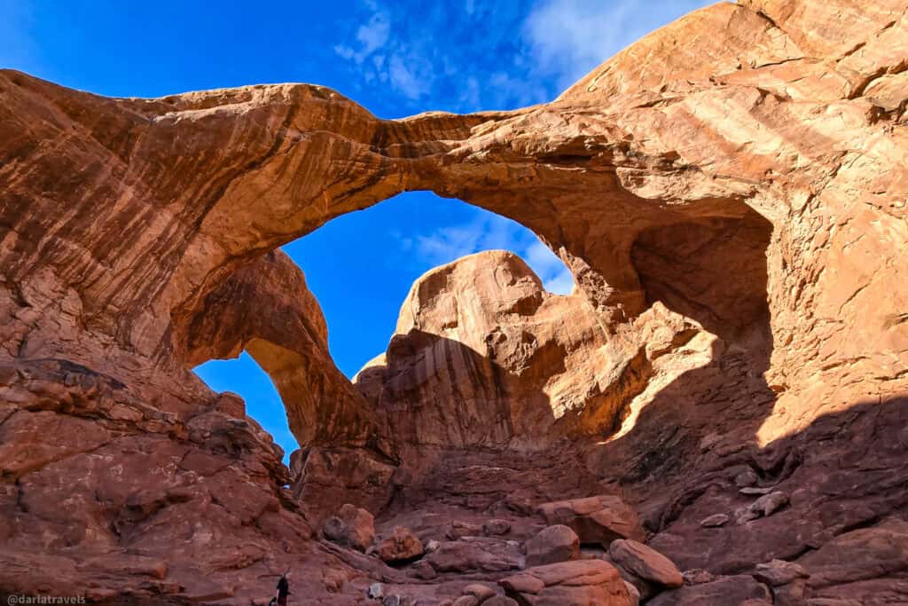
Length: 0.6 miles (1 km)
Elevation Gain: 95 feet (29 m)
Difficulty: Easy
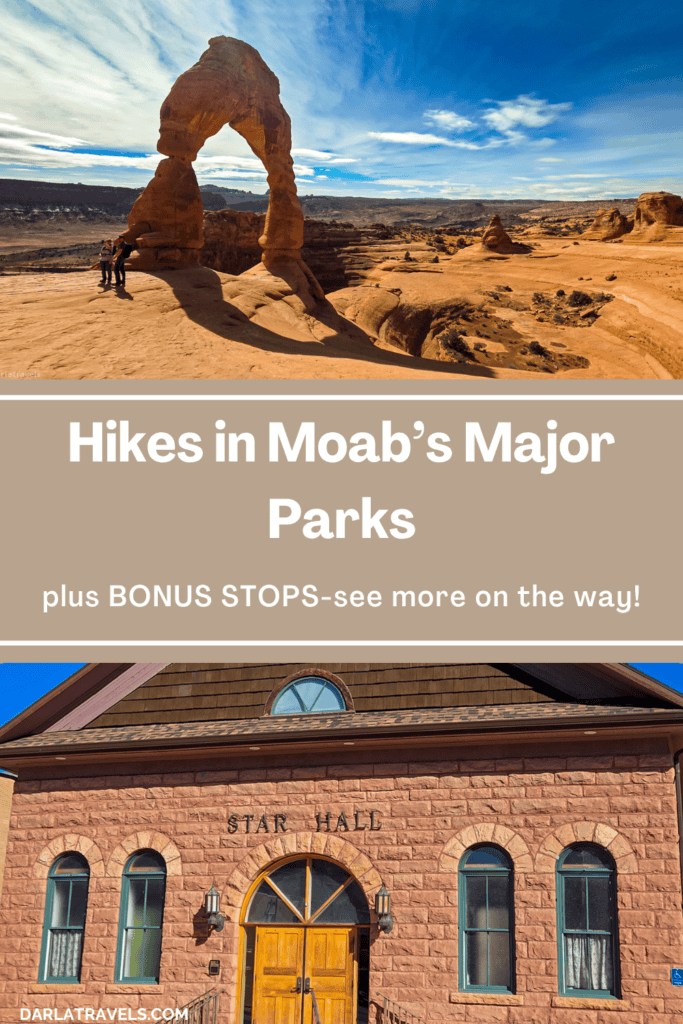
Bonus Stop -Moab History
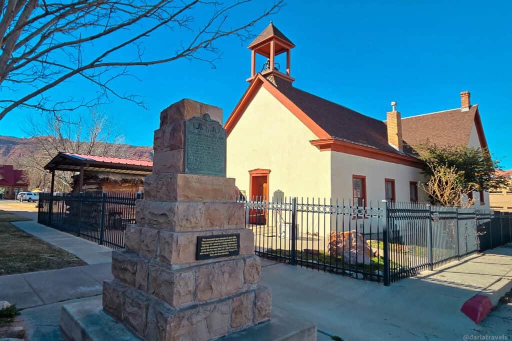
The first day’s bonus stop keeps you right in Moab, where a small historic complex in the heart of downtown offers a quick but meaningful snapshot of the area’s early history. Look for:
The Moab Cabin, a preserved log structure that was relocated from its original site to this gathering of historic buildings.
📍GPS: 38.57385396094672, -109.5471859568684
📍Google Plus Code: HFF3+G4 Moab, Utah
The Moab LDS Church is next to the cabin. It’s an adobe building constructed for the Church of Jesus Christ of Latter-day Saints in 1888-89.
Finally, there is a commemorative plaque marking the location of the Elk Mountain Mission Fort, one of the earliest attempts at settlement in the region. This monument has been moved from its original location. The Elk Mountain Mission was short-lived, yet notable as one of the few failures of a Mormon (LDS) settlement during this era.
Also close by, within easy walking distance:
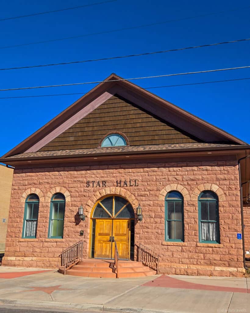
Star Hall (1906, 159 E Center St.) was designed in the Richardsonian Romanesque style. Star Hall served as a social and cultural hub for the community, hosting dances, meetings, and events that brought residents together. Today, it’s a performing arts center.
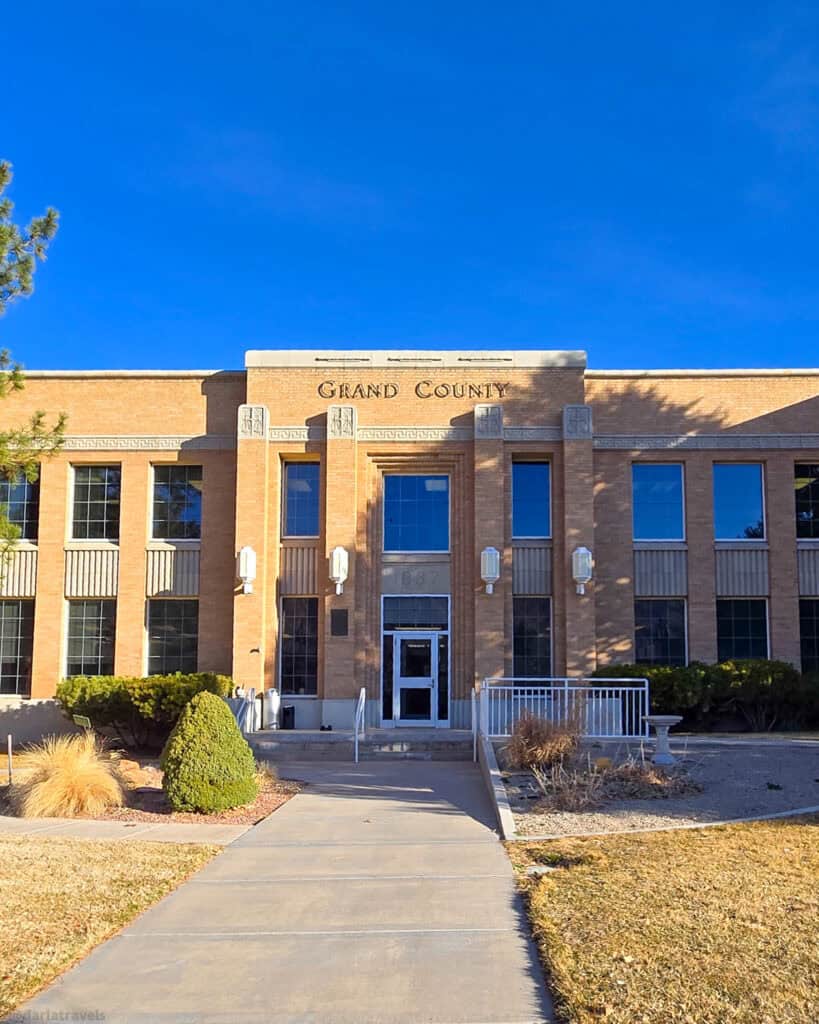
The Art Deco Grand County Courthouse (1938, 1259 E Center St.).
Together, these nearby sites create a walkable cluster of history, offering insight into Moab’s evolution from a remote frontier settlement.
If you have a little more time, stop by the Moab Museum (118 E Center St., admission fee required). It offers a compact and engaging look at the region’s history. Exhibits range from early Native American cultures and pioneer settlers to the town’s mining and outdoor recreation heritage.
Day 2 Arches Trails plus a Rock Art Hike Bonus Stop
Back in Arches National Park for a second day, I have two hikes.
Balanced Rock Trail
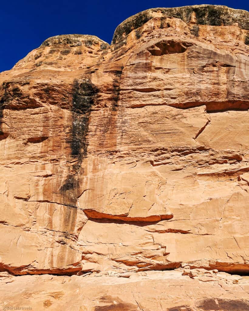
This short, partially paved trail approaches and loops around the rock formation known as Balanced Rock. Although it is a single piece, the formation appears like a large rock sitting atop a rock tower. The 73-ft.-tall (22.2 m) column is made of faster-eroding Dewey Bridge sandstone, while the 55-ft.-tall (16.7 m) cap rock is the harder Entrada Member sandstone, which is less prone to erosion.
Walking around this quirky rock formation, you’ll get to see it from different angles and will also be able to view some further away rocks, like those in the Windows area that you saw on Day 1.
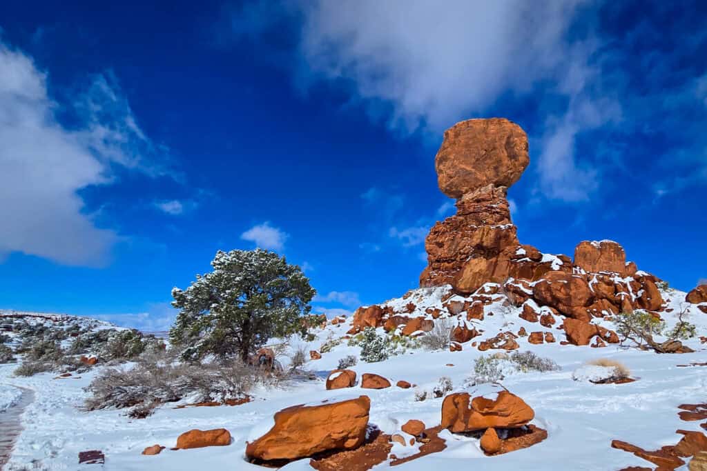
Length: 0.3 miles (0.5 km)
Elevation gain 42 feet (13m)
Difficulty: Easy
Delicate Arch (Main Trail)
This is the trail that takes you right to this stunning 52-foot-tall (16 m) freestanding natural arch that is Delicate Arch. It’s a must-do! There’s something special about seeing this iconic landmark come into view on foot. Most of the hike is over open slickrock (bare sandstone) with no shade, and on average, takes two to three hours to complete the hike out and back.
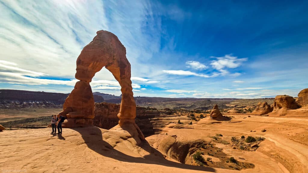
Length: 3.2 miles round trip out and back (5.1 km)
Elevation gain: 629 feet (192 m).
Difficulty: Moderate
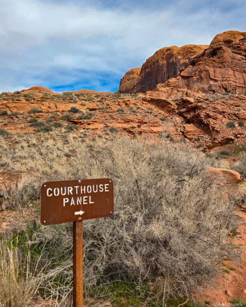
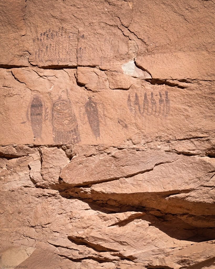
Bonus Stop – The Courthouse Wash Rock Art Panel
Today’s bonus stop is the Courthouse Wash Rock Art Panel, one of the many fascinating rock art sites in the Moab area, and an especially intriguing example just north of town. It’s a natural stop once you leave Arches National Park and head back toward Moab.
📍To get there, park at the Courthouse Wash Trail parking lot at mile marker 129 on Highway 191. From the lot, follow the paved path before veering left onto a natural surface trail. The walk is brief and straightforward, making it an easy add-on to your Arches itinerary with little time or effort.
The trail ends at an interpretive sign, where you’ll look up to see the petroglyphs etched into the rock wall above. The panel’s elevated position adds a sense of distance and mystery. You can’t help but wonder about the people who created them centuries ago as you notice human-like figures, abstract shapes, and animal forms.
Pro tip: bring binoculars to see the details.
If you’re feeling energetic, you can continue scrambling up the slickrock for a closer view. Of course, watch where you’re stepping, and practice respectful viewing. These petroglyphs are fragile, irreplaceable cultural resources. Admire them up close, but never touch or climb directly on the rock art panels.
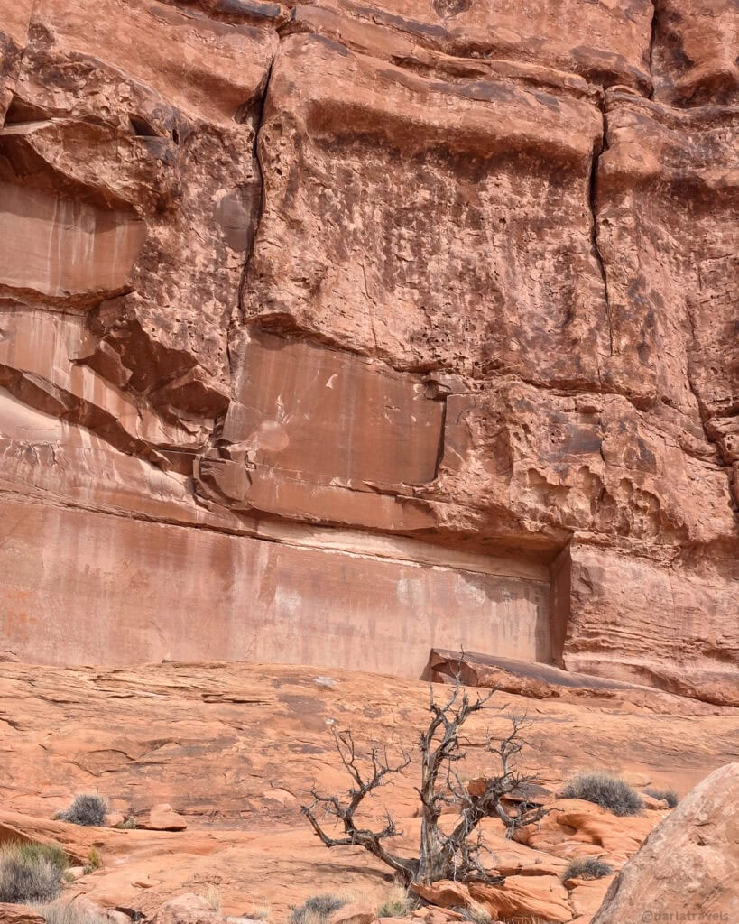
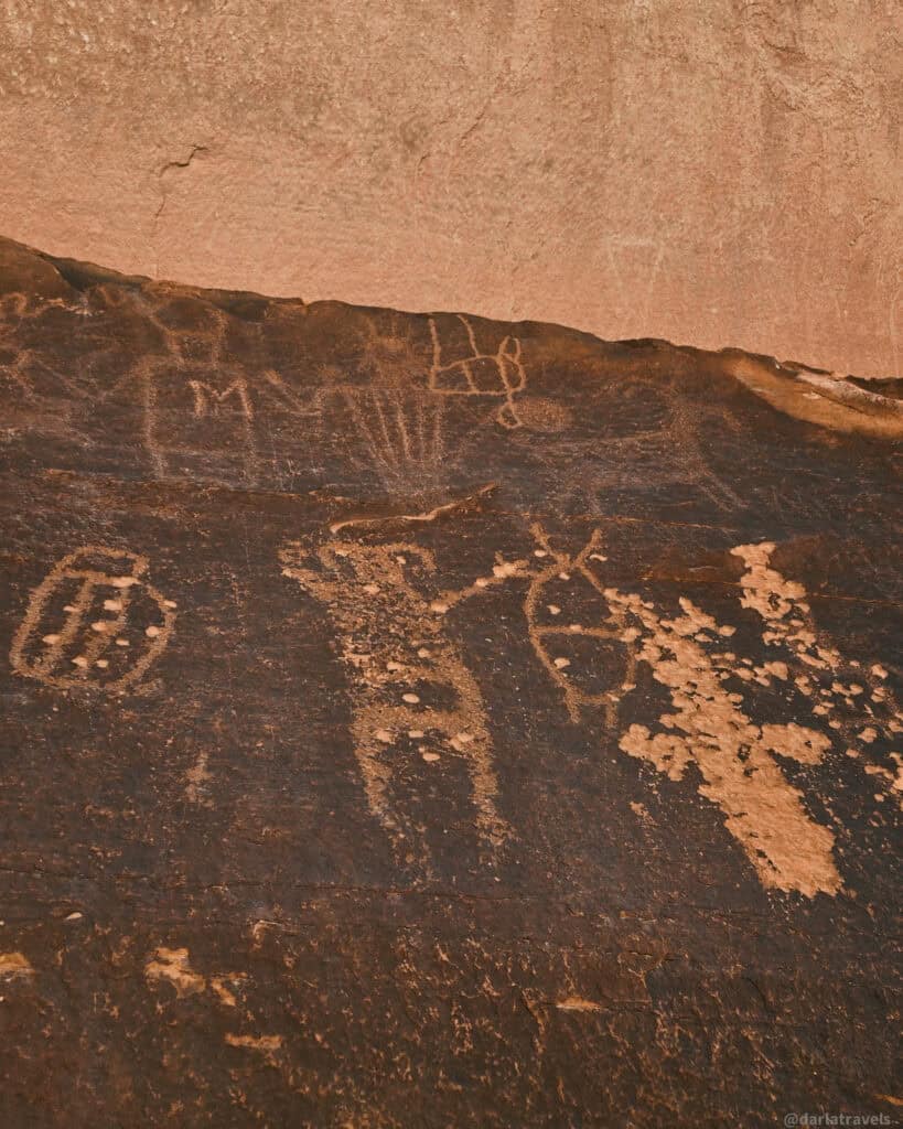
This quick stop adds an entirely different dimension to your Moab experience, connecting the dramatic landscape with the people who called this region home for thousands of years.
Length: One mile round-trip out and back (1.6 km)
Elevation gain: up to 167 feet (51 m)
Difficulty: Easy to Moderate
Courthouse Wash Rock Art Panel – Trail Map
Canyonlands National Park Island in the Sky: Short Walks plus Petroglyphs
For day 3, head to the Island in the Sky District of Canyonlands National Park. It’s located about 32 miles (51.5 km) from Moab and takes about 40 minutes to get to. Canyonlands is another epic National Park with many short trails so that you can make multiple stops in a single day. Here are some suggestions.
Notes: Dogs are not allowed on the trails in Canyonlands National Park. For a full explanation of the Park’s pet policy, visit https://www.nps.gov/cany/planyourvisit/pets.htm.
Canyonlands National Park charges an entrance fee. For current rates on different types of passes, visit https://www.nps.gov/cany/planyourvisit/fees.htm.
Mesa Arch Trail
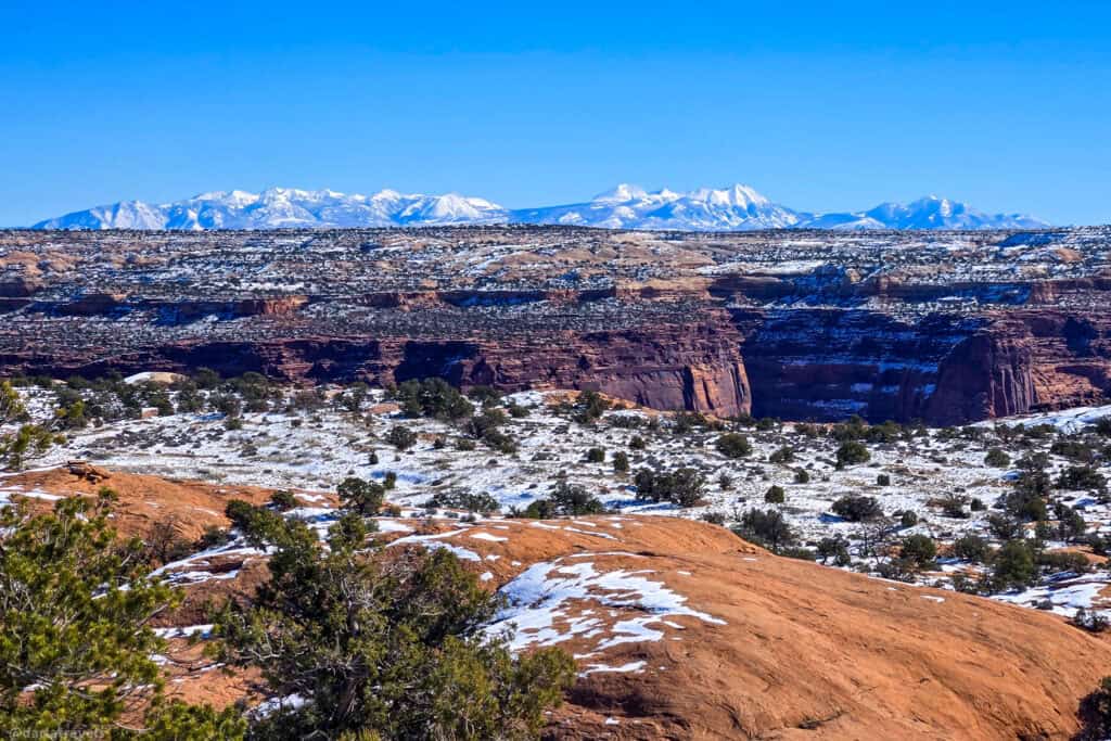
The hike to Mesa Arch is short, easy, and one of the most visually rewarding walks in the park. Mesa Arch sits right at the canyon rim, creating a natural window to view canyons, towering rock formations, and the La Sal Mountains in the distance. The arch is especially breathtaking at sunrise, when the first light illuminates not only the open landscape, but the underside of the arch. This quick loop hike will take around 30 minutes to one hour to complete.
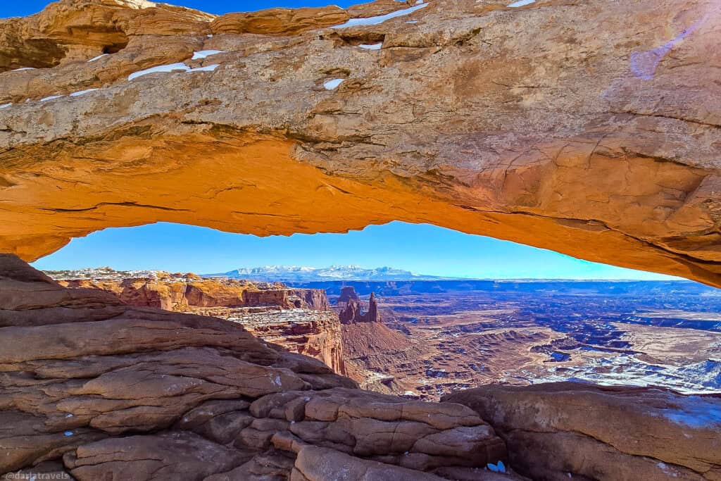
Length: 0.7 mile (1.1 km) loop
Elevation gain: 62 feet (19 m)
Difficulty: Easy
Whale Rock Trail
If you ever wanted to climb a massive, whale-shaped rock formation, then this is your trail. This quick hike takes you over and up smooth slickrock on the “back” of the whale. Walk along to take in the surrounding desert canyons, mesas, and even the distant La Sal Mountains.
Length: 1.3 miles (2.1 km) round-trip out and back.
Elevation gain: 124 feet (38 m)
Difficulty: Moderate
Upheaval Dome Trail with Two Overlooks
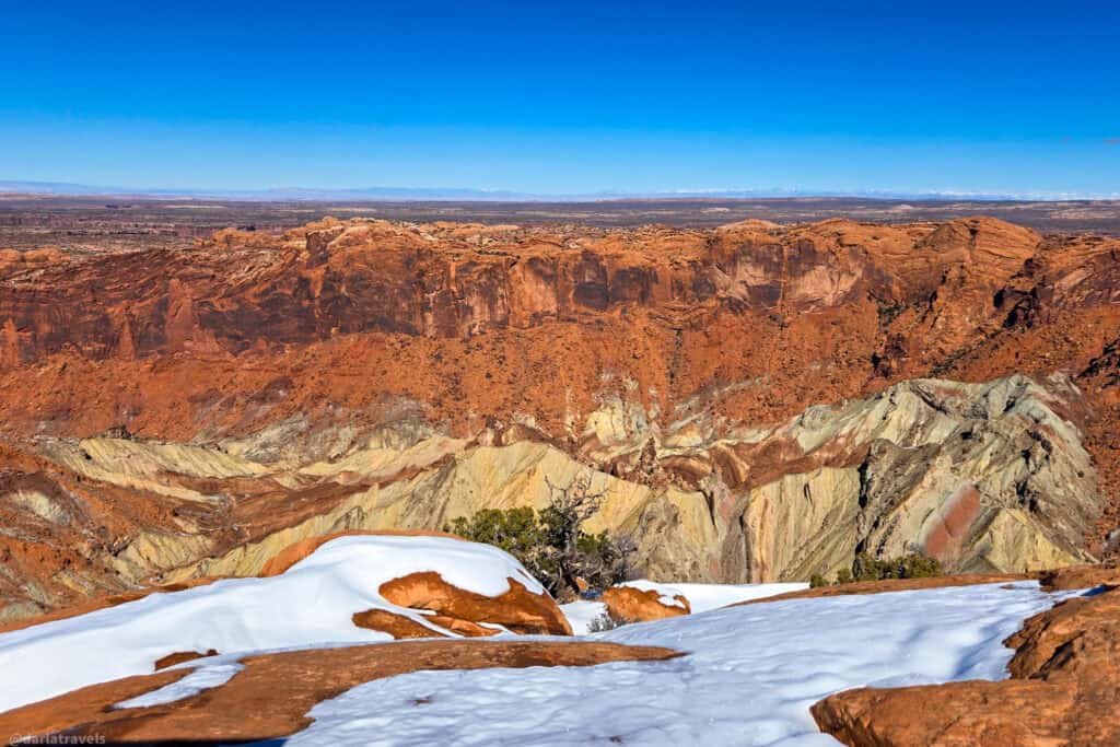
The Upheaval Dome Overlook Trail offers views of a spectacular and mysterious geological formation: a crater roughly 1,300 feet (about 400 meters) deep from rim to floor and spanning approximately 3 miles (5 km) in diameter. Two overlooks on this trail give different perspectives of this geological riddle.
There are two main propositions to explain the formation of the crater. The first suggests it was formed by a meteorite impact. The second explanation is the collapse of an underground salt dome that cracked and tilted over time. Regardless of which explanation is correct, the crater is striking, and the crater geology looks distinctly different from the surrounding canyon landscape.
Length: 1.3 miles (2.1 km) round-trip out and back.
Elevation gain: 229 feet (70 m)
Difficulty: Moderate
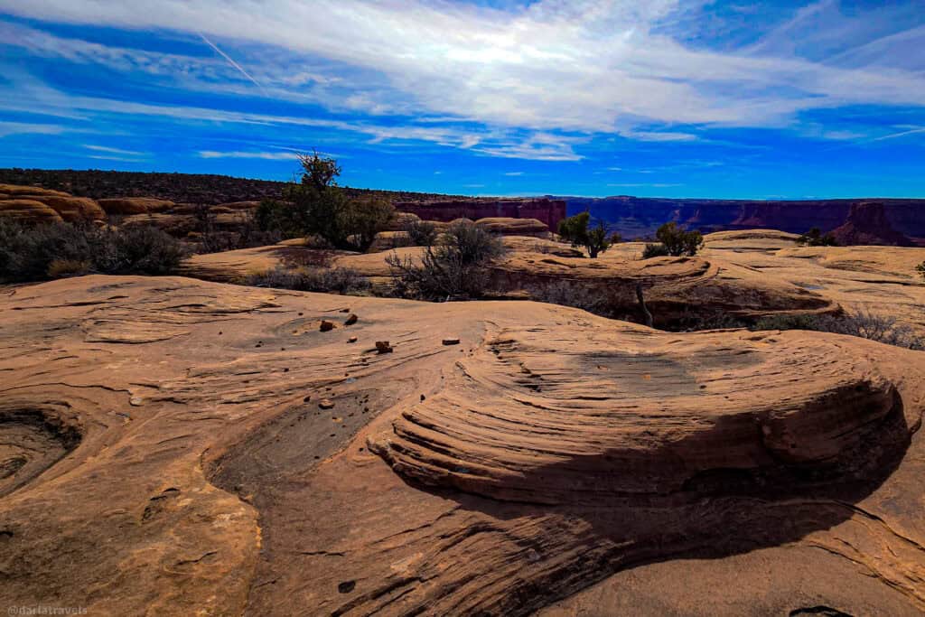
Grand View Point Trail
Starting from the Grand View Point Overlook at the very southern end of the Park’s scenic drive, this out-and-back trail stretches about 2 miles (3.1 km) round-trip along a narrow mesa. From the start, you’ll have sweeping canyon views of eroded rock revealing millions of years of geologic history: note how the Green and Colorado Rivers have carved the network of canyons. The scenery is constant, appearing on both sides of the mesa. True to its name, the trail ends at a dramatic viewpoint for viewing the landscape,
Length: 1.9 miles (3.1 km) out and back
Elevation gain: 164 feet (50 m)
Difficulty: Moderate
Bonus Stop – Intestine Man Petroglyphs Site
The Intestine Man Petroglyphs site is a fascinating bonus stop that highlights the deep human history of the Moab area.
The site is located approximately 12 to 13 miles (19-21 km) north of Moab, along Highway 313 at mile marker 2.7 from the Highway 191 turnoff.
📍GPS Coordinates: 38.64873668575998, -109.72467930287362
On the north side of the highway, it’s easier to access on the way to Canyonlands, but could certainly be viewed on the return trip to Moab. From this pull-off, a short walk of 50–100 feet (15-30 m) leads to the rock art panel, which is above head level on the cliff.
Look for three anthropomorphic figures in a row. The central design is nicknamed “Intestine Man” as the figure’s intestines, or perhaps a snake, appear to wind through his torso. The Intestine Man and his companions are really pictographs, not petroglyphs, since they are painted on the rock, rather than carved into it.
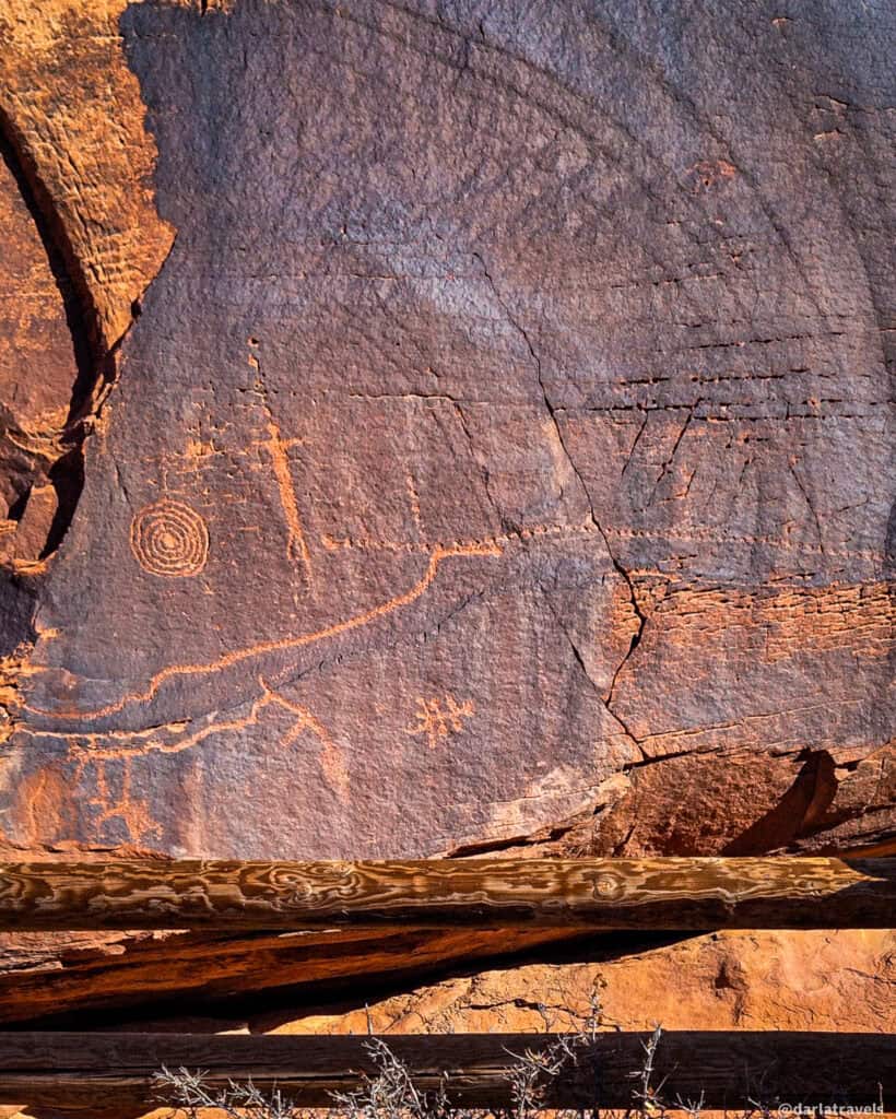
Binoculars will be useful to see the finer details from the ground, though a careful scramble can get you closer if you’re comfortable with the terrain. As always, admire these fragile cultural artifacts without touching them.
Petroglyphs to the right of Intestine Man include geometric shapes, abstract designs, and animal-like forms.
Dead Horse Point State Park Rim Hike plus a Classic Viewpoint Bonus
If you went to Canyonlands the prior day, you passed the turnoff to Dead Horse Point State Park. This State Park delivers maximum visual impact with minimal logistical effort. It’s often calmer and less crowded than Arches or Canyonlands National Parks, but the views are no less impressive.
Notes: Dead Horse Point State Park is dog-friendly, allowing leashed pets on hiking trails, overlooks, and in most campgrounds. For a full explanation of the Park’s pet policy, visit https://stateparks.utah.gov/parks/dead-horse/traveling-with-pets/
Dead Horse Point State Park charges an entrance fee. For current rates on different types of passes, visit https://stateparks.utah.gov/parks/dead-horse/park-fees/
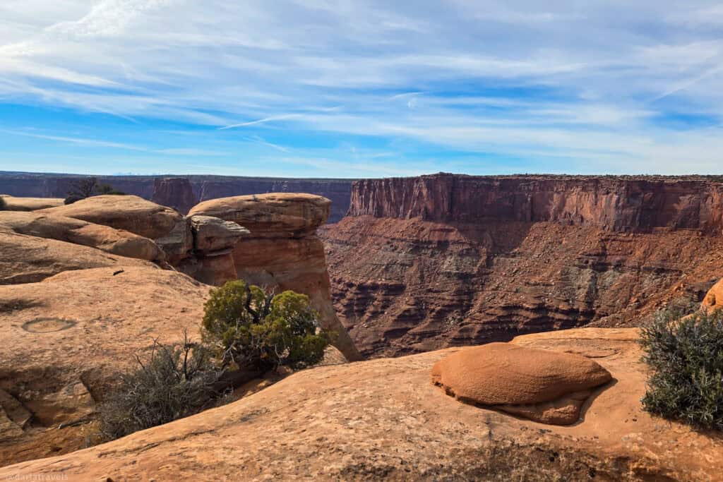
East & West Rim Loop Trail (with Big Horn Overlook Add-On)
The East & West Rim Loop Trail in Dead Horse Point State Park is a scenic hike following the edge of a high plateau above the Colorado River, with mostly flat terrain and minimal elevation gain. This hike is not short compared to others in this guide, but the extra distance is worth it. From the visitor center, you can walk the entire rim trail and short spur paths to three awe-inspiring overlooks, which provide natural stopping points. These are:
- Basin Overlook
Slightly quieter and more tucked away, Basin Overlook offers a layered view into a broad canyon basin. The perspective here emphasizes the textures and colors of the rock formations, especially in softer morning or late-afternoon light. - Dead Horse Point Overlook
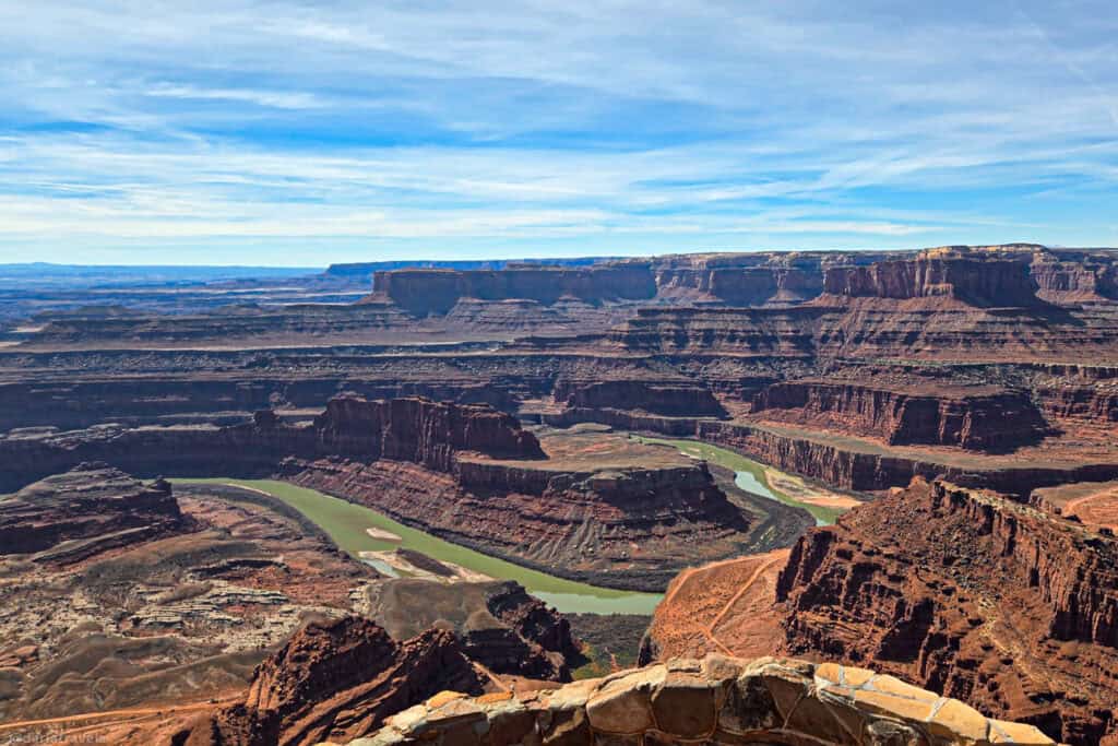
The park’s signature viewpoint, Dead Horse Point Overlook, offers a breathtaking panorama of the Colorado River, which makes a tight, horseshoe-shaped bend nearly 2,000 feet below. The maze of canyons, mesas, and buttes forms an iconic view of the American Southwest. A short paved path from the parking area leads to multiple viewing platforms. - Shafer Canyon Overlook
A striking viewpoint, the overlook reveals the dramatic drop into Shafer Canyon below. From here, you can see the Shafer Trail switchbacks of Canyonlands National Park etched into the far cliffside. - Meander Overlook
A highlight of the loop, Meander Overlook showcases a sweeping bend of the Colorado River far below. The river appears almost still from this vantage point, winding between sheer canyon walls.
If you’re not up for the full loop hike, you can walk some shorter segments. There are several pull-outs along the drive to Dead Horse Point Overlook to access trails and overlooks. Whether you walk shorter segments or connect multiple sections into a longer loop, the views will be amazing.
Length: 5.5 miles (8.9 km) loop
Elevation gain: 866 feet (264 m)
Difficulty: Moderate
Add-On: Big Horn Overlook Trail
If you’d like to hike even further, add on the Big Horn Overlook Trail. It branches off the rim trail not far from the park’s Visitor Center. This extension leads to a lesser-visited viewpoint with expansive canyon views. The overlook is named for an eroded fin visible in the distance, resembling a pair of horns.
The trail remains easy to moderate, with gentle terrain and minimal elevation change, making it a natural addition for hikers who want a bit more time on the trail without significantly increasing difficulty.
This combined route is ideal for walkers who want to experience multiple iconic viewpoints in a single outing without committing to an overly strenuous hike.
Big Horn Overlook Trail
Length: 3.1 miles (5 km) round-trip out and back
Elevation gain: 236 feet (72 m)
Difficulty: Moderate
Rim Hike with Overlooks plus Big Horn Overlook Trail
Length: 7.5 miles (12 km) loop plus out and back on overlook trails
Elevation gain: 594 feet (183 m)
Difficulty: Moderate
Bonus Stop- Monitor and Merrimack View Point
Approximately 9 miles north of Moab on Highway 313 (Dead Horse Point Mesa Scenic Byway), near the Sevenmile Canyon area, make a stop at the Monitor and Merrimack Viewpoint. On the north side of the road, the small parking area will be easier to access on the way to Dead Horse Point State Park, but a stop on the way back is also possible.
This stop showcases two massive and visually striking rock formations rising from the desert floor. The names derive from two Civil War-era ironclad ships that faced off in a pivotal battle, the USS Monitor and CSS Merrimack. The buttes are so-named as their shapes allegedly resemble those of the old ships, with the Merrimack being the larger formation.
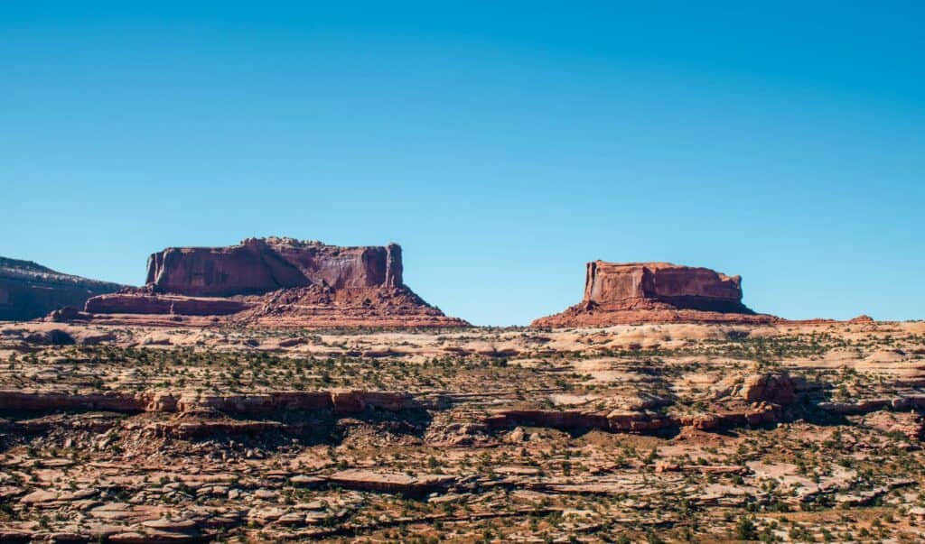
The viewpoint offers a clear, unobstructed look at these towering formations, making it an excellent photo stop and another chance to appreciate the scale of the natural features in the Moab area.
Length: 0.1 mile (0.2 km) out and back
Elevation gain: 0
Difficulty: easy
Where to Stay in Moab
Moab’s robust tourism scene means lodging options abound. The options range from nostalgic motels and familiar chains to high-end resorts and private rentals.
During my recent stay, I chose the MainStay Suites Moab near Arches National Park on South Main. This extended-stay spot delivers roomy suites with kitchenettes and ample seating, plus a complimentary breakfast buffet. It’s ideal for fueling your hikes without leaving the property on busy mornings.
🎥 Video walkthrough of a king suite at the MainStay Suites Moab near Arches National Park
Use the map and links below to research and book your accommodation in Moab.
Search at: Booking.com🔷Expedia🔷Hotels.com
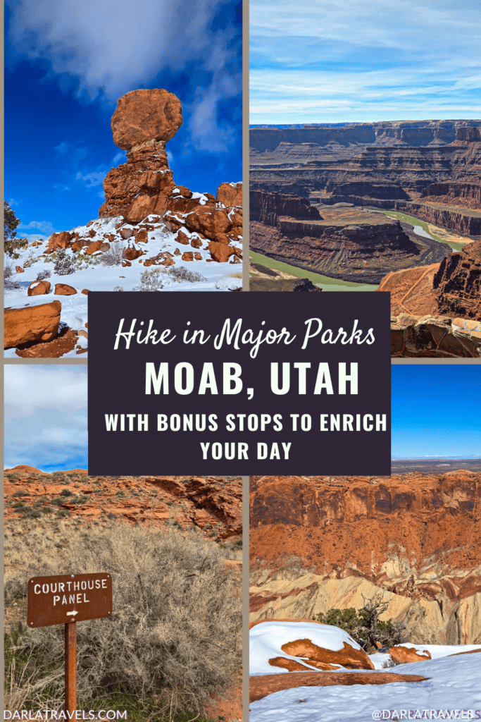
Hiking in Moab’s Parks with Bonus Stops – Pin It for Later!
I created these images for your Pinterest Boards on hikes in Arches National Park, Canyonlands National Park, and Dead Horse Point State Park:
Final Thoughts on Moab Area Park Hikes with Bonus Stops
I hope you’re convinced that by combining shortish hikes with meaningful bonus stops while visiting Moab, Utah’s parks, you can have a deeply enriching experience. From the iconic arches of Arches National Park to the sweeping canyon views and dramatic overlooks of Canyonlands and Dead Horse Point, you don’t need long miles to feel immersed in this landscape. And the bonus stops add geological, cultural, and historic depths to the overall adventure.
Moab thrives on extreme adventures, but slowing down to see multiple geologic wonders, petroglyphs, dinosaur tracks, and historic sites can be just as rewarding.
So many people overlook Deadhorse Point State Park. While we often bike through here, the hiking trails have stunning views too! Some of our other favorite hikes around Moab that I’d recommend include Fisher Towers, Pinto arch, and Faux Falls (down by Ken’s Lake). So many hikes to choose from.
You’re right that there are so many places to hike close to Moab! Stay tuned for content on Pinto Arch and Fisher Towers!
When I meet people from other countries, they seem to think if they’re been to New York, San Francisco, and Las Vegas, they’ve seen the United States. But I think the national parks are America’s “hidden treasures”.
I agree! While New York, San Francisco and Las Vegas are iconic destinations, America’s National Parks definitely showcase natural beauty and geographic, cultural, and geological diversity, enriching the experience of traveling in the United States.
My happiest childhood memories are of the two weeks we spent camping in Yosemite National Park every summer. It continued until I graduated from high school.
This is such a smart way to explore Moab, especially if you don’t have a lot of time. I love the idea of combining shorter hikes with those bonus stops—it really adds more depth to the experience. Arches, Canyonlands, and Dead Horse Point are all incredible, and this makes planning so much easier. Definitely saving this for our next trip to Moab!
Thank you for the comment, and glad you found this post useful!
My happiest childhood memories are of the two weeks we spent camping in Yosemite National Park every summer. It continued until I graduated from high school.
What great memories to have!