
** Darla Travels is reader-supported.
When you buy through our links, we may earn a commission. **
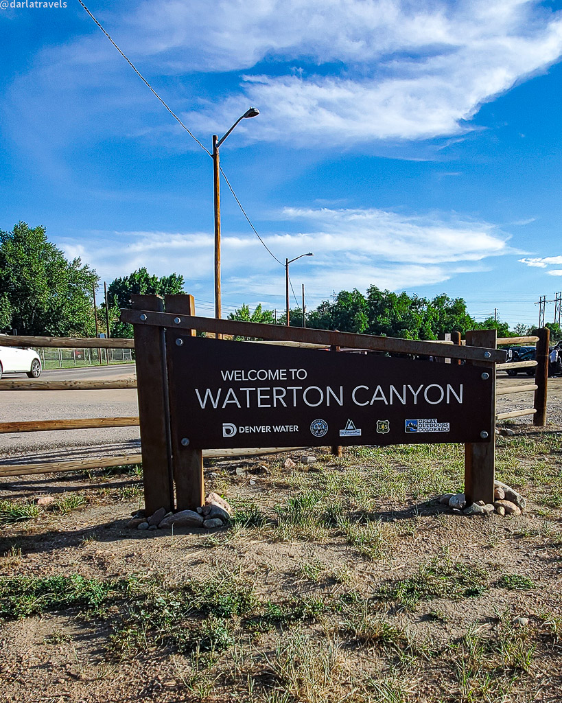
Why are there so many must-see attractions in Waterton Canyon, a scenic and wild outdoor recreation area near Denver, Colorado? It’s the result of combining a rugged natural landscape with sustainable management practices.
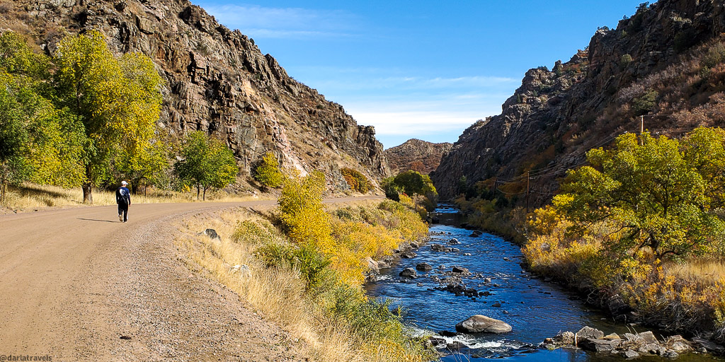
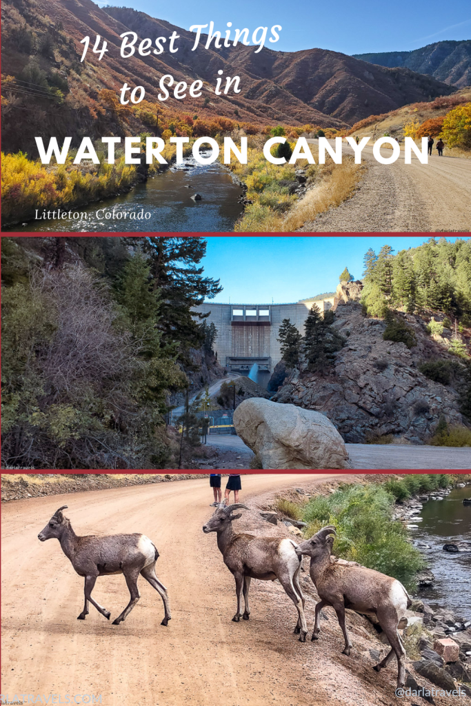
At Waterton Canyon, visitors can run, hike, bike, or ride a horse next to the South Platte River in Colorado’s Jefferson County. Along the 6.2-mile (10 km) route with a barely perceptible elevation gain, the gorge becomes progressively narrower, and its walls approach 1000 feet (300 m) above the river bed. The canyon allows views of the river, wildlife, the Pike National Forest foliage, and various signs of historical and current water management.
This pristine environment is due to Denver Water’s stewardship. Denver Water owns and operates part of the canyon and manages its recreation. The Waterton Canyon trail is a wide (around 12 feet or 3.7 m) Denver Water service road, where you’ll likely see an occasional Denver Water vehicle on your visit.
- Quick Facts on Waterton Canyon
- #1: See the Kassler Center
- #2: Take Advantage of Accessibility for Disabled Visitors
- #3: Enjoy the South Platte River
- #4: See Waterton Canyon’s Pipelines
- #5: Note the Pike National Forest
- #6: Observe Bighorn Sheep and Other Wildlife
- #7: Relax and Picnic at Waterton Canyon’s Rest Areas
- #8: See the Start of the High Line Canal and High Line Canal Trail
- #9: Go Geocaching in Waterton Canyon
- #10: See the Caretaker’s Residence
- #11: Admire the Marston Diversion Dam
- #12: Cross the Mill Gulch Bridge
- #13: View the Strontia Springs Dam
- #14: Trail Connections from Waterton Canyon
- Waterton Canyon Trail Map with Route Highlights
- How to Get to Waterton Canyon
- Where to Stay Near Waterton Canyon
- Wrapping Up 14 Best Things to Do in Waterton Canyon
Quick Facts on Waterton Canyon
Some basic information about Waterton Canyon will ensure a smooth visit.
- Waterton Canyon is an astoundingly popular recreation area–over 100,000 people visit the canyon annually.
- Waterton Canyon is open year-round, from one-half hour before sunrise to one-half hour after sunset, although it can be closed for annual dust mitigation (in May or June) or other needed maintenance. Before you go, check Denver Water’s Waterton Canyon Recreation Page for updates.
- Horses, donkeys, and mules are allowed in Waterton Canyon, but dogs and other domestic animals are not.
- Other things not allowed: e-bikes, drones, firearms, camping, fires, fireworks, and alcohol.
- Waterton Canyon has been designated a Gold Standard Site by Leave No Trace, the non-profit outdoor ethics association.
- Fishing is allowed on the South Platte River, but that’s about it. Any tubing or boating (canoeing, kayaking, or rafting) is prohibited.
- Swimming or wading with body/water contact is also a no-no.
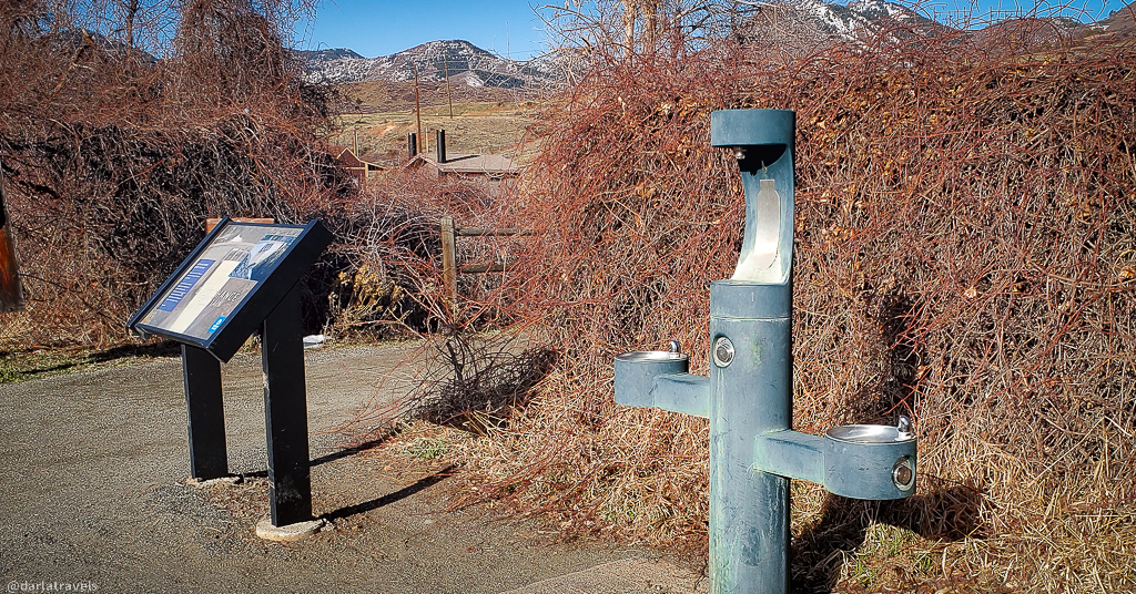
- The river water is not drinkable! The only place to get potable water in Waterton Canyon is the “Last Chance” water fountain at the start of the trail.
- No overnight parking is allowed.
So, with the basics out of the way, let’s move on to the best things to do in Waterton Canyon.
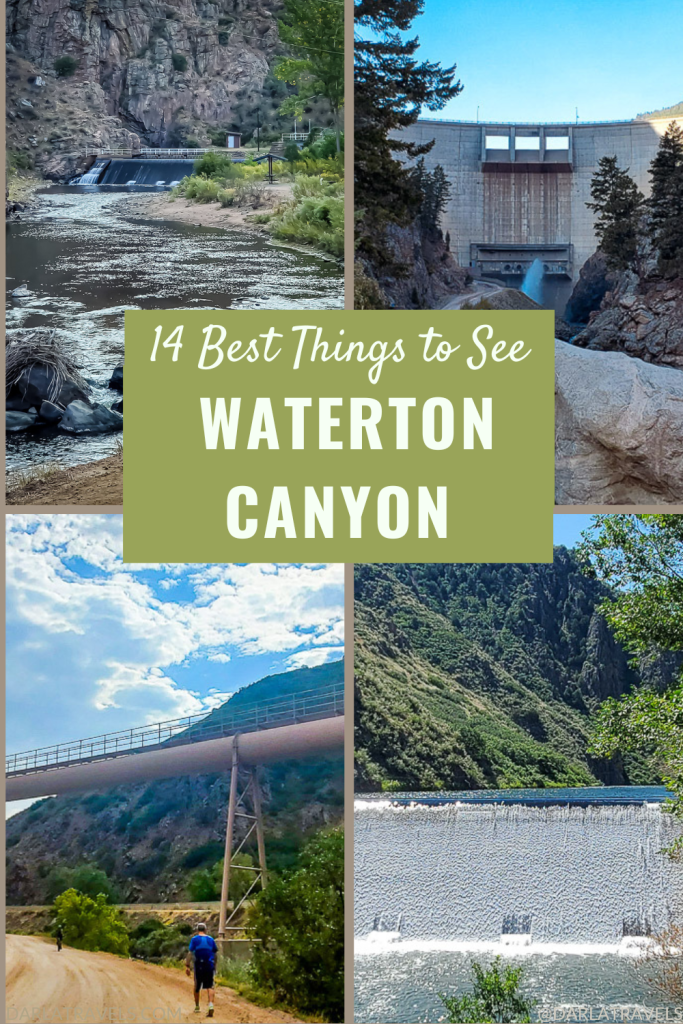
#1: See the Kassler Center
The recreational trail heading up Waterton Canyon starts next to the decommissioned Kassler Water Treatment Plant. Kassler was the first “English slow-sand treatment system” west of the Mississippi River. From about 1901, it could filter and purify up to 50 million gallons of water from the South Platte River daily. It operated until 1985.
The plant’s location, twenty miles (32 km) from Denver, was too far to commute in the early days. Consequently, the town of Kassler developed to house, feed, and support the water plant workers and their families.
Today, it’s a ghost town, and the renamed Kassler Center is behind a fence and closed to the public. Only a handful of buildings remain, including the Swan House, named for the generations of the Swan family that lived and worked at Kassler. Look for more historic structures and old equipment along the initial part of the Waterton Canyon trail.
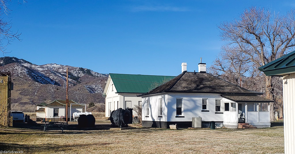
Fun fact: Kassler was designated as an American Water Landmark in 1979. (Did you even know that was a thing?)
#2: Take Advantage of Accessibility for Disabled Visitors
- The best things to do in Waterton Canyon include facilities designed to accommodate individuals with diverse needs.
- The Waterton Canyon parking lot has accessible parking spaces.
- A handicapped-accessible fishing pier is about 1.3 miles (2 km) up the canyon.
- Waterton Canyon is wheelchair-accessible.
- Those with an ADA accommodation can and must get permission from Denver Water to use an e-bike (class 1 or 2) on the first 2.6 miles (4.2 km) of Waterton Canyon. Click here for contact information.
The initial part of the trail is flat; however, wheelchair visitors should consider using off-road or all-terrain tires to navigate the route. In addition, anyone with a wheelchair or other mobility equipment should have assistance available if heading up to the steeper section of the canyon.
#3: Enjoy the South Platte River
As mentioned above, the South Platte River was the water source for the Kassler plant. The river originates in Park County, Colorado, and several dams control the water flow toward Denver. The next-to-last major dam, the Strontia Springs Dam (Number 13 below), is at the top of Waterton Canyon. The natural beauty of the canyon route next to the river not only draws visitors, but it’s also an attraction for local wildlife, such as Rocky Mountain bighorn sheep and various bird species.
Fishing on the South Platte River
Recreation on the river is limited to fishing. It’s a popular area, with many anglers arriving on mountain bikes. If you would like to join in, note the rules for fishing depend on your location. From the Waterton Canyon entrance to Marston Diversion Dam (Number 11 below), it’s OK to use live bait; the bag limit is four trout (any size). Only artificial flies and lures are allowed from the Marston Diversion Dam to Strontia Springs, and the bag limit is two trout (any size).
Word on the street is that fishing is better closer to the dam, and brown and rainbow trout are the most abundant fish.
As you’re taking in the South Platte River, consider its path after it exits Waterton Canyon: It flows through Denver and Greeley, Colorado, before meeting with the North Platte River near North Platte, Nebraska. Here, the two rivers combine to form the Platte River. The Platte River flows into the Missouri River, which flows into the Mississippi River, which empties into the Gulf of Mexico. Those water droplets you see in Waterton Canyon might eventually end up off the Gulf Coast!
#4: See Waterton Canyon’s Pipelines
Around 1.2 miles (2 km), pipelines passing high over the trail come into view. One is 5 feet (1.5 m) wide and has been here since 1912.
The pipelines originate from Conduit 20, a larger pipe that pulls water from the South Platte River at the Marston Diversion Dam (Number 11 below). Water sent through the pipes is destined for Denver Water’s Marston Treatment Plant.
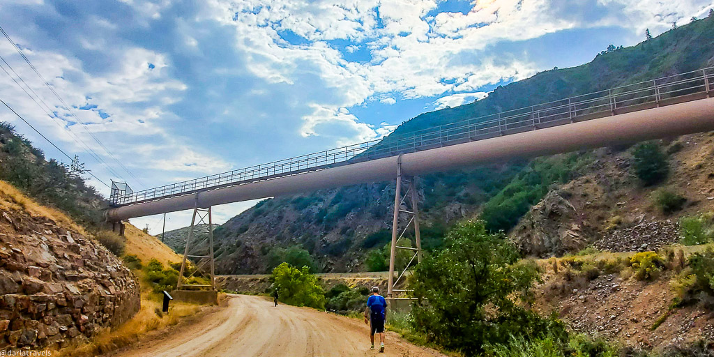
Conduit 20 and the pipelines remind us that water is still scarce in the Denver metropolitan area and that the South Platte River contributes significantly to reliable water distribution.
#5: Note the Pike National Forest
About 2.7 miles (4.3 km) into the Waterton Canyon Trail, the trail enters the Pike National Forest. At this point, sightings of wildlife like bighorn sheep become more likely.

#6: Observe Bighorn Sheep and Other Wildlife
Waterton Canyon’s Bighorn Sheep
One of the important and notable things about Waterton Canyon is the resident herd of Rocky Mountain bighorn sheep. They are often on the canyon’s rocky hillsides, sometimes grazing on the shrubbery. If you’re lucky, you may see them crossing the trail on their way to or from the river. You’ll notice they’re incredibly sure-footed and agile. The males’ curved horns give the animals their name, and their size is a rough estimate of their age relative to other sheep.
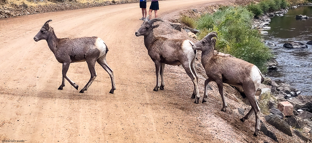
My “pro” tip: Wildlife photographers flock to Waterton to get pictures of sheep. On days with many photographers present, you don’t need to look for the sheep yourself. Just look for the photographers and then find what they’re looking at. Most likely, you’ll see bighorn sheep!
It should go without saying, but keeping a safe distance from the sheep is always essential. Denver water recommends staying two bus lengths away.
Black Bears
Less common than the bighorn sheep, black bears can be found in Waterton Canyon, as it contains abundant food sources. In 2015, the canyon was closed for two months to protect animals and humans after numerous visitors approached the wild bears to take selfies. Denver Water takes the management of the canyon’s wildlife seriously.
They recommend observing bears in Waterton Canyon from a safe distance of at least 150 feet (47 m). So forget about selfies and focus on your camera zoom function instead. Other bear-safe practices include sticking to the trail and taking food leftovers with you to avoid inappropriately attracting bears.
Mule Deer and other Mammals
Mule deer can sometimes be seen in the canyon, grazing in open areas or browsing on shrubs and grasses.
Almost any location in Colorado with deer, elk, and a place to hide can support the elusive mountain lion. And the canyon has very occasional mountain lion sightings. (If you see a mountain lion, don’t run–running triggers the cat’s predatory instincts. Instead, stand your ground. More extensive mountain lion safety tips are here.)
Plenty of smaller mammals call the canyon home, including rabbits, squirrels, raccoons, and coyotes. Once, I even saw a beaver gathering branches for his dam.
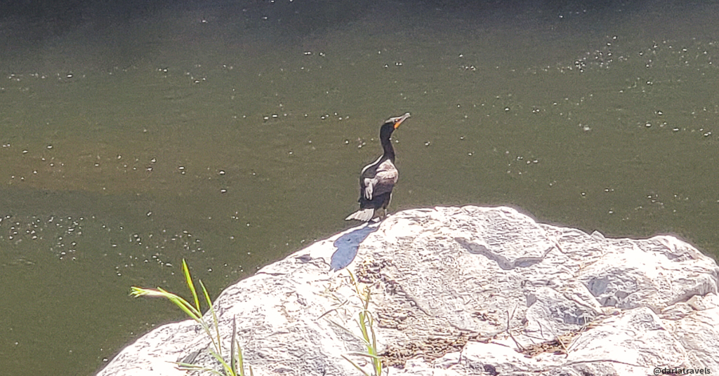
Birds, Birds, and More Birds
Birdwatching is another popular activity in Waterton Canyon, with dozens of bird species to see. Birds of all types can be found flitting amongst the trees and bushes, soaring overhead, and swimming in the South Platte River. Birds of prey that frequent the canyon include golden eagles and red-tailed hawks. The waterfowl category includes various ducks, geese, and herons. Finally, some birds are easier to hear than see, such as several types of warblers, sparrows, finches, and thrushes with their distinctive songs.
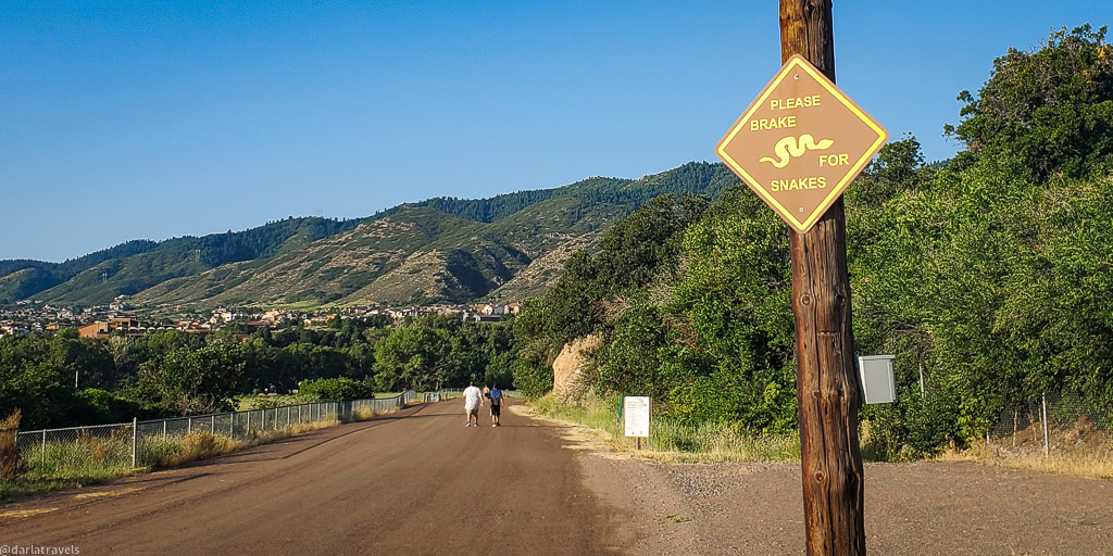
Rattlesnakes
Waterton Canyon is home to several reptiles, one of which is the poisonous prairie rattlesnake. When walking the canyon, watch where you’re going and be mindful of your hands and feet: rattlesnakes camouflage themselves. For rattlesnake safety advice, see my post here.
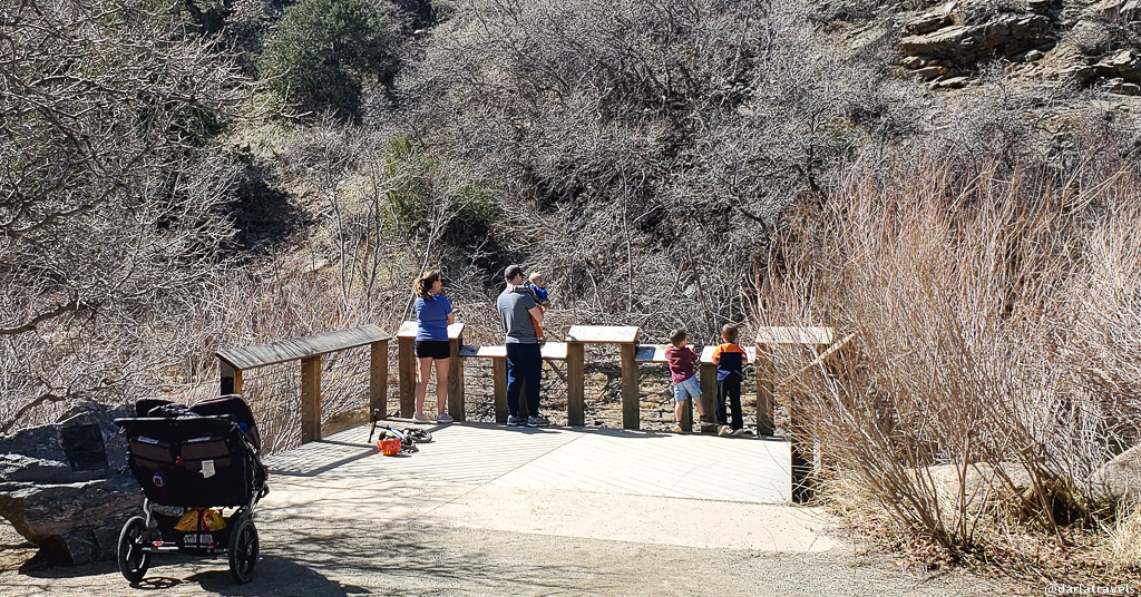
#7: Relax and Picnic at Waterton Canyon’s Rest Areas
You can learn more about Waterton’s wildlife at the rest areas dotted along the trail, as each rest area has the name of a species found in the canyon. The rest areas offer a welcome opportunity to observe the canyon further and enjoy the soothing sounds of water running in the South Platte River.
At each rest stop, picnic shelters and tables allow you to enjoy an al fresco snack or meal. Several additional picnic tables are also available in the canyon.
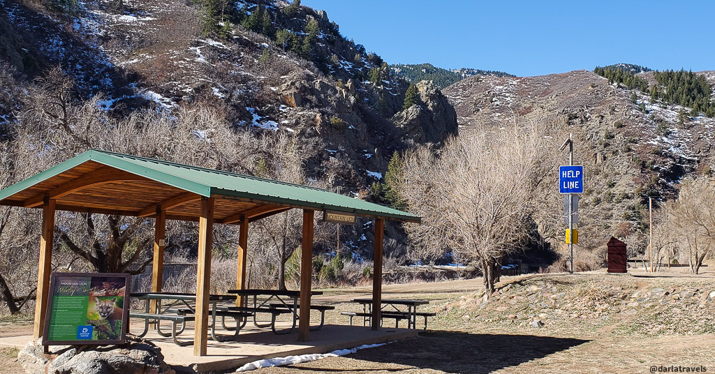
Additionally, each rest stop has vault toilets. This trail may have the highest density of restrooms in metro Denver! So be assured that you can be comfortable on a short or long hike in the canyon.
The rest areas are as follows;
- Mile Marker 0.25 (0.4 km): Mule Deer Rest Area (restroom building is before the rest area)
- Mile Marker 0.6 (1 km): Great Blue Heron Rest Area
- Mile Marker 1.9 (3 km): Black Bear Rest Area
- Mile Marker 3.1 (5 km): Mountain Lion Rest Area (also has an emergency phone)
- Mile Marker 4.5: (7.2 km) Rattlesnake Rest Area
- Mile Marker 6.2 (10 km): Bighorn Sheep Rest Area
#8: See the Start of the High Line Canal and High Line Canal Trail
The Black Bear Rest Area mentioned above has a unique feature: It’s the official start of the High Line Canal and Highline Canal Trail.
The High Line Diversion Dam redirects water from the South Platte into a tunnel, supplying water for the High Line Canal. The Canal was built to provide irrigation water for farmers and other settlers starting in 1881, and it still delivers water to this day. Cutting across the Denver metro area, the Canal ends in Aurora after about 71 miles (114 km).
The maintenance road adjacent to the High Line Canal was officially opened to the public for recreation in 1970, and today, the High Line Canal Trail is a favorite for urban recreation throughout the metro area.
#9: Go Geocaching in Waterton Canyon
Geocaching is searching for and navigating to hidden containers, called “geocaches” or “caches,” at precise locations using a GPS-enabled device. Waterton Canyon contains several geocaches. While geocaching is optional, hunting for caches can add interest to your walk or ride up the canyon.
Upon finding a cache, it is customary to sign its logbook to validate the find. Many caches contain small toys, keychains, stickers, or other trinkets. Finders can take one of these items and replace it with a new item of equal or greater value before returning the cache to its hiding place.
Set up an account on GEOCACHING to learn about the geocaches in Waterton Canyon and nearby areas.

#10: See the Caretaker’s Residence
Around 3.2 miles (5.1 km), just past the Mountain Lion Rest area, the Denver Water caretaker’s residence sits behind a fence. The caretaker performs essential work in the canyon and nearby Strontia Springs dam.
It’s near the Mountain Lion Rest Area, and in addition to the picnic facilities and toilets, there’s an emergency phone here.
Click here to read a memoir of living in this house as a caretaker’s daughter.
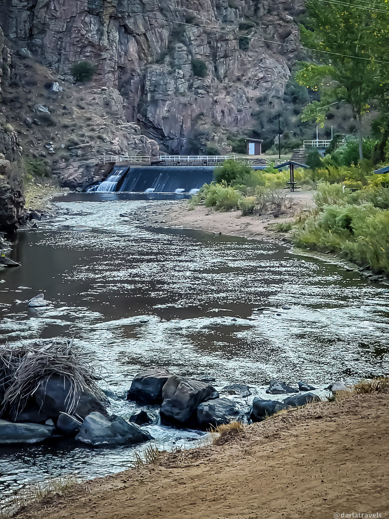
#11: Admire the Marston Diversion Dam
You’ll come across the Marston Diversion Dam a little over halfway up the trail (3.5 miles, 5.7 km). At first glance, the sheet of water flowing over the top makes it seem like a decorative water feature. However, This functional dam diverts river water through Conduit 20 (Number 4 above) at the dam’s base. The diverted water eventually arrives at the Marston Water Treatment Plant for processing before being sent to Denver Water customers.
It’s worth noting that fishing rules change at this spot, so it’s a significant location for anglers.
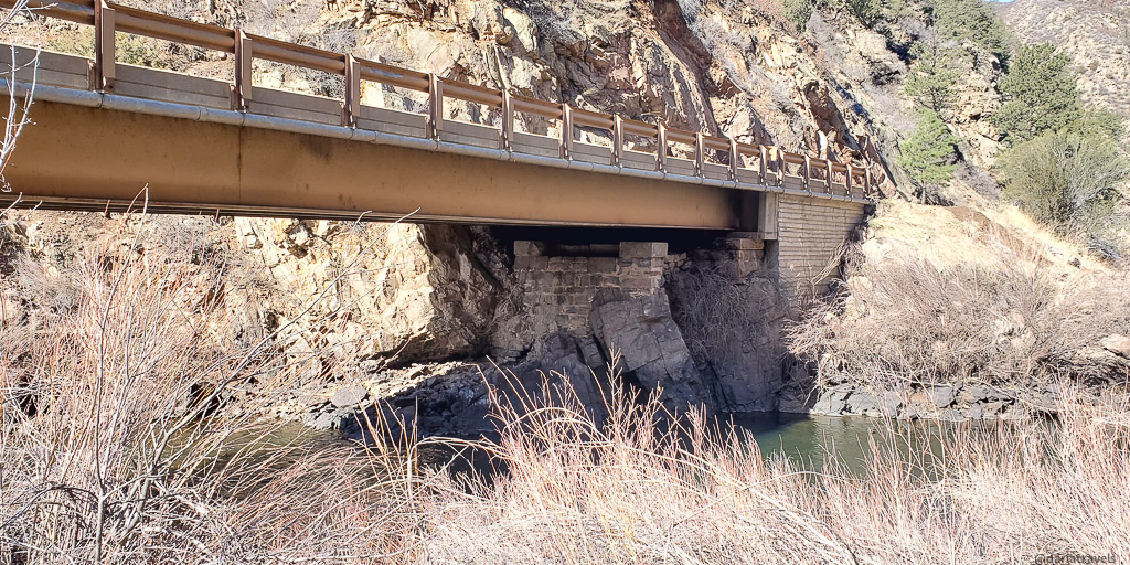
#12: Cross the Mill Gulch Bridge
The Waterton Canyon Trail starts on the right side of the river. At approximately mile 4.7 ( 7.5 km), it crosses over to the other side of the river via the Mill Gulch Bridge.
This crossing was once the site of a railroad bridge. When trains ran between Denver and Gunnison, Waterton Canyon had railroad tracks where the road is now. Railroad operations ceased in 1937, but the railroad bridge supports are still there: look under the current bridge to take a look.
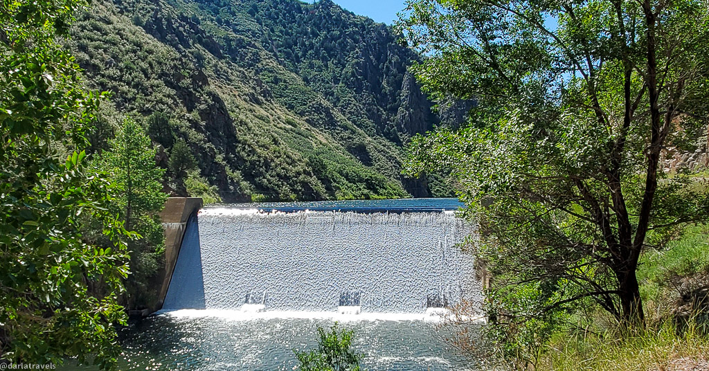
#13: View the Strontia Springs Dam
After the bridge, the trail becomes slightly steeper.
If you walk the entire 6.2 miles (10 km) up the canyon, just past the Bighorn Sheep rest area, you’ll view the 234-foot (71.3 m) tall Strontia Springs Dam.
Behind the dam, the Strontia Springs reservoir stores water for diversion through a 3.4-mile (5.5 km) tunnel to the Foothills Treatment Plant just east of Roxborough State Park.
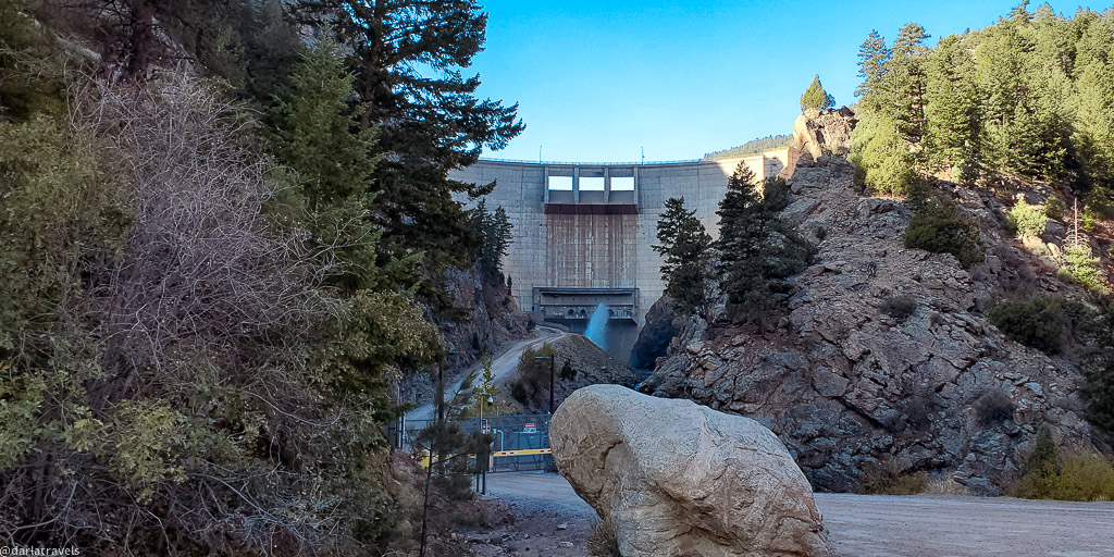
The dam, functioning since 1983, is not open to the public, so you’ll have to admire it from a distance.
#14: Trail Connections from Waterton Canyon
Note: To plan and execute hikes on these routes, use a navigation device and a hiking app, such as AllTrails or Cotrex.
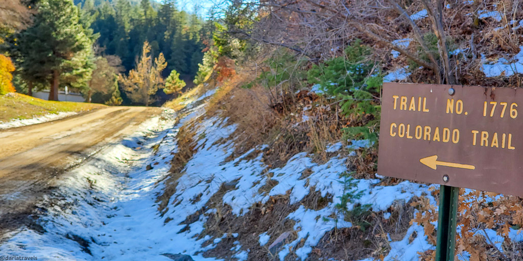
While the Bighorn Sheep rest area at the Strontia Springs Dam access road is the last major attraction in the canyon, the road continues with more opportunities for hiking and biking. There is a fork in the road less than 1000 feet (304 m) from the Bighorn Sheep rest area. From this intersection, you can explore many more miles of trail. Options include the Colorado Trail, trails that go all the way to Roxborough State Park, an epic hiking loop, and more.
The Colorado Trail
The first of these is the Colorado Trail (USFS #1776). The Colorado Trail is a 567-mile (912.5 km) trail between Denver and Durango, Colorado. The Waterton Canyon Trailhead near Kassler is the start of the Colorado Trail, making the Waterton Canyon Trail part of Colorado Trail Segment 1.
Popular with thru-hikers, the Colorado Trail passes through some beautiful high-altitude scenery across the Centennial State.
So, to continue on the Colorado Trail past the Strontia Springs Dam, follow the signs and stay on the main trail.
Toward Roxborough State Park
To get to Roxborough State Park, take the trail veering off to the left at the fork. The trail name may be the Indian Creek Trail (USFS Trail #800) or the Roxborough Connection Trail (#605).
This trail continues for 2.3 miles (3.7 km) to another trail intersection with the (real) Indian Creek Trail. You can keep heading toward Roxborough State Park on this trail, and after a further 2.25 miles (3.6 km), you’ll be right below the Carpenter Peak summit within the park.

On the other hand, going in the opposite direction on the Indian Creek Trail will bring you to the Colorado Trail Connection Trail (USFS #619), discussed below.
Lenny’s Rest
If staying on the Colorado Trail, after about 1.5 miles (2.4 km), you’ll find Lenny’s Rest, a bench placed in honor of a teen who lost his life in a hiking accident.
It’s also the intersection with the Colorado Trail Connection (USFS #619), a 0.3-mile (0.5 km) trail that intersects the Indian Creek Trail.
The Indian Creek Trail and a Big Loop Hike
The Indian Creek Trail intersects the Roxborough Connection and the Colorado Trail Connection. These three trails and the Colorado Trail make a 4.6-mile (7.4 km) loop. (The clockwise route from the trail intersection just above the dam will be Roxborough Connection-Indian Creek-Colorado Connection-Colorado Trail.)
The Indian Creek Trail is a 9.3-mile (15 km) U-shaped trail with two trailheads off Highway 67.
Goat Mountain
A separate trail to Goat Mountain branches off the Waterton Canyon Trail at the pipelines (Number 4 above). This trail is rated hard, and users often report difficult conditions.

Waterton Canyon Trail Map with Route Highlights
I created this map on AllTrails to ensure you see everything highlighted in this article on Waterton Canyon. Of course, there’s no guarantee of a wildlife sighting, but keep your eyes peeled.
If you don’t see the map or want to see the original, Click here.
How to Get to Waterton Canyon
To reach Waterton Canyon, located southwest of Denver, Colorado, follow these directions:
From US-85 S
- From US-85 S/S Santa Fe Dr. south of Highway C-470, take the exit to merge onto Titan Pkwy. From Titan Pkwy, turn Right on Waterton Rd and continue for about 2 miles (3.2 km) until you reach the entrance to Waterton Canyon.
From Wadsworth Blvd./Highway 121
- From Highway C-470, head south on Wadsworth Blvd./Highway 121 for about 4.3 miles (6.9 km), then turn left on Waterton Rd. Continue for about 0.3 miles (0.5 km) to reach the parking lot and trailhead.
Parking and Access
You can access the trail on foot, bicycle, or horseback by crossing the road from the Waterton Canyon parking lot.
- Note: The parking lot is for day use only–overnight parking is prohibited!
- Note: Due to Waterton Canyon’s enormous popularity, arriving early, especially on weekends, is advisable. Parking can and will fill up quickly.
- Caution: The canyon has little shade on the trail. Be prepared for varying weather conditions and direct sun. Bring plenty of water, sunscreen, and appropriate clothing.
Where to Stay Near Waterton Canyon
The entrance to Waterton Canyon is not exactly remote, as housing developments and shopping centers are within a few miles of the trailhead. However, traditional hotels are slightly farther away, mainly along Highway C470 in the Highlands Ranch and Ken Caryl areas. Use the map below to find lodging near Waterton Canyon.
Wrapping Up 14 Best Things to Do in Waterton Canyon
Waterton Canyon is a beloved hiking and biking route, partly due to the natural landscape and partly due to its management by Denver Water. Whether you want to have a leisurely picnic, look for wildlife, or hike to the Strontia Springs Dam, Waterton Canyon awaits you to explore and discover.
Pin it for later! Here are a couple of pins for your Pinterest boards.
This is a great recap of Waterton Canyon’s highlights. What a great hike to Strontia Springs Dam!
Thanks for reading, Sonia!
This looks like a fun itinerary.
Glad you liked it! Thanks for stopping by!
I’ve been through here many times, but never knew it had so much to do. Thanks.
Glad to help-I hope you can visit on your next time through!
Nice that this is such a big outdoor area close to Denver!
Yes it is. And we are fortunate that it’s one of many!
I would want to visit for the wildlife alone…well, except for the rattlesnakes. I’m good there!
I hear you–thanks for reading! Lamb season for bighorn sheep is around mid-April to mid-June if you want to time your visit.
It seems you have visited the place in different seasons. What would you say is the best time to visit?
Fall is my favorite time for the colors! The canyon has no shade and the heat can be overwhelming in the summer, so that’s my least favorite time. This is a good option for a winter hike when nearby trails are icy, too!
I love the last chance water fountain!
It’s a great feature, to be sure!
Excellent description of the trail especially the upper trail options that are so vague on many other trail descriptions. Great pictures too!
So glad you enjoyed the post-thank you for your comment!