** Darla Travels is reader-supported.
When you buy through our links, we may earn a commission. **

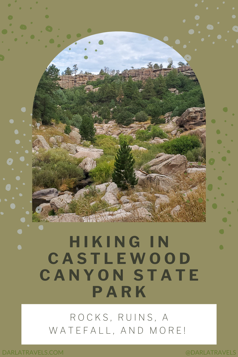
Hiking in Castlewood Canyon State Park can take many forms. It may be a walk on the canyon rim, looking down the valley and out to the prairie land of Douglas County. But it can also be a trek into the canyon and along Cherry Creek to a charming waterfall. Maybe it’s a hike to historically significant sites, including the ruins of a failed dam and what’s left of an 1890s homestead. All these features are within 13 miles (21 km) of trails in and around the canyon. Keep reading to learn more about hiking in Castlewood Canyon State Park.
About Castlewood Canyon State Park
Castlewood Canyon State Park in Franktown, Colorado, is a day-use park south of Denver with varied terrain and historical ruins, making it an excellent choice for hikers.
Castlewood Canyon cuts into the prairie of Douglas County, exposing millennia of rock layers and providing an ecosystem for local wildlife.

The park’s beginnings date to 1961, when Colorado’s state park system bought the 87 acres of land, formerly part of the Lucas Homestead, for the low, low price of $10. Established in 1964, Castlewood Canyon State Park expanded its acreage starting in the 1970s. The park added the last part of the Lucas Homestead in 2002. Trail-building began in the 1980s, and the Visitor Center opened in 1993. Today the park has around 13 miles (21 km) of trails ready to enchant hikers within its 2,628 acres (1,063 ha).
Sorry, cyclists, bicycles are not allowed on the trails. However, pets on a leash are welcome, except for the East Canyon Preservation Area.
Castlewood Canyon’s Geology
The canyon is relatively young, geologically speaking, perhaps only about 100,000 years old, but its geologic history goes back millions of years.
36.7 million years ago, a massive volcanic eruption about 90 miles (145 km) from today’s Castlewood Canyon State Park changed the landscape here. Molten rock, ash, and other emissions from the blast solidified into rhyolite, also known as ignimbrite or Wall Mountain Tuff. As a result, rhyolite fragments are everywhere in the park. At the park Visitor Center, look for rhyolite on the outside walls. The pieces you’ll see while hiking often have sharp edges, small air holes, and shiny spots, and colors range from purple to brown.

Castle Rock Conglomerate tops the rhyolite rock layer. It’s a conglomerate because it includes different pebbles and boulders embedded within sedimentary rock “cement” created by natural forces. The conglomerate is about 34 million years old. It’s here because water eroding the Rocky Mountains washed sedimentary stones downhill. Polished by water, some developed smooth surfaces, and others eventually disintegrated into sandy grains. Silicate in the water had a cementing action on the rocks, trapping the bigger stones within a solid matrix of sand. Castle Rock Conglomerate forms the canyon walls and caprock, and large boulders of conglomerate line some park trails.

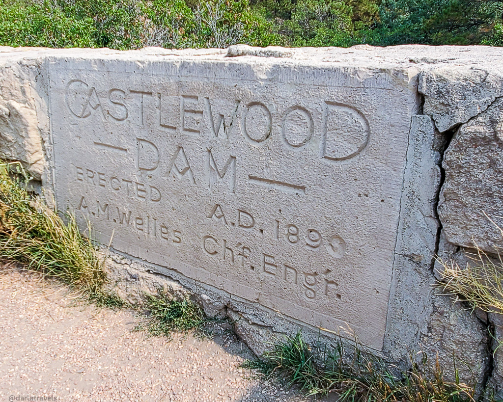
The Castlewood Dam
The Castlewood Dam is a large part of the park’s human history. Homesteaders began showing up in the Castlewood area in the 1880s, and with the increase in farming and ranching, irrigation became an issue. The masonry and rock-fill Castlewood Dam, built in 1890, was the solution. Built across Cherry Creek, the dam was 600 feet (183 m) long and 92 feet (28 m) high at its completion.
But the dam had structural problems, developing cracks and leaking water from the beginning. Denver citizens downstream were concerned that the leaky dam would fail, especially since Cherry Creek had the propensity to flood. The dam’s minders dismissed the complaints as unfounded and maintained, rather forcefully at times, that the water barrier was sturdy, safe, and would hold.
You can probably guess what happened. After a wet summer, up to 9 inches (23 cm) of rain fell in the Castlewood area during a stormy three hours on August 2, 1933. The water level in the reservoir rose rapidly and began flowing over the top of the dam around midnight. At approximately 1:20 AM on August 3, the dam breached, resulting in the stored water rushing violently downstream through the canyon. A 15-foot (4.5-m) wall of water reached Denver, 40 miles (64 km) away, causing the flood that Denver residents had feared for years, along with over one million dollars in damage.
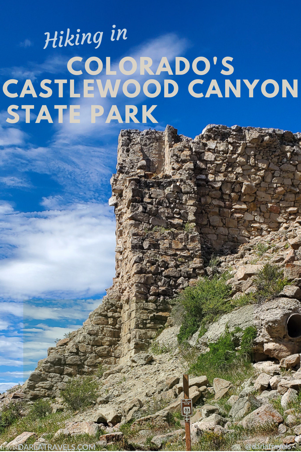
Today, the remnants of the dam remain in Castlewood Canyon State Park. They can be approached on the west side and viewed from various angles on the surrounding trails.
Getting to Castlewood Canyon State Park
Castlewood Canyon State Park has two entrances on opposite ends of the park. Decide which access to use before your visit based on your preferred hiking route, as it is not possible to drive through the park from one entrance to the other.
The main (east) entrance leading to the park’s visitor center is at:
2989 South State Highway 83, Franktown, CO, 80116
To get to the west entrance, use the address:
125 N Castlewood Canyon Rd, Castle Rock, CO 80104
The park is about a 50-60-minute drive from central Denver, Colorado, and 15-20 minutes from Castle Rock.
Hiking in Castlewood Canyon State Park
The individual trails in the park range up to 4 miles (6.4 km) in length and easily combine into longer treks. On the park brochure, each named track is accompanied by a letter from “A” to “O,” but on other park trail maps, the routes have numbers 1-16. The letters and numbers do not match up in order, and the numbered map contains one extra trail (a very short path to the park’s amphitheater). And to make it even more confusing, the signs on the actual trails sometimes show letters even if there is a display map with numbers!

So you’ll be excused if you find it a little bit difficult to navigate the multiple trails on your first visit to Castlewood Canyon State Park. Below, I’ll clear up this ambiguity as well as I can, putting the letters and numbers next to the trail names. And once you’ve been on the trails, confusion will likely dissipate.
Let’s start with the Canyon View Nature Trail on the canyon rim.
The Paved Canyon View Nature Trail (A, 15)
The Canyon View Nature Trail is near the parking areas by the park’s main entrance on Highway 83. The canyon is relatively hidden on the drive into the park, and you might wonder what the attraction is here. But you’ll quickly get a feel for this natural landmark by walking along the accessible Canyon View Nature Trail that follows the cliff edge. This 1.4-mile (2.25 km) trail has four viewpoints along its length for taking in the breadth and depth of the canyon.
Along the way, look at the ground around the paved trail and notice the cross-bedded stone, its ripples shaped by millions of years of running water.
This flat trail has inspiring views, but there is more of the canyon to explore. Venture down into the canyon on the following route.
A Two-Mile (3.2 km) Loop Hike into the Canyon
For a short, picturesque hike, start near the Canyon Point parking area, accessible from the main entrance on Highway 83. This two-mile (3.2 km) loop consists of the Lake Gulch Trail (L, 13) and the Inner Canyon Trail (K, 12). Inner Canyon descends rapidly via a staircase and winds its way along Cherry Creek. There are multiple opportunities to view the creek and a few large boulders to step around on this moderate path before the canyon opens up and the trail starts to climb.

Follow the signs and cross over Cherry Creek to the Lake Gulch trail to make your way back to the parking lot on a gentle uphill. On a clear day, you’ll be treated to an awe-inspiring view of Pike’s Peak to the south.

Both trails connect at the Canyon Point parking lot, so the loop can be taken in the opposite direction if desired.
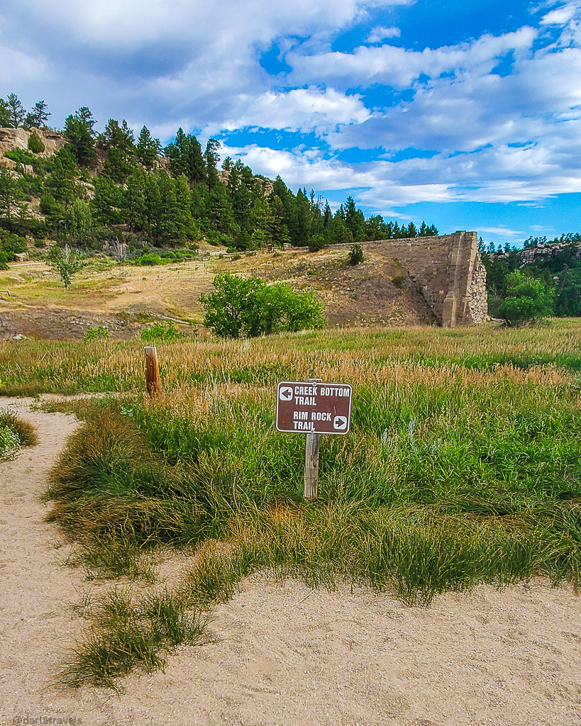
A Four-Mile (6.4 km) Loop Hike Features a Waterfall and Dam Remnants
This longer loop starts at the Westside Trailhead parking lot at the west park entrance. It combines the 2-mile (3.2 km) Creek Bottom Trail (G, 4), the Dam Trail (H, 11), and the Rimrock Trail (M,5). Follow the signs to the Creek Bottom trail from the trailhead. Take the path in either direction, but if heading south (right), listen for the sound of a 20-foot (6 m) waterfall, Cherry Creek Falls, which you’ll see from a distance. A few short spur trails lead to the creek upstream of the waterfall, where you can spend as long as you like.

As you walk along Creek Bottom, notice the landscape. When the 1890 Castlewood Dam failed, the rushing water moved dam masonry and natural stones in its path. Additionally, the water scraped the canyon walls. The results of the dam failure are still noticeable today. For example, water erosion exposed 55 million-year-old rocks from the Dawson Arkose formation along the lower walls of the canyon. (For more on Dawson Arkose rock formations, see my post on the Paint Mines Interpretive Park)
You’ll also find that this part of the canyon seems to be in much rougher shape than the area visible from the Canyon View Trail or along the Inner Canyon Trail, thanks to the damage inflicted by the failed dam.
Approaching the end of Creek Bottom, the remains of the Castlewood Dam itself come into view. Take the steep but short Dam Trail (0.3 miles, 0.5 km) to the top of the Dam, where you can stop and admire the ruins. Continue on the trail and follow the signs to the 2.2-mile (3.5 km) Rimrock Trail.

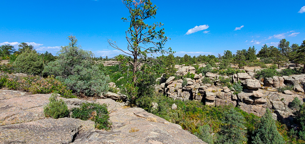
This path will switchback uphill through a forested area before leveling out on the canyon rim opposite the Creek Bottom Trail. The terrain along this natural surface path, which is sometimes difficult to follow, is very similar to that of the Canyon View Nature Trail described above.
On this trail, look at the large ranches spreading out away from the canyon. And notice–from a safe distance–the striking rock formations near the canyon rim.
Overhead, you may see turkey vultures crossing the canyon in wide circles. The park has a large population of these scavengers, although they migrate south during the winter.

Caution: There are absolutely no safety features here!
Eventually, the Rimrock Trail descends toward the creek level via a short but steep section of switchbacks. Shortly after crossing a bridge over Cherry Creek, look for the intersection. The Creek Bottom Trail is a sharp turn to the left. The path to the right is the Homestead Trail.
Note: If taking the loop in the reverse direction, the directions and landmarks will be backward.
Note: Take the Homestead Trail from the Homestead Trailhead for another way to access this loop. The end of the Homestead trail is the connection to the Cherry Creek Trail/Creek Bottom Trail intersection. The Homestead Trail description is below.
A Six-Mile (10 km) “Figure 8” Hike puts it all Together
Combine the two- and four-mile loops to hike a 6.2-mile (10 km) “Figure 8” loop. Start with any trail and connect to the others, noting the signs and directions at the trail intersections near the dam ruins. My favorite sequence of trails for the full double-loop from the Canyon Point parking lot (main entrance) is:
- Inner Canyon
- Rimrock
- Canyon Bottom
- Dam
- Lake Gulch
The Trail Map for this hike is shown below.
The East Canyon Trail (O, 16) Showcases the Landscape
The East Canyon Preservation area of the park contains only one trail: the “lollipop” East Canyon Trail, an out-and-back trail with a loop at the far end. Start this rustic trail from the park’s main entrance off Highway 83. It branches from the Canyon View Trail near the Bridge Canyon Overlook. The route takes hikers down the canyon and under Highway 83 into the Preservation area. The hike’s round-trip distance is about 4.1 miles (6.6 km).

Because the East Canyon is considered a fragile environment and is home to rare plant and animal species, special rules apply on this route:
- First, the trail is closed from November 1 to May 1.
- Straying off-trail is forbidden–keep to the designated path.
- Dogs and other pets are not allowed.
- There is no access to rock formations and no climbing on the rocks in this part of the park.
Much of this trail travels over a rocky surface but is well-marked with cairns. Keep looking for these markers, and you’ll have no trouble staying on the path. After walking under Highway 83 and getting an up-close view of the arch bridge over the canyon, the trail descends with good opportunities to view the marvelous rock walls of Castle Rock Conglomerate up close. The loop portion of the route, on the opposite side of the canyon, includes a section through prairie grasses with views of nearby ranches.

Hike to Historic Ruins on the Homestead Trail (J, 3)
The Homestead Trail (J, 3), accessible from the west entrance, is suitable for families and anyone with an interest in the history of the Castlewood Canyon area. To get there, park at the Homestead Parking lot just inside the west entrance to hike this 0.4-mile (0.6 km) trail.
Note: If the small Homestead lot is full, keep driving to the west side trailhead. From there, follow signs to the Creek Bottom Trail and take it south (left). Just before crossing over Cherry Creek to the Rimrock Trail, continue south on the Homestead Trail, which was unmarked on my last visit.
The Homestead Trail is so-named for the 160-acre homestead established here by Patrick Lucas and Margaret McCardle, who arrived in 1893. The shell of their concrete-framed house still stands at the trailhead, and it’s seen better days. Empty since 1941, it suffered from a fire some years later.

In addition to the house ruins, the Homestead Trail features other structures from the former homestead. Some of these remnants include a livestock-loading chute, a milking parlor, a spring house, and a lovely rock-filled wall structure. For detailed information on the ruins, download the Discover the Lucas Homestead: A Self-Guided Tour brochure.

As mentioned above, the end of the Homestead trail forms an intersection with the Creek Bottom trail and the Rimrock Trail.
Other Trails at Castlewood Canyon’s West Entrance
Three very short trails at the park’s west entrance are rated as difficult and provide access to rock-climbing areas. These include the Climbers Trail (0.14 mile, 0.2 km), the Cliff Base Trail (0.18 mile, 0.3 km), and the Cave Trail (0.14 mile, 0.2 km). And yes, there is a cave-like chamber in the rock face.
Finally, the short Falls Spur (0.2 miles, 0.3 km) trail connects the Falls trailhead to the Creek Botton Trail.
Future Trail Connection to the Cherry Creek Regional Trail
The Cherry Creek Trail (1 mile (1.6 km) natural surface, 0.24 mile (0.3 km) paved) connects the West Side Trailhead and the Homestead Trailhead, then extends to the park boundary. There are plans to connect this park trail to the over 40-mile-long (64.4 km) Cherry Creek Regional Trail.

With this new two-mile (3.2 km) connection, it will be possible to travel on the trail from Castlewood Canyon State Park to multiple municipalities in the metro area through parks and open spaces, including Cherry Creek State Park, and into downtown Denver. The final segment of the trail was scheduled to be completed by May 2023, but unfortunately, this segment has not yet been built.
Castlewood Canyon State Park Trail Maps
This AllTrails map shows an actual hike of the double loop around Castlewood Canyon State Park from the Canyon Point parking lot (main entrance). The route is Inner Canyon (K, 12) – Rimrock (M, 5) – Canyon Bottom (G, 4) – Dam (H, 11) – Lake Gulch
Don’t see the map or want to see the original? Click here to go to the map page on AllTrails.
More Things to do in Castlewood Canyon State Park
Another main draw of the park is its rock-climbing routes, over 600 by some accounts. Various courses are all over the park, and the 20- to 50-foot cliffs are filled with opportunities for beginners and more experienced climbers. Note that some of these routes are closed seasonally to protect nesting raptor populations, so check the calendar if you’re coming for climbing.
Food and Drink
Castlewood Canyon State Park has no food and limited water sources. But it does have picnic tables, so considering bring your own meal to enjoy in this beautiful setting.
Alternatively, Adriana’s Mexican Restaurant (7272 E Hwy 86) specializes in homemade family recipes and has a reputation for flavorful food. It’s close to the intersection of Highway 86 and Highway 83 in Franktown.
Another option is the Mariachi Food Truck near the same intersection.
Camping and Accommodations In Castlewood Canyon
Camping is not allowed in Castlewood Canyon State Park and Franktown has no hotels. But nearby Castle Rock has multiple hotel options from the major chains. Use the map below to research and book your Castle Rock lodging near Castlewood Canyon State Park:
Castlewood Canyon State Park Fees
Daily Vehicle Pass: $10
Individual Daily Pass: $4
Annual Affixed Pass (one vehicle): $83
Additional affixed pass $40
Family Annual Pass (multiple vehicles): $123
Aspen Leaf Annual Pass (64+) (one vehicle) : $73
Aspen Leaf Multiple Pass (64+) (multiple vehicles): $36
Note: Castlewood Canyon State Park requires an entrance fee if you come in without a vehicle. This Individual Daily Pass costs $4 unless you can show a receipt from a yearly vehicle pass.
The Colorado State Parks Passport
Stop into the Castlewood Canyon State Park visitor center to pick up a Colorado State Parks passport and have it stamped by a ranger or other park employee. Since every park has a different stamp design, the passport program is an engaging way to keep track of your visits.
Pin it for later!
Here are two images for your Pinterest boards.
Wrapping up Hikes in Castlewood Canyon State Park
Near Franktown, Colorado, Castlewood Canyon State Park’s trails showcase the canyon’s natural beauty, the creek that runs through it, and the geology that formed this cut through the bedrock. The routes also incorporate thought-provoking artifacts from a bygone time of homesteading and scarce water resources.
This post was updated on November 8, 2024
Have you been to Castlewood Canyon State Park? Leave a comment below!
You found some gorgeous views on this hike! I love the historic ruins in this state park.
We love hiking at Castlewood Canyon, followed by lunch in Castle Rock. Looking forward to the completion of the connector with Cherry Creek as well.
You have hiked to so many amazing destinations!
Are you counting the trails you did?
The Garmin Connect and AllTrails apps capture everything, but I’m not focused on counting like I was in my younger days.
What a thorough guide for this area! You must have spent a lot of time here. It’s so pretty!
I’m glad you enjoyed this post! I do like to visit this park at least a few times a year. It’s always a good visit!
Love your pix! The ruins are especially interesting! I’d love to try the Mexican restaurant and food truck you mentioned!
Thank you for your comment Michael!