** Darla Travels is reader-supported.
When you buy through our links, we may earn a commission. **
The Challenge Hill Climb isn’t easy, but its popularity suggests that accomplishing this climb is worth the difficulty. You’ll feel the burn on this short but super steep ascent in Philip S. Miller Park and get the reward of sweeping views at the top. Keep reading to find out.
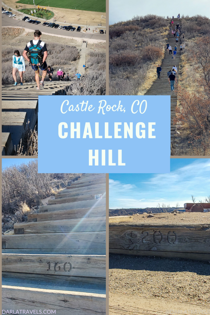
No Time to Read about Challenge Hill? Pin It for Later!
Here’s are three images of Challenge Hill for your Pinterest Boards:


About the Challenge Hill Incline
Challenge Hill is a large staircase built into the side of a sloping hillside within Philip S. Miller Park in Castle Rock, Colorado. Castle Rock lies about 30 miles (48.3 km) south of Denver and 40 miles (64.4 km) north of Colorado Springs, off of Interstate-25.
The park, including Challenge Hill, quickly became a local favorite when Castle Rock opened it in 2016. The recreation area owes its existence to the legacy of local businessman, town planner, banker, and philanthropist Philip S. Miller and his wife, Jerry. This prominent couple set aside funds for the development of Castle Rock upon their deaths.
Sometimes called the Incline at Castle Rock or the Castle Rock Incline, Challenge Hill is one of the most popular attractions in this feature-packed park.
Dogs are not allowed on Challenge Hill, but leashed dogs appear to be welcome in the rest of the park.
Opening hours for Philip S. Miller Park are 5 AM to 11 PM. Oddly, the restroom building opens two hours later at 7 AM. (It closes at 10 PM from March to October and at 7 PM from November to February.)
Climbing Challenge Hill
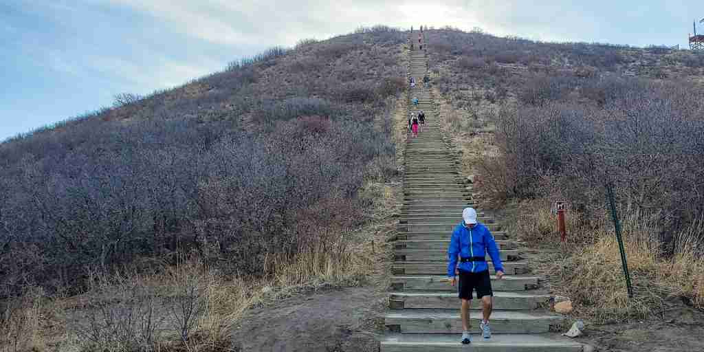
Challenge Hill is a 200-step staircase built into the side of a steep hill as part of the 0.6 mile (1 km) “Blue Loop” Trail. The Incline part of the trail is less than 0.1 mile (approximately 400 feet, or 120 m) long. Official sources state that the elevation gain on the climb is 178 feet (54.2 m). Do the math, and the grade works out to an astonishing 45%. But this number is just an average. The hill is much steeper higher up than at the base, meaning that the lower steps have a grade of less than 45%, but the highest steps are at an even greater pitch.

This change in the slope is evident when viewing the hill at a distance as the steps appear to curve upward along with the hill profile. The lower stair steps have wide treads (landing spots). However, the treads are considerably narrower near the top, with barely enough room to stand comfortably.
All this to say that the climb starts moderately challenging and becomes arduous as it goes along.
The Climb
The base of the staircase is easily accessible from the park parking lots, and there are a few picnic tables and benches here.
Get started and mount the steps. Realize there WILL be huffing and puffing as you continue to put one foot in front of the other. Slow and steady is a good strategy, and there’s no problem stopping to catch your breath and rest your burning thighs when needed.

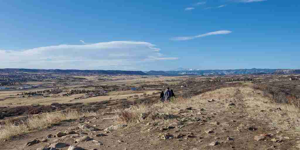
Once the 200th step is complete, pat yourself on the back and take a few minutes to admire the views from the hilltop. There are also a couple of sturdy benches here for a rest.

From here, take the trail past a zipline tower. The path switchbacks down the hill and returns to the start after a total distance of about a kilometer. Another more adventurous option is to try coming back down the stairs the way you came.

After a few minutes of rest and recovery, don’t be surprised to find yourself thinking about climbing up Challenge Hill again. Despite the difficulty, the elements of effort and reward explain the route’s popularity. Following are a few observations to help you plan your visit to Challenge Hill.
Tips for the Challenge Hill Climb
- Challenge Hill is close to an east-west line with the uphill direction going easterly. This orientation means that the staircase will be in the shade in the mornings, but it will gradually become sunny over the day. So it pays to consider the time of day and sun position. On a cold winter day, consider doing the ascent in the afternoon; however, the afternoon sun may be disadvantageous if attempting to come down the stairs.
- Traffic is two-way on Challenge Hill. Be alert for descending runners/hikers.
- Every 10th step has the step number carved into it, which is both motivating and humbling.

- Because of the increasing steepness, this hike may be more difficult for anyone with balance issues.
- Fearful of heights? Keep moving up the stairs, and don’t look down behind you.
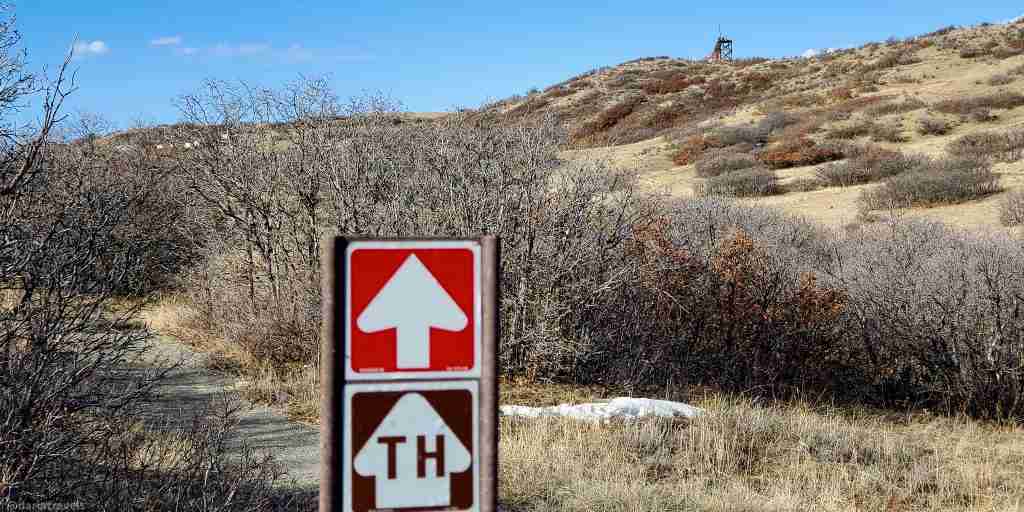
- A side trail just after step 120 can be taken back to the start if the summit seems out of reach See the custom trail map below.
Trail connections
In addition to the Blue Loop containing Challenge Hill, the park has about eight additional miles of trails. Following the color theme, the main courses are named Red Loop (1.9 miles, 3 kM), Green Loop (1.4 miles, 2.25 km), Gold Loop (2.1 miles, 3.4 km), and Purple Loop (0.9 miles, 1.4 km). These natural surface trails are interconnected and are well-marked. The Blue Loop connects to the Red Loop (see the connection on the custom trail map below). This connection makes the Red Loop a good choice for a warm-up or add-on to the Challenge Hill climb.
In addition to the natural surface trails, there is a one-mile (1.6 km) sidewalk loop around the park’s main features. This sidewalk also has connections to the soft surface trails.
The Challenge Hill Climb Compared to Nearby Inclines

Challenge Hill is a miniature version of the Manitou Incline in Manitou Springs, Colorado. The steps of the Manitou Incline were once railroad ties for a cable car delivering building materials to the adjacent Pikes Peak. When the rail was removed, people began hiking uphill. Today, hikers and trail runners flock to this grueling ascent.
The 2,744 steps cover less than a mile while climbing over 2000 ft. in elevation. That makes the average grade about the same as Challenge Hill, but over ten times the distance and elevation.
The other nearby incline is another mini-incline: the Rueter-Hess Incline near Parker, Colorado, in the southeast metro Denver. The Rueter-Hess Incline has 132 steps that gain 232 feet (71 m) elevation over about 0.1 mile (0.16 km). The Challenge Hill climb has a similar profile but 50% more steps. For a guide to the Rueter-Hess Incline, click here.
Additional Information on Philip S. Miller Park
This 300-acre (121.4 ha) park has much more than trails. Amenities include an indoor recreation center, events center, amphitheater, soccer field, playground, outdoor gym, and more.

Remember the zipline tower at the top of Challenge Hill? It’s operated by The Edge, which also runs a climbing and free-fall tower, a ninja course, and Sky Trek, a 4-story aerial trekking course. All are within the park.
Post-Climb Meal in Castle Rock
After your incline climb, you may feel you deserve a good meal! Head to the B&B Cafe in Castle Rock’s Historic Downtown (324 Wilcox St.) for a late breakfast or lunch. The cafe has been serving customers for over 55 years. The interior still has its original tin ceiling, Italian marble and onyx back bar, and booths–talk about historic charm!
The extensive breakfast menu includes inspired skillets, omelets, benedicts, southwestern favorites, and pancakes, waffles, and French toast. Each plate is expertly prepared and well-seasoned. A large selection of burgers, salads, and sandwiches round out the lunch offerings.

There’s often a line at this popular eatery, but it’s worth the wait. Note that the B&B Cafe closes at 2 PM.
Where to Stay Near Challenge Hill in Castle Rock
Castle Rock has many hotels, with a number situated close to Challenge Hill and Castle Rock’s large outdoor shopping mall, Outlets at Castle Rock. Use the links or the map below to explore and book your Castle Rock hotel or vacation rental:
Book Castle Rock lodging at booking.com
Book Castle Rock lodging at hotels.com
Book Castle Rock lodging at expedia.com
Custom Map of the Challenge Hill Climb
I created this map on AllTrails to highlight information about the Challenge Hill Incline.
Legend: Purple: Challenge Hill; Blue: rest of the Blue Loop; Green: “bail out point” around step 120; Red: connector to the Red Loop
Don’t see the maps or want to see the originals? Click here to go to the map pages on AllTrails.
Other Trail Information
| Getting There | Philip S. Miller Park1375 W. Plum Creek ParkwayCastle Rock, CO 80109 |
| Distance | About 0.6 miles (1 km) for the entire loop |
| Difficulty | Hard! |
| Trail Type | Loop |
| Trail Surface | Natural, with timber steps |
| Besides Hiking: | Trail running |
| Links | Castle Rock Parks and Recreation Page Colorado Trail Explorer (COTREX) Page (Blue Loop) AllTrails page for Challenge Hill (Blue Loop) |
| Closest Towns | Castle Rock |
Wrapping Up the Challenge Hill Climb
Challenge Hill is an aptly named 200-step staircase built into a hillside in Philip S. Miller Park in Castle Rock, Colorado. Steep? Yes. Rewarding? Absolutely!
Would you climb Challenge Hill? Leave a comment below!
This post was originally published on April 6, 2022 and updated on October 28, 2024.
This is such a fun hill climb. Not so long as the Manitou Incline, but definitely challenges you. I’ve only walked or run up it, but enjoy the gentle trail that winds down to the bottom to recover before climbing again.
Thanks for your comment -glad to know you’re an incline fan!
Oooh that does look much more steep towards the top than it does at the start. I can see where I would think “no problem” and then later be like “missed the mark on that one”. Haha…but this is the type of challenge I love and well, it’s name says it all! So, yes, please!
I love your sense of adventure, Heather!
What an appropriately chosen name for this hill! It sounds like a fantastic adventure, blending physical challenge with rewarding views. Even if that meal at the end seems to be a reward in itself! Thanks for sharing!
Thanks for your comment, Ivan! The promise of good views and a good breakfast are great motivators!
As a foodie, I’m most intrigued by the pumpkin waffles at the B&B Cafe! I can’t imagine what they would taste like. But I felt the same way the first time I was served pumpkin soup at the set Thanksgiving dinner. I though “yuck!” and nearly sent it back. Then I tasted it, and it became my favorite type of soup! s
The waffles tasted somewhat like pumpkin pie…I usually don’t eat wheat, but I did try a few bites because I was curious about the flavor. They were good!!
Wow! The Challenge hill climb sure looks challenging! 200 steps and 45 degree incline is a great work out for the legs. The view from the top is the best reward. That Autum Skillet with pumpkin waffle looks totally yum! I would love to indulge in that meal.
Thanks for your comment Jan!